Hike at a Glance
Max elevation: 0m
Min elevation: 0m
Total Ascent: 0m
Hike overview
Take a journey back in time and follow a route that has been used for thousands of years. Popular today with bushwalkers and horse riding groups, Corn Trail walking track was originally used by Aboriginals on their seasonal travels between the coast and the tablelands, then later by European settlers on pack horses carrying supplies.
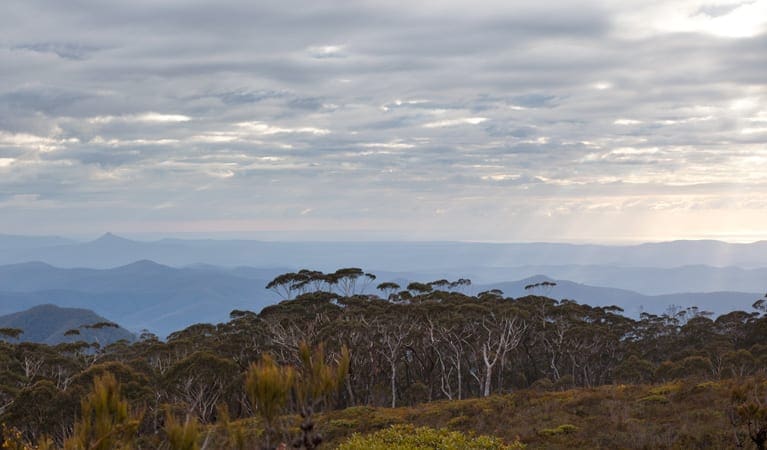
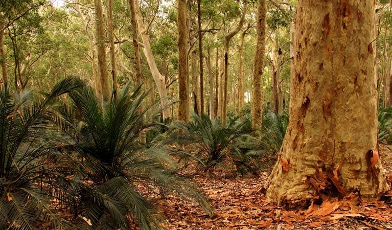
This historic trail takes you downhill from high mountain ridges to deep rainforest-filled valleys. You'll pass the gently flowing Buckenbowra River, wander through warm temperate rainforest and walk through eucalypt forests. You'll also catch glimpses of Mount Budawang and the sandstone peaks of Pigeon House and Castle Mountain further north.
It's a difficult walk, so you'll need to come prepared, but the scenery is worth it. A carpark at the bottom allows you to do a car shuffle and have a vehicle and supplies waiting for you at the end.
Tips
There is limited mobile reception in this park
The weather in this area can be extreme and unpredictable, so please ensure you're well-prepared for your visit.
Pack a small medical kit as a wise precaution
Remember to take your binoculars if you want to bird watch
Visit NSW National Parks and Wildlife Service for more information on this trail.
The longitude and latitude of the start and end points are approximately only and should not be used for navigation purposes. Please contact me if you know the correct coordinates.
Gallery
Got some great shots from this hike? Upload your photos here to inspire others and show off the beauty of the trail!
Click to view form >>
Submitting your photos doesn’t mean you lose ownership. You can be credited for your contributions, and you can request removal at any time.
Content use
Please don’t copy GPX files or content from this site to AllTrails or other platforms. Each trail has been personally mapped, documented, and refined to support Australia’s bushwalking and hiking community. While some details come from land managers, every listing reflects significant personal effort. This is a free, community-driven initiative—your respect helps keep it that way.
Walk map and GPX file
It looks like I don’t have a GPX file for this trail yet. If you have one to share, please email it to me! I’ll verify it against official maps before adding it to help other hikers have a safer, easier experience. Thanks for contributing to a better hiking resource.
Getting there
Getting to the trailhead: Monga National Park.
To Corn Trail lower end carpark. Corn Trail walking track is in the northern precinct of Monga National Park. To get there:Take the first left turn, approximately 200m after entering the park.Follow this road 400m to arrive at Dasyurus picnic area, where the walking track starts.The track finishes at a carpark which can be accessed via Misty Mountain and No Name Mountains roads. This carpark is 40 minutes one-way from the Kings Highway. Park entry points Corn Trail lower end carpark See on map Road quality Check the weather before you set out as the roads to the carparks at both ends of the trail can become boggy when it rains. Parking Parking is available at Dasyurus Picnic area, where the walking track starts. There is also a carpark at the bottom end of the track.
Closest towns to this walk: Bodalla, Braidwood, Canberra, Cooma, Delegate, Nimmitabel, Queanbeyan
About the region
Monga National Park has something for all, with 4WD touring routes, walking and horse riding tracks to enjoy, peaceful places to picnic, and ancient forests to discover. Whether you're looking for a peaceful place to picnic, a stroll through the forest, a challenging full day hike, or a scenic drive on a 4WD touring route, there's something for everyone at Monga National Park.
You'll find cool temperate rainforest filled with ancient plumwood trees from the Gondwana Age, warm temperate rainforests and old growth eucalypt forests. Enjoy relaxing picnics along the banks of Mongarlowe River, with peaceful spots to watch the local wildlife and admire the unique Monga waratahs in flower.
Similar walks nearby
Looking for more walks in or near Monga National Park? Try these trails with a similar difficulty grade.
Track grade
Grade 4 (Hard) - Challenging Walks for Experienced Walkers: Grade 4 on the AWTGS signifies challenging walking tracks. Bushwalking experience is recommended for these tracks, which may be long, rough, and very steep. Directional signage may be limited, requiring a good sense of navigation. These walks are suited for experienced walkers who are comfortable with steeper inclines, rougher terrain, and potentially longer distances.
Explore safe
Plan ahead and hike safely! Carry enough water, pack layers for changing conditions, and bring safety gear like a torch, PLB, and reliable communication device. Check official sources for trail updates, closures, and access requirements, and review local weather and bushfire advice. Most importantly, share your plans with someone before you go. Being prepared makes for a safer and more enjoyable hike! Stay Safe, Explore More, and Always #ExploreSafe.
Packing checklists
What you carry in your pack depends on factors like weather, terrain, and your adventure type. Not sure what to bring? My free planning, food, and packing checklists are a great starting point, covering day hikes, overnight trips, and multi-day adventures. Use them to customise your kit and always prioritise safety.
Let someone know
Before heading out, take a moment to fill out your trip intentions form. It’s a quick way to share your hike details with family or friends. If something goes wrong, they can notify emergency services, ensuring a faster response and peace of mind. Stay safe and enjoy your adventure
Suggest an edit
Spotted a change on this trail? Maybe there are new features, the route has shifted, or the trail is permanently closed. Whatever the update, I’d love your input. Your feedback helps fellow hikers stay informed and ensures that our trail info stays fresh and reliable.
Acknowledgement of Country
Trail Hiking Australia acknowledges the Traditional Owners of the lands on which we hike and pay respects to their Elders, past and present, and we acknowledge the First Nations people of other communities who may be here today.


6 Reviews on “Corn Trail Walking Track (12km)”
Helen O’Sullivan – still for one day!