Hike at a Glance
Max elevation: 1348m
Min elevation: 335m
Total Ascent: 1278m
Important info
The region is subject to extreme, unexpected weather changes. Be prepared for all weather conditions regardless of the forecast as extreme winds and snow events are common, even in summer. The final summit climb to Mount Anne is exposed and requires good scrambling skills with significant height exposure.
Hike overview
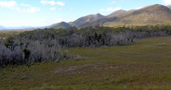
The Mount Anne Day Walk, located in Tasmania's South West National Park and World Heritage Area, is a challenging and picturesque hike. Spanning 15 km, this Grade 5 trail typically takes 8-10 hours to complete. Standing at 1,423 metres, Mount Anne is the highest peak in Southwest National Park.
Walkers should be aware that this hike is not suitable for the inexperienced or faint-hearted. The trek begins at the car park at Condominium Creek and features a steep ascent to High Camp, situated at approximately 1,000 metres. High Camp offers emergency shelter in a hut, a toilet, tent sites 150 metres to the west, and a water tank. It provides expansive views over Lake Pedder and is an ideal spot to rest and enjoy the surrounding landscape. The hut, while functional, may be somewhat unclean but remains serviceable, with an upstairs loft accommodating five to six people comfortably. It is advisable to use the hut primarily in adverse weather conditions. Replenishing water supplies at High Camp is essential, as water sources are limited beyond this point.
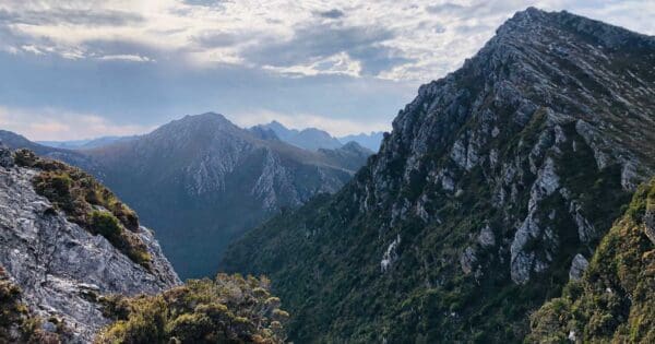
From High Camp, the trail becomes more demanding, involving rock scrambling and a steep climb. This section is highly exposed and requires navigation with a map and compass, along with scrambling over extensive boulder fields. Walkers must traverse a boulder field above High Camp to reach Mount Eliza (1,289 metres). The trail may be poorly defined in places, but following the upward direction will lead to the peak.
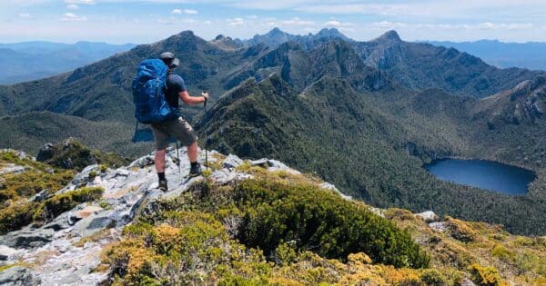
Mount Eliza marks entry into an alpine plateau characterised by cushion plants, pandani, alpine flowers, and small tarns. From here, the track levels out slightly, heading north to a small saddle with several tarns. On clear days, Mount Anne is prominently visible from this point. The trail continues across the Eliza Plateau, over boulder fields, and skirts the western side of Eve Peak (1,388 metres). At a junction, walkers should continue straight to Mount Anne (1,413 metres).
Continuing towards Mount Anne, the trail follows the ridge, passing through another boulder field and a high point before descending slightly and approaching the summit. The final ascent requires climbing and turning to the right, with sections of the trail involving scrambling where the use of hands is necessary. The route is exposed, and caution is essential to avoid falls. The summit, accessible in favorable conditions, offers panoramic views, including Frenchmans Cap to the northwest, the Weld River Valley, Federation Peak, and Precipitous Bluff to the south.
Due to the exposed nature of the final climb, a safety line may be required in some sections. It is crucial to avoid attempting the summit in poor visibility or adverse weather conditions. Walkers should have strong navigation skills using a map and compass. At the summit, there is a logbook, and the views extend towards Mount Lot to the southeast. Summiting Mount Anne should only be undertaken by those with experience in heights and challenging rock scrambling, as the route is extremely exposed and poses significant safety risks.
The return journey involves retracing the route from Mount Anne, navigating the Eliza Plateau, Mount Eliza, and High Camp, and concluding at the trailhead by following the same path back.
Tips
- The region is subject to extreme, unexpected weather changes.
- Be prepared for all weather conditions regardless of the forecast extreme winds and snow events are common, even in summer.
- The final summit climb to Mount Anne is exposed and requires good scrambling skills with significant height exposure.
Track grade
Grade 5 (Difficult) - Walks for the Most Experienced: Grade 5 represents the most challenging walking tracks on the AWTGS. These are only recommended for very experienced and fit walkers with specialised skills, including navigation and emergency first aid. Tracks are likely to be very rough, very steep, and unmarked. Walks may be more than 20 kilometers. These challenging walks demand a high level of fitness and experience to navigate difficult terrain, significant elevation changes, and potentially unformed paths.
Walk map and GPX file
Max elevation: 1348 m
Min elevation: 335 m
Total climbing: 1278 m
Total descent: -1278 m
Content use
Please don’t copy GPX files or content from this site to AllTrails or other platforms. Each trail has been personally mapped, documented, and refined to support Australia’s bushwalking and hiking community. While some details come from land managers, every listing reflects significant personal effort. This is a free, community-driven initiative—your respect helps keep it that way.
Getting there
Getting to the trailhead: Southwest National Park.
To access the Mount Anne Walk, travel 74 km west from Mount Field National Park via Maydena on Gordon River Road (B61). Turn south onto Scotts Peak Road (C607), where the circuit begins at the car park located at Condominium Creek. The circuit ends further south on Scotts Peak Road at Red Tape Creek, approximately 8.3 km from the start. As public transport is not available along Scotts Peak Road, arranging transport between the start and end points requires advance planning. Additionally, fuel is not available beyond Maydena, and phone reception in the area is unreliable. It is advisable to avoid driving in the reserves at night due to the presence of native wildlife; drive slowly and remain vigilant for animals on the road.
Need a rental car to get you to the hike? Find one here.
About the region
Tasmania’s largest expanse of wilderness is in Southwest National Park – a remote and rugged landscape in the heart of the Tasmanian Wilderness World Heritage Area. Home to majestic Huon pine, sassafras, celery top and myrtle, the region is awash with the distinctive fragrances of the Tasmanian forest.
The Gordon River Road is a narrow ribbon through the largely untracked region of forests, imposing mountain ranges and buttongrass plains, providing access to the vast expanses of Lake Pedder and Lake Gordon.
In Southwest National Park, you’ll find one of Tasmania’s most challenging wilderness walks, the multi-day South Coast Track. There are also endless shorter walks to take you up and over mountains and out to the coast. For a real ‘ends-of-the-Earth’ experience, travel to Australia’s southernmost point accessible by road, Cockle Creek, where a day walk to South Cape Bay allows walkers to immerse themselves in the raw power of this wilderness landscape.
Southwest National Park is vast, wild and spectacular. Rocky coastline, windswept beaches, dramatic mountain ranges, deep harbours and extensive buttongrass plains are home to unique plant and animal species.
Find a place to stay
Wondering where to stay near this hike? Find accommodation close to the trailhead — hotels, cabins and campgrounds nearby. Click the button to view the interactive map.
Closest towns to this walk: Cygnet, Derwent Bridge, Dover, Franklin, Geeveston, Gordon, Gordon River, Huonville, Kingston, Lake Pedder, Macquarie Harbour, Maydena, Queenstown, Strathgordon, Tullah
Let someone know
Heading out? Fill in a trip intentions form so someone knows your plans. If things go wrong, they can raise the alarm fast, giving you peace of mind on the trail.
Similar walks nearby
Looking for more walks in or near Southwest National Park? Try these trails with a similar difficulty grade.
Suggest an edit
Notice something different about this trail? Whether it’s a new feature, a route change, or a closure, share your update so we can keep our info accurate and helpful for fellow hikers.
Click to suggest edits >>
Explore safe
Plan ahead and hike safely! Carry enough water, pack layers for changing conditions, and bring safety gear like a torch, PLB, and reliable communication device. Check official sources for trail updates, closures, and access requirements, and review local weather and bushfire advice. Most importantly, share your plans with someone before you go. Being prepared makes for a safer and more enjoyable hike! Stay Safe, Explore More, and Always #ExploreSafe.
Packing checklists
What you carry in your pack depends on factors like weather, terrain, and your adventure type. Not sure what to bring? My free planning, food, and packing checklists are a great starting point, covering day hikes, overnight trips, and multi-day adventures. Use them to customise your kit and always prioritise safety.
Acknowledgement of Country
Trail Hiking Australia acknowledges the Traditional Owners of the lands on which we hike and pay respects to their Elders, past and present, and we acknowledge the First Nations people of other communities who may be here today.
/Mount-Anne-Day-Walk_28.jpg)
/Mount-Anne-Day-Walk_11.jpg)
/Mount-Anne-Day-Walk_29.jpg)
/Mount-Anne-Day-Walk_10.jpg)
/Mount-Anne-Day-Walk_6.jpg)
/Mount-Anne-Day-Walk_19.jpg)
/Mount-Anne-Day-Walk_35.jpg)
/Mount-Anne-Day-Walk_22.jpg)
/Mount-Anne-Day-Walk_34.jpg)
/Mount-Anne-Day-Walk_27.jpg)
/Mount-Anne-Day-Walk_32.jpg)
/Mount-Anne-Day-Walk_1.jpg)
/Mount-Anne-Day-Walk_2.jpg)
/Mount-Anne-Day-Walk_23.jpg)
/Mount-Anne-Day-Walk_12.jpg)


