Hike at a Glance
Max elevation: 204m
Min elevation: 3m
Total Ascent: 480m
Hike overview
Explore beyond the Wineglass Bay Lookout with this extended 12.5km circuit, offering a comprehensive and challenging experience of the stunning Freycinet National Park. The Wineglass Bay and Hazards Beach Circuit is a grade 4 hike that typically takes 4 to 5 hours to complete.
The journey begins with a descent from the lookout to Wineglass Bay. Take the opportunity to enjoy a picnic, walk along the beach, and paddle in the clear waters before crossing the isthmus to reach Hazards Beach. This isthmus is an unusually wide and well-developed tombolo-dune barred lagoon system, composed of Holocene sand and alluvial deposits. It features low hills of weathered granite, distinct from the bare granite outcrops of the Hazards and Mount Freycinet-Mount Graham mountains.
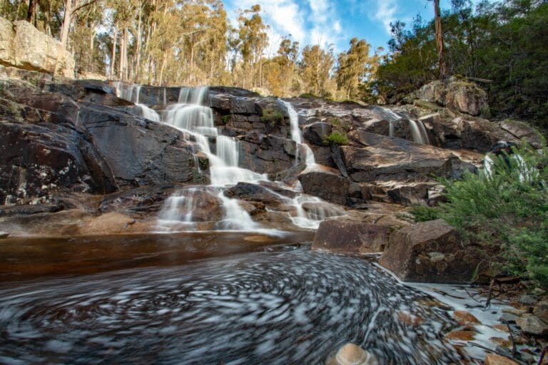
Walking along Hazards Beach brings you to the circuit’s halfway point. From there, the trail ascends inland through She-oak forests, providing views over Great Oyster Bay. As the track rounds Mount Mayson, it meanders through coastal woodland and occasionally crosses seasonal creeks. This section, though scenic, can feel longer than anticipated before leading you back to the car park via a rocky coastal path.
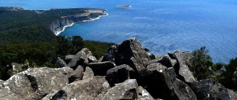
The Wineglass Bay and Hazards Beach Circuit is a premier family hike in Freycinet National Park, located on Tasmania's east coast. The trailhead is easily identifiable from the car park, where the trail begins by winding through bushland and gently rising to the saddle between Mount Mayson and Mount Amos. The steep climb to the Wineglass Bay Lookout offers the hike's only significant elevation gain and rewards you with a view of the bay, where you can see the clear waters and dark reefs below.
After returning from the lookout, descend a natural staircase with some steep sections down to Wineglass Bay’s beach. The trail then crosses the park's isthmus on a well-maintained, mostly flat path, including some boardwalk sections, reaching Hazards Beach in about 45 minutes. This quieter, equally beautiful area offers a serene contrast to Wineglass Bay.
The return journey to the car park follows the coast, where you may discover hidden coves ideal for swimming on warm days. Expect a gentle elevation gain as you make your way back.
Tips
- Park entry fees are required.
- Picnic and toilet facilities are available nearby.
- The trail features a steep uphill climb and a rough descent.
- Supervise children closely, as there are hazardous cliffs and unpatrolled beaches.
- Stay within designated barriers and be aware that the steep track may not be suitable for those with health issues or restricted mobility.
- Pets, firearms, and bicycles are not permitted.
- During peak times, such as summer, holidays, and weekends, the park is extremely popular. Arrive early, between 8am and 9am, to secure a parking spot and avoid a long walk back to your car. This will also help you avoid crowds on the lookout.
- Pack a bathing suit for swimming opportunities at Hazards Beach. Note that the northern end of Wineglass Bay can be rough, so swimming there is not recommended.
- Bring bug spray during the summer months, as mosquitoes and March flies can be a nuisance.
- Ensure you carry enough water for the entire hike, as there is no freshwater available along the trail.
Gallery
Got some great shots from this hike? Upload your photos here to inspire others and show off the beauty of the trail!
Click to view form >>
Submitting your photos doesn’t mean you lose ownership. You can be credited for your contributions, and you can request removal at any time.
Content use
Please don’t copy GPX files or content from this site to AllTrails or other platforms. Each trail has been personally mapped, documented, and refined to support Australia’s bushwalking and hiking community. While some details come from land managers, every listing reflects significant personal effort. This is a free, community-driven initiative—your respect helps keep it that way.
Walk map and GPX file
Max elevation: 204 m
Min elevation: 3 m
Total climbing: 480 m
Total descent: -480 m
Getting there
Getting to the trailhead: Freycinet National Park.
Freycinet National Park is approximately a 2.5 to 3-hour drive from either Launceston or Hobart. To reach the main park entrance and the Freycinet Visitor Centre, follow the Tasman Highway (A3) and turn onto Coles Bay Road (C302), located 12km south of Bicheno. Continue on Coles Bay Road for 28km, driving through the Coles Bay township on a sealed road until you reach the park entrance. The Peninsula Circuit walk begins at the walking tracks car park, which is located about 4 kilometres further into the park from the Visitor Information Centre near Coles Bay. For those using public transport or tours, access to the park is also available. Please avoid driving in the park at night, as wildlife frequently crosses the roads; proceed slowly and be vigilant for animals.
Closest towns to this walk: Bicheno, Coles Bay, Orford, Swansea, Triabunna
About the region
Freycinet National Park, located on Tasmania’s east coast, is a renowned coastal destination featuring a diverse and stunning landscape. The park, which occupies most of the Freycinet Peninsula, is famous for its dramatic pink granite peaks, secluded bays, pristine white sandy beaches, and rich wildlife. It offers a range of activities, from walking trails that lead to scenic bays and beaches to opportunities for swimming, snorkelling, and kayaking in its inviting waters.
The park’s main area covers the southern tip of the Freycinet Peninsula and extends along its east coast, encompassing the Friendly Beaches and stretching almost to the coastal town of Bicheno. Freycinet, along with Mount Field, holds the distinction of being one of Tasmania’s oldest national parks.
Wineglass Bay, the park’s most iconic feature, is a perfect crescent of white sand nestled beneath the Hazards mountains. This beach is one of Tasmania’s most celebrated natural attractions, drawing visitors from around the world. The Hazards, a striking line of granite peaks, form a dramatic barrier across the park, with the Wineglass Bay Lookout offering breathtaking views from one of the passes.
The Friendly Beaches, lining the peninsula’s east coast, present a stunning contrast of white sand and blue sea, while Cape Tourville, topped with a lighthouse and ringed by a boardwalk, offers glimpses into Wineglass Bay and opportunities to spot marine life, including whales.
Freycinet National Park’s appeal lies not only in the beauty of Wineglass Bay but also in the variety of its coastal landscapes. The park’s terrain ranges from rocky coves and surging surf to sheltered bays and serene beaches, all set against the backdrop of the Hazards’ granite peaks. Despite its popularity, the park still offers moments of solitude and a wide range of experiences.
The park, jutting out into the sea, is home to a rich array of plants and animals, protected within the rugged and beautiful Freycinet Peninsula. The scenic beauty and diverse activities available make it a popular destination for visitors, especially during the summer months. Whether you choose to walk to the pass overlooking Wineglass Bay, undertake the three-day trek across the Freycinet Peninsula, kayak to secluded beaches, or enjoy more leisurely pursuits like beach strolls, swimming, fishing, birdwatching, or wildlife spotting, Freycinet offers something for everyone.
Similar walks nearby
Looking for more walks in or near Freycinet National Park? Try these trails with a similar difficulty grade.
Track grade
Grade 4 (Hard) - Challenging Walks for Experienced Walkers: Grade 4 on the AWTGS signifies challenging walking tracks. Bushwalking experience is recommended for these tracks, which may be long, rough, and very steep. Directional signage may be limited, requiring a good sense of navigation. These walks are suited for experienced walkers who are comfortable with steeper inclines, rougher terrain, and potentially longer distances.
Explore safe
Plan ahead and hike safely! Carry enough water, pack layers for changing conditions, and bring safety gear like a torch, PLB, and reliable communication device. Check official sources for trail updates, closures, and access requirements, and review local weather and bushfire advice. Most importantly, share your plans with someone before you go. Being prepared makes for a safer and more enjoyable hike! Stay Safe, Explore More, and Always #ExploreSafe.
Packing checklists
What you carry in your pack depends on factors like weather, terrain, and your adventure type. Not sure what to bring? My free planning, food, and packing checklists are a great starting point, covering day hikes, overnight trips, and multi-day adventures. Use them to customise your kit and always prioritise safety.
Let someone know
Before heading out, take a moment to fill out your trip intentions form. It’s a quick way to share your hike details with family or friends. If something goes wrong, they can notify emergency services, ensuring a faster response and peace of mind. Stay safe and enjoy your adventure
Suggest an edit
Spotted a change on this trail? Maybe there are new features, the route has shifted, or the trail is permanently closed. Whatever the update, I’d love your input. Your feedback helps fellow hikers stay informed and ensures that our trail info stays fresh and reliable.
Acknowledgement of Country
Trail Hiking Australia acknowledges the Traditional Owners of the lands on which we hike and pay respects to their Elders, past and present, and we acknowledge the First Nations people of other communities who may be here today.


