Trail Fast Facts
Kings Canyon Rim Walk is a 6km, grade 3 hike in Watarrka National Park, Northern Territory. This hike typically takes 3 hours to complete.
Warning
Temperatures across the Northern Territory can be very hot between October and April. It can exceed 40 degrees Celsius in some locations. High humidity in the Top End can also make you tire easily. Check forecast temperatures before you visit.
Hike Overview
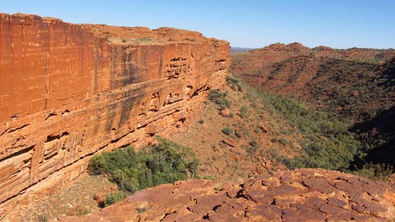
Watarrka National Park boasts the awe-inspiring Kings Canyon, and the Kings Canyon Rim Walk is the crown jewel experience for visitors. This 6-kilometer loop trail takes you on an unforgettable journey along the rim of the majestic canyon. The Rim Walk is a moderate to challenging hike, typically lasting 3-4 hours. This hike must be undertaken in a clockwise direction. The track is marked with blue arrows.
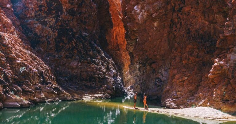
Be prepared for an initial climb that will test your legs. But conquer this first hurdle, and you'll be rewarded with breathtaking panoramic views that stretch for miles across the entire canyon. Descend further into the heart of the canyon and discover the hidden oasis called the Garden of Eden. Here, crystal-clear rockholes and unique plant life create a tranquil escape. Please note that swimming is not permitted in the waterhole.
To ensure a safe and enjoyable hike, plan your adventure for the cooler mornings, especially during the hot season from September to April. On days with scorching temperatures exceeding 36°C, start your hike before 9am to comply with park safety regulations. Always check the Bureau of Meteorology website for the latest weather forecast.
Respect the designated walking tracks and boardwalks throughout your hike. These pathways ensure your safety and minimise environmental impact. Pack plenty of water and stay hydrated throughout the journey. Sun protection is crucial, so don't forget your hat, sunscreen, and sunglasses.
Finally, be honest about your fitness level. While the Rim Walk is considered moderate, the initial climb can be demanding.
With proper preparation and a sense of adventure, the Kings Canyon Rim Walk promises a truly rewarding experience.
Please Remember
- Stay on the marked tracks and follow the track markers.
- Stay at least 2m from cliff edges.
- All historic, cultural items and wildlife are protected.
- Bins are not provided, please carry your rubbish out with you.
- Pets are permitted on a leash in the Kings Canyon and Kathleen Springs carparks only.
- Throwing rocks into the Canyon is dangerous and illegal. Please report any rock-throwing or graffiti to a Park Ranger.
- A permit is required for Drone use – conditions apply and it must be obtained prior to your arrival in the Park.
Track Grade
Grade 3 (Moderate) - Walks for Most Fitness Levels: Grade 3 on the AWTGS represents moderate walking tracks. These are ideal for walkers with some fitness who are comfortable with some hills and uneven terrain. While suitable for most ages, some bushwalking experience is recommended to ensure a safe and enjoyable experience. Tracks may have short, steep hill sections, a rough surface, and many steps. The total distance of a Grade 3 walk can be up to 20 kilometers.
Tips
Essential Tips for a Safe and Enjoyable Watarrka Adventure:
- Observe park safety signs.
- Pack a hat, sunscreen, and sunglasses. Apply sunscreen liberally and reapply often, especially during the harsh midday sun.
- Carry plenty of water and sip regularly throughout your visit.
- Opt for comfortable, lightweight, and breathable clothing that covers your arms and legs. Sturdy walking shoes or hiking boots will provide good traction on uneven terrain.
- Avoid strenuous activity during the hottest part of the day (typically midday). Plan your hikes for the cooler mornings or evenings.
- Be honest about your fitness level when selecting a walking trail. Park maps can help you choose the right path for your abilities.
- Download free interactive park maps onto your phone or tablet before you arrive.
- Walkers planning extended and overnight walks should notify a reliable person of their intended route and walk plans. Carry a satellite phone or personal locator beacon.
Emergencies
If someone is in urgent need of medical attention, you can contact a Park Ranger using the Emergency Radio Call Devices (ECD). There are three call devices located along the Kings Canyon Rim Walk and one near the carpark’s safety information shelter. Basic first aid equipment and emergency water is available from the emergency first aid boxes at the top of the Canyon. Avoid leaving an injured person alone. Stay with them to administer first aid and send another person to get help, with careful note of your location. The Park Ranger Station is situated 2.1km east of the Canyon turn-off, then a further 2 km off the Luritja Road. Please note, this is strictly for emergency situations only.
Heat Management Strategy
When the temperature is forecast to be 36°C or above*, visitors wishing to undertake the Rim Walk need to start their walk before 9.00am. On days when the temperature is forecast to be 36°C or above*, visitors wishing to undertake the South Wall Return Walk need to start their walk before 11.00am. Signs at the safety information shelter and the television with weather forecast will be updated daily to indicate current access conditions. There is no drinking water available once you leave the carparks. *Based on Bureau of Meteorology forecasts for Watarrka.
Map and GPX file
Max elevation: 764 m
Min elevation: 624 m
Total climbing: 337 m
Total descent: -337 m
Trail Location (trailhead)
Sorry, no records were found. Please adjust your search criteria and try again.
Sorry, unable to load the Maps API.
Getting there
Reaching Watarrka National Park: Your Driving Options
Watarrka National Park lies 450 kilometers southwest of Alice Springs. Three routes offer access, catering to different vehicles and preferences.
- The Easy Route (2WD): Take the sealed Stuart and Lasseter Highways, connecting with Luritja Road. This is the fastest and most straightforward option for standard vehicles, suitable for those coming from Yulara or Alice Springs.
- The Adventurous Route (4WD): Experience the Red Centre Way via Larapinta Drive, traversing the West MacDonnell Ranges. However, a Mereenie Loop Pass permit is required for this route. Permits are available for purchase at various locations, including Kings Canyon Resort, Hermannsburg General Store, and Alice Springs Visitor Information Centre.
- The Alternative Route (4WD): A more challenging option involves following the Stuart Highway south, then turning onto the unsealed Ernest Giles Road before connecting with Luritja Road. This route is recommended only for experienced drivers with four-wheel drive vehicles.
Remember:
- A Parks Pass is mandatory for entry into Watarrka National Park.
- Always check road conditions before embarking on your journey, especially for unsealed roads.
About the region
Just a three-hour drive from Uluru lies Watarrka National Park, home to the awe-inspiring Kings Canyon. This majestic landscape boasts 300-meter-high red sandstone walls, palm-filled crevices, and breathtaking desert vistas. The park encompasses the western end of the George Gill Range, a haven for diverse plant and animal life with rugged ranges, hidden rockholes, and refreshing gorges.
Kings Canyon: A Geological Wonder
Kings Canyon is the crown jewel of Watarrka National Park. Its ancient red walls rise 100 meters above Kings Creek, leading to a plateau dotted with rocky domes. Sheltered by the canyon walls, a unique ecosystem thrives, including the rare MacDonnell Ranges Cycad.
Kathleen Springs: A Place of Cultural Significance
Venture 21 kilometers from Kings Canyon to discover Kathleen Springs. A pleasant, wheelchair-accessible path lined with remnants of old stockyards leads to a permanent waterhole. Deeply significant to the local Aboriginal people and a vital source of life for wildlife, swimming is prohibited here.
Plan Your Visit: A Parks Pass is required for entry into Watarrka National Park. With its diverse landscapes, rich cultural heritage, and stunning natural beauty, Watarrka National Park offers an unforgettable experience for any adventurer.
Similar trails nearby
Explore Safe
While planning your hike, it’s important to check official government sources for updated information, temporary closures and trail access requirements. Before hitting the trail, check local weather and bushfire advice for planned burns and bushfire warnings and let someone know before you go. Plan ahead and hike safely.
Let someone know
Adventure with peace of mind: Fill out your trip intentions form. Before you hit the trail, fill out an online form to privately send important details about your hike to your family or friends. If you don’t return on time, they can easily alert emergency services, preventing worry and ensuring a swift response. Hike with peace of mind and enjoy your outdoor adventure to the fullest. Be smart, be safe: Register your plans here.
Gear to consider
What you carry in your pack will depend on the weather, terrain, time of year, type of adventure, and personal preferences. Having trouble deciding what gear’s right for you? My free planning, food and packing checklists provide an introduction to things your could consider (as well as the Ten Essentials) on your day, overnight and multi-day adventures. Customise your kit according to your personal needs, always considering safety first.
Suggest an edit
Trail changed? New features discovered? Has the route changed? Trail permanently closed? Help fellow hikers by suggesting edits! Click above to update route descriptions, GPX file, trail features (like boardwalks), or access conditions (like parking availability). Help me keep the trails info fresh!
Weather
Acknowledgement of Country
Trail Hiking Australia acknowledges the Traditional Owners of the lands on which we hike and pay respects to their Elders, past and present, and we acknowledge the First Nations people of other communities who may be here today.


1 Review on “Watarrka (Kings Canyon) Rim Walk (6km)”
The Kings Canyon Rim Walk was an incredibly rewarding experience. The breathtaking views and hidden oasis made all the sweat and effort worth it. If you’re up for a good trek and have a sense of adventure, I highly recommend this hike.