Hike at a Glance
Max elevation: 774m
Min elevation: 599m
Total Ascent: 191m
Hike overview
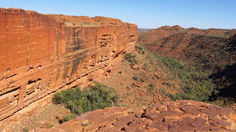
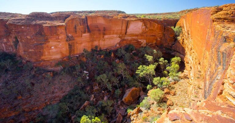
Immerse yourself in a sacred landscape at Walpa Gorge. Walpa Gorge, named for the refreshing winds ("Waḻpa" in the local language) that whistle through, is a desert refuge for plants and animals. Guarded from the hot desert sun, they find a cool haven within these walls. The 2.5km Walpa Gorge Walk, a moderate grade 3 hike in Uluru-Kata Tjuta National Park, takes roughly an hour to complete.
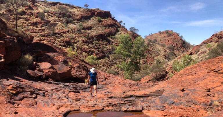
Imagine entering an ancient temple carved by time itself. The rocky path leads gently uphill, following a seasonal stream. Depending on the weather, you may come across a small stream running through the landscape. Keep your eyes peeled for rare flora and end your journey at a grove of spearwood trees.
Look out for kanyaḻa, or common wallaroos, hopping amongst the domes - a sight unique to Walpa Gorge within Kata Tjuta.
Escape the crowds by visiting later in the day. As others head for the Kata Tjuta sunset, find a quiet spot and admire the gorge bathed in the warm glow of the setting sun, its colors shifting with the fading light.
Stay on designated trails to preserve this delicate ecosystem. Avoid climbing boulders or descending into gullies. Remember, Kata Tjuta holds deep cultural significance. Walpa Gorge is part of Kata Tjuṯa, a sacred men's site. To protect sacred sites, the Anangu people request that you capture the entire gorge in your photos and videos, avoiding close-ups of specific features. Filming for Commercial Purposes? A media permit is necessary for commercial or public filming.
Allow at least an hour to complete the walk and make sure you take plenty of drinking water, sturdy shoes, sunscreen, and a hat. To enter the park you'll need a park pass, which you can pre-purchase online for quick and easy entry.
Content use
Please don’t copy GPX files or content from this site to AllTrails or other platforms. Each trail has been personally mapped, documented, and refined to support Australia’s bushwalking and hiking community. While some details come from land managers, every listing reflects significant personal effort. This is a free, community-driven initiative—your respect helps keep it that way.
Walk map and GPX file
Max elevation: 774 m
Min elevation: 599 m
Total climbing: 191 m
Total descent: -191 m
Getting there
Getting to the trailhead: Uluru-Kata Tjuta National Park.
From Yulara, drive along Uluru Road into the National Park and keep right at the fork to Kata Tjuta. Continue on for 43km then follow the sign to the Walpa Gorge carpark.
Closest towns to this walk: Alice Springs, Curtin Springs, Kings Canyon, Yulara
About the region
The ancient red rock formations of Kata Tjuta rise from the dusty land to make an incredible sight in Central Australia. Witness the spectacular rocks as they appear to change colour and immerse yourself in the Aboriginal stories of this special place, 500 million years in the making.
Kata Tjuta is a group of large, ancient rock formations about 30 kilometres (18.6 miles) away from Uluru in Australia's Red Centre. Together, these giant stone formations form the two major landmarks within the Uluru-Kata Tjuta National Park. Kata Tjuta is made up of 36 domes spread over an area of more than 20 kilometres (12.4 miles). The highest point is Mount Olga, named in honour of Queen Olga of Württemberg by the explorer Ernest Giles.
Similar walks nearby
Looking for more walks in or near Uluru-Kata Tjuta National Park? Try these trails with a similar difficulty grade.
Track grade
Grade 3 (Moderate) - Walks for Most Fitness Levels: Grade 3 on the AWTGS represents moderate walking tracks. These are ideal for walkers with some fitness who are comfortable with some hills and uneven terrain. While suitable for most ages, some bushwalking experience is recommended to ensure a safe and enjoyable experience. Tracks may have short, steep hill sections, a rough surface, and many steps. The total distance of a Grade 3 walk can be up to 20 kilometers.
Explore safe
Plan ahead and hike safely! Carry enough water, pack layers for changing conditions, and bring safety gear like a torch, PLB, and reliable communication device. Check official sources for trail updates, closures, and access requirements, and review local weather and bushfire advice. Most importantly, share your plans with someone before you go. Being prepared makes for a safer and more enjoyable hike! Stay Safe, Explore More, and Always #ExploreSafe.
Packing checklists
What you carry in your pack depends on factors like weather, terrain, and your adventure type. Not sure what to bring? My free planning, food, and packing checklists are a great starting point, covering day hikes, overnight trips, and multi-day adventures. Use them to customise your kit and always prioritise safety.
Let someone know
Before heading out, take a moment to fill out your trip intentions form. It’s a quick way to share your hike details with family or friends. If something goes wrong, they can notify emergency services, ensuring a faster response and peace of mind. Stay safe and enjoy your adventure
Suggest an edit
Spotted a change on this trail? Maybe there are new features, the route has shifted, or the trail is permanently closed. Whatever the update, I’d love your input. Your feedback helps fellow hikers stay informed and ensures that our trail info stays fresh and reliable.
Acknowledgement of Country
Trail Hiking Australia acknowledges the Traditional Owners of the lands on which we hike and pay respects to their Elders, past and present, and we acknowledge the First Nations people of other communities who may be here today.
/Walpa-Gorge-Walk-Uluru-Kata-Tjuta-8.jpg)
/Walpa-Gorge-Walk-Uluru-Kata-Tjuta-4.jpg)
/Walpa-Gorge-Walk-Uluru-Kata-Tjuta-2.jpg)
/Walpa-Gorge-Walk-Uluru-Kata-Tjuta-10.jpg)
/Walpa-Gorge-Walk-Uluru-Kata-Tjuta-6.jpg)
/Walpa-Gorge-Walk-Uluru-Kata-Tjuta-7.jpg)
/Walpa-Gorge-Walk-Uluru-Kata-Tjuta-3.jpg)
/Walpa-Gorge-Walk-Uluru-Kata-Tjuta-5.jpg)
/Walpa-Gorge-Walk-Uluru-Kata-Tjuta-12.jpg)
/Walpa-Gorge-Walk-Uluru-Kata-Tjuta-9.jpg)
/Walpa-Gorge-Walk-Uluru-Kata-Tjuta-11.jpg)
/Walpa-Gorge-Walk-Uluru-Kata-Tjuta-1.jpg)


