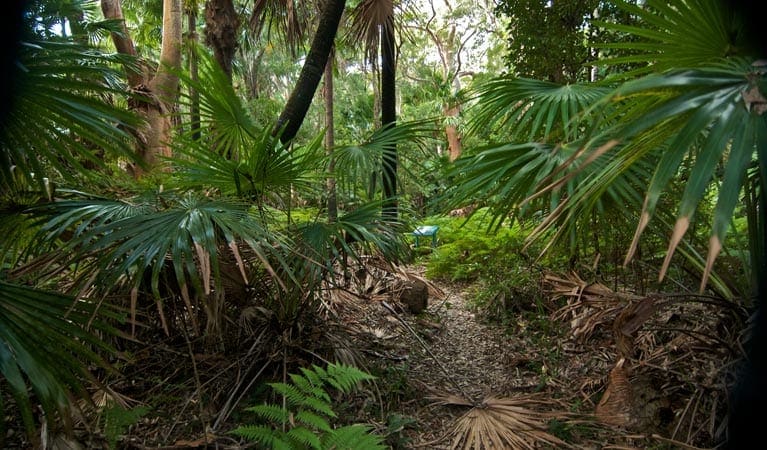
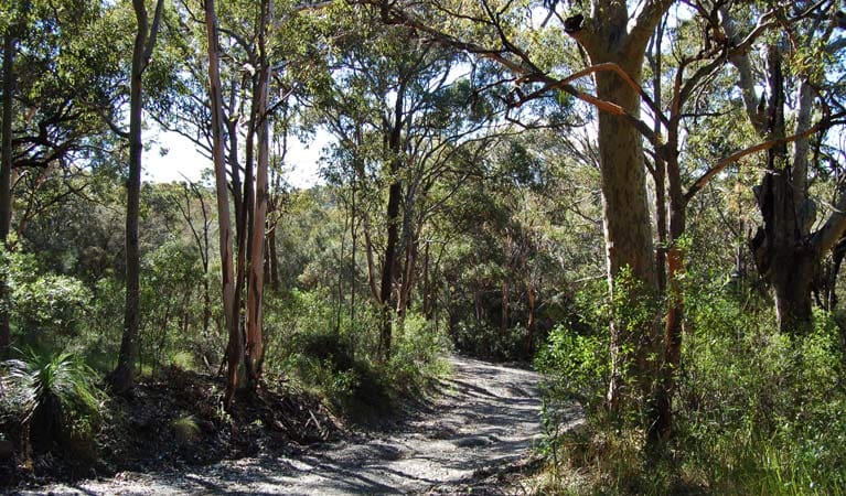
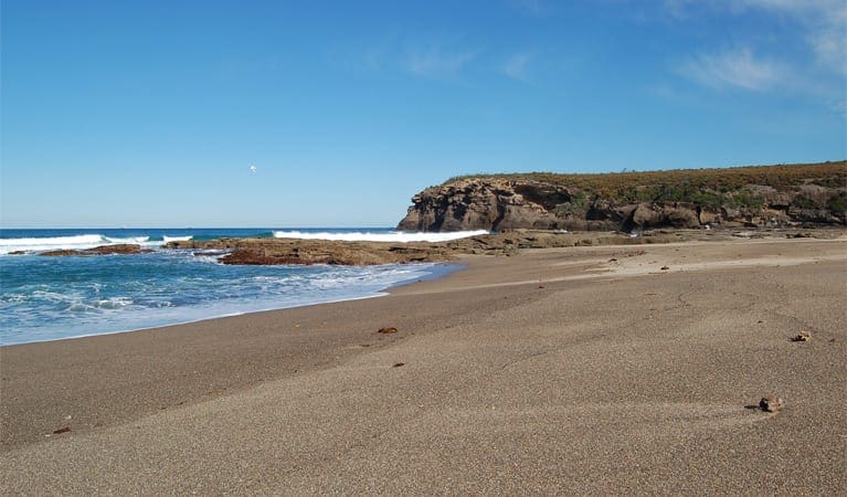
Timber Beach is a secluded beach in Munmorah State Conservation Area. The walk starts from a short side road off Snapper Point Rd at Timber Beach Lookout. From here the walk follows an eroded track down the ridge then bends left to cross a clearing and come to the back of Timber Beach. The beach is surrounded by rock walls and is quite small especially at high tide. A lovely quiet spot to visit.
Download maps and tracknotes for Timber Beach hiking track from wildwalks.com.
Got some great shots from this hike? Upload your photos here to inspire others and show off the beauty of the trail!
Submitting your photos doesn’t mean you lose ownership. You can be credited for your contributions, and you can request removal at any time.
Please don’t copy GPX files or content from this site to AllTrails or other platforms. Each trail has been personally mapped, documented, and refined to support Australia’s bushwalking and hiking community. While some details come from land managers, every listing reflects significant personal effort. This is a free, community-driven initiative—your respect helps keep it that way.
It looks like I don’t have a GPX file for this trail yet. If you have one to share, please email it to me! I’ll verify it against official maps before adding it to help other hikers have a safer, easier experience. Thanks for contributing to a better hiking resource.
Getting there
Getting to the trailhead: Munmorah State Conservation Area.
Closest towns to this walk: Budgewoi, Cams Wharf, Canton Beach, Catherine Hill Bay, Chain Valley Bay, Colongra, Doyalson, Gorokan, Gwandalan, Lake Haven, Lake Munmorah, Mannering Park, Mooney Mooney, Morisset, Morrissett, Norah Head, Noraville, Nords Wharf, Sandy Beach, Shelly Beach, Summerland Point, Swansea, Toukley, Tuggerah, Wadalba, Wyee, Wyong, Wyongah
About the region
Pristine beaches, beautiful picnic and camping spots, first-class fishing and grand views are just a taste of what is on offer at Munmorah State Conservation Area. Munmorah State Conservation Area is a park for all seasons. Beautiful, sandy surf beaches, craggy coastlines, tranquil bays and dazzling ocean views make this a place to return to time and again. Bushwalking, camping, fishing, surfing and swimming are just some of the many activities you can enjoy at Munmorah. Bring your binoculars to spot passing whales in winter and keep an eye out for some of the incredible bird species that call this park home you might see a bar-shouldered dove in the coastal dunes or the southern emu wren on the low coastal heaths. Part of the Sydney Basin, Munmorah State Conservation Area illustrates the impressive geology of the region the views are spectacular and it's no wonder, they've been millions of years in the making.
Similar walks nearby
Looking for more walks in or near Munmorah State Conservation Area? Try these trails with a similar difficulty grade.
Favourite

Munmorah State Conservation Area
Favourite

Favourite

Favourite

Track grade
Grade 4 (Hard) -
Challenging Walks for Experienced Walkers: Grade 4 on the
AWTGS signifies challenging walking tracks. Bushwalking experience is recommended for these tracks, which may be long, rough, and very steep. Directional signage may be limited, requiring a good sense of navigation. These walks are suited for experienced walkers who are comfortable with steeper inclines, rougher terrain, and potentially longer distances.
Explore safe
Plan ahead and hike safely! Carry enough water, pack layers for changing conditions, and bring safety gear like a torch, PLB, and reliable communication device. Check official sources for trail updates, closures, and access requirements, and review local weather and bushfire advice. Most importantly, share your plans with someone before you go. Being prepared makes for a safer and more enjoyable hike! Stay Safe, Explore More, and Always #ExploreSafe.
Packing checklists
What you carry in your pack depends on factors like weather, terrain, and your adventure type. Not sure what to bring? My free planning, food, and packing checklists are a great starting point, covering day hikes, overnight trips, and multi-day adventures. Use them to customise your kit and always prioritise safety.
Let someone know
Before heading out, take a moment to fill out your trip intentions form. It’s a quick way to share your hike details with family or friends. If something goes wrong, they can notify emergency services, ensuring a faster response and peace of mind. Stay safe and enjoy your adventure
Suggest an edit
Spotted a change on this trail? Maybe there are new features, the route has shifted, or the trail is permanently closed. Whatever the update, I’d love your input. Your feedback helps fellow hikers stay informed and ensures that our trail info stays fresh and reliable.


