Hike at a Glance
Max elevation: 948m
Min elevation: 883m
Total Ascent: 223m
Hike overview
The Threlfall Walking Track in Oxley Wild Rivers National Park offers a delightful escape for nature lovers seeking a moderate 5.5km (grade 3) adventure. This track winds along the Gara Gorge ridge, providing breathtaking views of the surrounding wilderness.
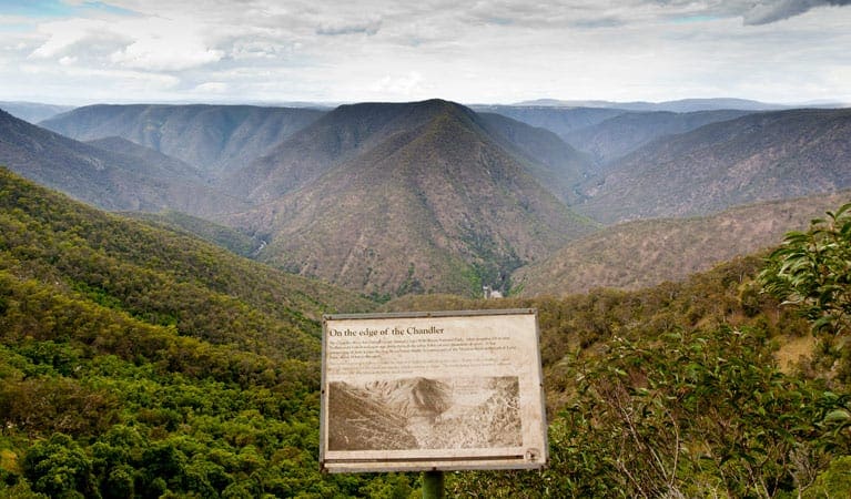
As you explore, you'll encounter remnants of the historic 1894 hydro-electric scheme, following old embankments and granite cuttings. Reach Gara Gorge lookout for a truly awe-inspiring view: rugged landscapes framed by majestic blackbutt and spotted gum trees, with the Gara River flowing below.
The Threlfall Walking Track is a haven for birdwatchers. Keep your eyes peeled for colorful rosellas, lyrebirds flitting through the undergrowth, or king parrots adding a splash of vibrancy to the scene. You might even be lucky enough to spot a koala enjoying a leisurely snack in a gum tree.
After completing the loop, you can choose to return to either the Threlfall picnic area or the nearby Blue Hole picnic area for a well-deserved lunch break. Both locations provide a scenic backdrop to unwind and reflect on your invigorating adventure.
Gallery
Got some great shots from this hike? Upload your photos here to inspire others and show off the beauty of the trail!
Click to view form >>
Submitting your photos doesn’t mean you lose ownership. You can be credited for your contributions, and you can request removal at any time.
Content use
Please don’t copy GPX files or content from this site to AllTrails or other platforms. Each trail has been personally mapped, documented, and refined to support Australia’s bushwalking and hiking community. While some details come from land managers, every listing reflects significant personal effort. This is a free, community-driven initiative—your respect helps keep it that way.
Walk map and GPX file
Max elevation: 948 m
Min elevation: 883 m
Total climbing: 223 m
Total descent: -223 m
Getting there
Getting to the trailhead: Oxley Wild Rivers National Park.
The Threlfall Walking Track offers a delightful escape within the Gara Gorge precinct of Oxley Wild Rivers National Park. This moderate 5.5km hike can be accessed from the Threlfall picnic area.
Reaching the trailhead is straightforward. Begin your drive from Armidale and travel along Waterfall Way for about 2 kilometers. Keep an eye out for a left turn onto Castledoyle Road. Follow this road for approximately 15 kilometers. Once you reach Gara Gorge, signs will guide you to the Threlfall picnic area.
The roads leading to the park entrance include both sealed and unsealed sections. Thankfully, upon arrival at the Threlfall picnic area, you’ll find convenient parking available.
Closest towns to this walk: Armidale, Bendemeer, Dorrigo, Ebor, Gloucester, Guyra, Tamworth, Uralla, Walcha
About the region
Immerse Yourself in Wild Beauty: Oxley Wild Rivers National Park. Oxley Wild Rivers National Park, a World Heritage-listed Gondwana rainforest sanctuary near Armidale, stuns visitors with its dramatic gorges, magnificent waterfalls, and rare dry rainforests. Explore scenic drives along the Waterfall Way, or delve deeper with multi-day hikes like the Green Gully walk, offering overnight stays in heritage-listed stockman's huts. For a touch of luxury, stay at East Kunderang Homestead.
Camping, walking, paddling, picnicking, cycling, horse riding – Oxley Wild Rivers National Park caters to every outdoor enthusiast. Hike through diverse landscapes – wet and dry eucalypt forests, grassy woodlands, and heathlands. Keep an eye out for native flora like olive trees, lacebarks, and towering stinging trees.
Dramatic ridges, towering rock formations, and cascading waterfalls create a breathtaking backdrop for your exploration. Gaze upon the majestic Wollomombi Falls, the highest in New South Wales, or spot a wedge-tailed eagle soaring on the thermals.
Make the most of your Oxley Wild Rivers National Park adventure by checking the park website for current conditions, permits, and specific activity details.
Similar walks nearby
Looking for more walks in or near Oxley Wild Rivers National Park? Try these trails with a similar difficulty grade.
Track grade
Grade 3 (Moderate) - Walks for Most Fitness Levels: Grade 3 on the AWTGS represents moderate walking tracks. These are ideal for walkers with some fitness who are comfortable with some hills and uneven terrain. While suitable for most ages, some bushwalking experience is recommended to ensure a safe and enjoyable experience. Tracks may have short, steep hill sections, a rough surface, and many steps. The total distance of a Grade 3 walk can be up to 20 kilometers.
Explore safe
Plan ahead and hike safely! Carry enough water, pack layers for changing conditions, and bring safety gear like a torch, PLB, and reliable communication device. Check official sources for trail updates, closures, and access requirements, and review local weather and bushfire advice. Most importantly, share your plans with someone before you go. Being prepared makes for a safer and more enjoyable hike! Stay Safe, Explore More, and Always #ExploreSafe.
Packing checklists
What you carry in your pack depends on factors like weather, terrain, and your adventure type. Not sure what to bring? My free planning, food, and packing checklists are a great starting point, covering day hikes, overnight trips, and multi-day adventures. Use them to customise your kit and always prioritise safety.
Let someone know
Before heading out, take a moment to fill out your trip intentions form. It’s a quick way to share your hike details with family or friends. If something goes wrong, they can notify emergency services, ensuring a faster response and peace of mind. Stay safe and enjoy your adventure
Suggest an edit
Spotted a change on this trail? Maybe there are new features, the route has shifted, or the trail is permanently closed. Whatever the update, I’d love your input. Your feedback helps fellow hikers stay informed and ensures that our trail info stays fresh and reliable.
Acknowledgement of Country
Trail Hiking Australia acknowledges the Traditional Owners of the lands on which we hike and pay respects to their Elders, past and present, and we acknowledge the First Nations people of other communities who may be here today.


