Hike at a Glance
Max elevation: 89m
Min elevation: 23m
Total Ascent: 289m
Hike overview
Tanglewood Walk is a serene escape into the heart of Noosa National Park, offering a peaceful 8km loop through lush forests and wild landscapes. Starting at the Noosa Headland day-use area, this Grade 4 trail takes you deep into the inland forests, where the sounds of the bustling world fade into the background, leaving only the quiet rustling of leaves and the calls of birds.
As you make your way along the rainforest edge, you’ll find yourself surrounded by towering crows ash, small-leaved tuckeroos, and the impressive hoop and kauri pines. Keep an ear out for the distinctive 'whip-cracking' call of the eastern whipbird, which adds a unique soundtrack to your walk. The path continues through diverse forest, with vibrant pink bloodwoods, banksias, brush box, and scribbly gums lining the way. The air is thick with the earthy, woody scent of the trees, enhancing the sense of immersion in this wild place.
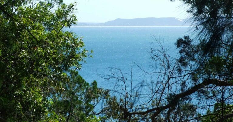
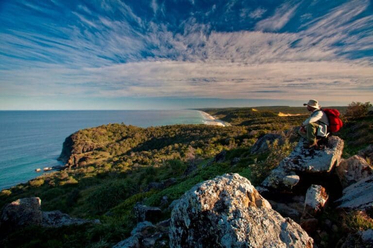
Along the route, keep an eye out for the creatures that call this forest home. Lace monitors may be spotted basking in the sun, while koalas, echidnas, and a variety of birds, including red-backed fairy wrens and little wattlebirds, add a touch of life to the landscape. The trail offers a few detours—take the extra 130-metre walk to Alexandria Bay for a glimpse of the ocean, or continue 400 metres to Hell's Gate for stunning coastal views. Alternatively, you can return via the Coastal Walk for a scenic 7.1km circuit.
This quiet, remote trail provides a wonderful opportunity to connect with nature, offering a mix of forest exploration and coastal glimpses. Whether you’re a seasoned hiker or simply looking to enjoy a peaceful escape, Tanglewood Walk delivers a memorable experience.
Gallery
Got some great shots from this hike? Upload your photos here to inspire others and show off the beauty of the trail!
Click to view form >>
Submitting your photos doesn’t mean you lose ownership. You can be credited for your contributions, and you can request removal at any time.
Content use
Please don’t copy GPX files or content from this site to AllTrails or other platforms. Each trail has been personally mapped, documented, and refined to support Australia’s bushwalking and hiking community. While some details come from land managers, every listing reflects significant personal effort. This is a free, community-driven initiative—your respect helps keep it that way.
Walk map and GPX file
Max elevation: 89 m
Min elevation: 23 m
Total climbing: 289 m
Total descent: -289 m
Getting there
Getting to the trailhead: Noosa National Park.
The Tanglewood Walk is located in the Headland section of Noosa National Park, on the Sunshine Coast, around 160km north of Brisbane. To reach the trailhead, drive along sealed roads suitable for conventional 2WD vehicles. The easiest way to access the Noosa Headland day-use area, which serves as the starting point, is by driving to the car park at the end of Park Road in Noosa Heads. From there, you can walk 1km along the scenic seaside boardwalk from Hastings Street or 1.1km from the nearby bus stop. Keep in mind that the boardwalk includes steps, making it unsuitable for wheelchairs. If cycling, be cautious along Park Road, as it’s a shared route with vehicles, but bike racks are available at the day-use area (bring your own padlock). Please note that there are no wheelchair-accessible facilities on this walk.
Closest towns to this walk: Cooroy, Marcus Beach, Noosa Heads, Peregian Beach, Sunshine Beach, Tewantin
About the region
Noosa National Park, nestled on Queensland's Sunshine Coast just 160km north of Brisbane, is a must-visit destination for its perfect blend of natural beauty and accessibility. This protected headland is a short stroll from Noosa's vibrant Hastings Street, making it one of the few national parks within walking distance of a bustling town centre. Covering 2,883 hectares, the park features interconnected trails winding through lush eucalypt forests, wallum heathlands, and rainforest pockets, offering stunning coastal views and hidden rock pools along the way.
Popular tracks, like the Coastal Walk, guide visitors past rugged cliffs and pristine beaches, with opportunities to spot koalas, dolphins, and migrating humpback whales. Whether you're walking from Hastings Street, cycling along Park Road, or starting from Sunshine Beach, the park’s easy access and variety of landscapes make it a standout on the Sunshine Coast. Its proximity to Noosa's dining scene and picturesque beaches further enhances its appeal, offering something special for both adventure seekers and casual visitors alike.
Similar walks nearby
Looking for more walks in or near Noosa National Park? Try these trails with a similar difficulty grade.
Track grade
Grade 4 (Hard) - Challenging Walks for Experienced Walkers: Grade 4 on the AWTGS signifies challenging walking tracks. Bushwalking experience is recommended for these tracks, which may be long, rough, and very steep. Directional signage may be limited, requiring a good sense of navigation. These walks are suited for experienced walkers who are comfortable with steeper inclines, rougher terrain, and potentially longer distances.
Explore safe
Plan ahead and hike safely! Carry enough water, pack layers for changing conditions, and bring safety gear like a torch, PLB, and reliable communication device. Check official sources for trail updates, closures, and access requirements, and review local weather and bushfire advice. Most importantly, share your plans with someone before you go. Being prepared makes for a safer and more enjoyable hike! Stay Safe, Explore More, and Always #ExploreSafe.
Packing checklists
What you carry in your pack depends on factors like weather, terrain, and your adventure type. Not sure what to bring? My free planning, food, and packing checklists are a great starting point, covering day hikes, overnight trips, and multi-day adventures. Use them to customise your kit and always prioritise safety.
Let someone know
Before heading out, take a moment to fill out your trip intentions form. It’s a quick way to share your hike details with family or friends. If something goes wrong, they can notify emergency services, ensuring a faster response and peace of mind. Stay safe and enjoy your adventure
Suggest an edit
Spotted a change on this trail? Maybe there are new features, the route has shifted, or the trail is permanently closed. Whatever the update, I’d love your input. Your feedback helps fellow hikers stay informed and ensures that our trail info stays fresh and reliable.
Acknowledgement of Country
Trail Hiking Australia acknowledges the Traditional Owners of the lands on which we hike and pay respects to their Elders, past and present, and we acknowledge the First Nations people of other communities who may be here today.


