Hike at a Glance
Max elevation: 55m
Min elevation: 6m
Total Ascent: 326m
Hike overview
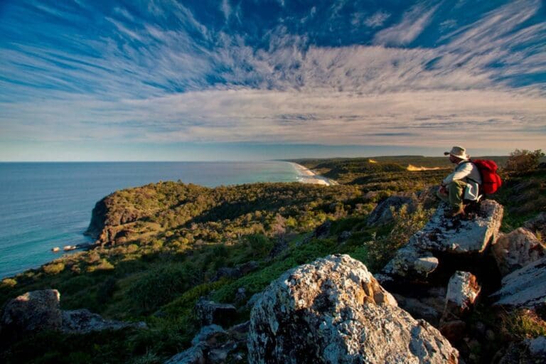
The Coastal Walk in Noosa National Park is a stunning 10.8-kilometre return journey that follows the shoreline between the Noosa Headland day-use area and Sunshine Beach. Allow about four hours to complete this Grade 4 track, which offers breathtaking views of the coastline, secluded beaches, and opportunities to spot marine life along the way.
Starting from the day-use area, the trail leads over rocky headlands and through stretches of coastal she-oaks and pandanus palms. As you walk, keep an eye on the treetops for koalas, often found dozing in the eucalypts. The first stop, Boiling Pot, is just 300 metres from the trailhead. Here, you’ll feel the salty spray of waves as they crash against the rugged rocks below, sending thunderous echoes up to the lookout. The sealed and accessible path to Boiling Pot makes it a great spot for walkers of all abilities.
Continuing along the track, you’ll reach Dolphin Point, 1.2 kilometres from the start, where sweeping views of the ocean often come with sightings of dolphins playing in the surf or turtles gliding through the waves. Between June and November, this section is one of the best vantage points for spotting humpback whales as they make their annual migration along the coastline.
The stretch from Dolphin Point to Hell’s Gates, about 2.7 kilometres from the trailhead, becomes unsealed and more challenging, with steep sections and steps. While the effort increases, the reward is worth it. Hell’s Gates offers dramatic views over Alexandria Bay, where the coastline stretches out in both directions, framed by wild waves and untouched sands.
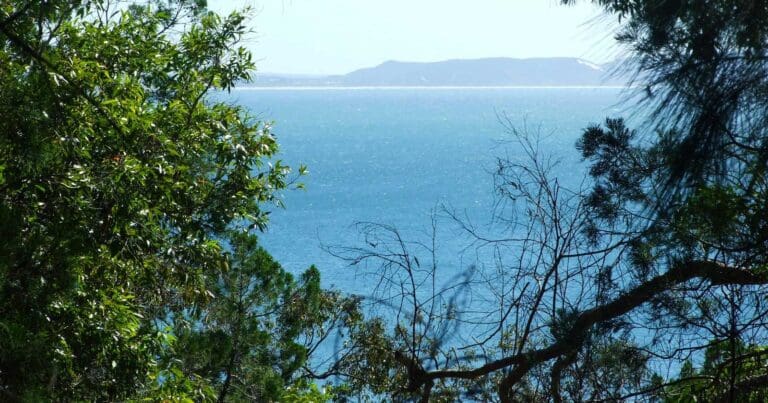
Beyond Hell’s Gates, the trail continues to Sunshine Beach, passing through lush vegetation and offering glimpses of the ocean through the trees. This final stretch leads to a pristine beach, perfect for cooling off with a swim or catching a few waves. The golden sands and gentle surf make Sunshine Beach an ideal spot to relax before deciding whether to take a local bus back to Noosa or retrace your steps to complete the full walk.
For those seeking a mix of scenic beauty, wildlife encounters, and the soothing sounds of the sea, the Coastal Walk in Noosa National Park is a must-do. Whether you’re an experienced hiker or simply enjoy exploring nature at your own pace, this track offers something special at every turn.
Accessibility
Wheelchair access is possible to The Boiling Pot lookout, located 300 metres from the day-use area, though gradients of up to 1:14 (4.1°) may require assistance. Beyond this point, sections leading to Dolphin Point feature steeper gradients and are generally not suitable for unassisted wheelchair access. Accessible toilets are available at the Noosa Headland day-use area and Tea Tree Bay, though assistance may also be required for these facilities.
Tips
- Exercise caution near cliff edges and always supervise children closely, as the terrain can be steep and unpredictable.
- The beach section of the Coastal Walk along Alexandria Bay is influenced by tidal changes and storm surges, so check conditions before setting out and plan your walk accordingly.
- Beaches in and around Noosa National Park are unpatrolled by surf lifesavers, and swimming is not advised due to strong currents and unpredictable surf conditions.
- Alexandria Bay often experiences high surf, making swimming hazardous. For safer swimming options, head to nearby patrolled beaches such as Noosa Main Beach.
- Emergency radios are positioned along the Coastal Walk for your safety. You’ll find them at the northern entrance to Alexandria Bay and further south, where the Alexandria Bay track meets the beach. These can be used to call for help if needed.
Gallery
Got some great shots from this hike? Upload your photos here to inspire others and show off the beauty of the trail!
Click to view form >>
Submitting your photos doesn’t mean you lose ownership. You can be credited for your contributions, and you can request removal at any time.
Content use
Please don’t copy GPX files or content from this site to AllTrails or other platforms. Each trail has been personally mapped, documented, and refined to support Australia’s bushwalking and hiking community. While some details come from land managers, every listing reflects significant personal effort. This is a free, community-driven initiative—your respect helps keep it that way.
Walk map and GPX file
Max elevation: 55 m
Min elevation: 6 m
Total climbing: 326 m
Total descent: -327 m
Getting there
Getting to the trailhead: Noosa National Park.
The Coastal Walk begins in the Headland section of Noosa National Park, located on the Sunshine Coast, approximately 140 kilometres north of Brisbane. The trailhead is accessible via sealed roads suitable for 2WD vehicles, but parking at the Noosa Headland day-use area is limited, especially during peak periods. Visitors are encouraged to leave their cars behind and instead walk, cycle, or take public transport using TransLink services.
For those starting at Noosa Heads, you can reach the day-use area at the end of Park Road by driving directly to the car park. Alternatively, enjoy a 1-kilometre stroll along the scenic seaside boardwalk from Hastings Street or walk 1.1 kilometres from the nearest bus stop, noting that this route includes steps and is unsuitable for wheelchairs. Cyclists can also ride along Park Road with caution, securing their bikes at racks provided in the day-use area—don’t forget to bring your own padlock.
If you prefer to access the walk from Sunshine Beach, you can drive to council car parks on Belmore Terrace or Seaview Drive, then follow the beach access tracks. From there, head north and walk along the public beach for up to a kilometre to connect with the trail. Alternatively, take public transport to Duke Street, Sunshine Beach, and use beach access track 32 near the Surf Lifesaving Club. This route involves a 1.3-kilometre beach walk to reach the trail.
Closest towns to this walk: Cooroy, Marcus Beach, Noosa Heads, Peregian Beach, Sunshine Beach, Tewantin
About the region
Noosa National Park, nestled on Queensland's Sunshine Coast just 160km north of Brisbane, is a must-visit destination for its perfect blend of natural beauty and accessibility. This protected headland is a short stroll from Noosa's vibrant Hastings Street, making it one of the few national parks within walking distance of a bustling town centre. Covering 2,883 hectares, the park features interconnected trails winding through lush eucalypt forests, wallum heathlands, and rainforest pockets, offering stunning coastal views and hidden rock pools along the way.
Popular tracks, like the Coastal Walk, guide visitors past rugged cliffs and pristine beaches, with opportunities to spot koalas, dolphins, and migrating humpback whales. Whether you're walking from Hastings Street, cycling along Park Road, or starting from Sunshine Beach, the park’s easy access and variety of landscapes make it a standout on the Sunshine Coast. Its proximity to Noosa's dining scene and picturesque beaches further enhances its appeal, offering something special for both adventure seekers and casual visitors alike.
Similar walks nearby
Looking for more walks in or near Noosa National Park? Try these trails with a similar difficulty grade.
Track grade
Grade 4 (Hard) - Challenging Walks for Experienced Walkers: Grade 4 on the AWTGS signifies challenging walking tracks. Bushwalking experience is recommended for these tracks, which may be long, rough, and very steep. Directional signage may be limited, requiring a good sense of navigation. These walks are suited for experienced walkers who are comfortable with steeper inclines, rougher terrain, and potentially longer distances.
Explore safe
Plan ahead and hike safely! Carry enough water, pack layers for changing conditions, and bring safety gear like a torch, PLB, and reliable communication device. Check official sources for trail updates, closures, and access requirements, and review local weather and bushfire advice. Most importantly, share your plans with someone before you go. Being prepared makes for a safer and more enjoyable hike! Stay Safe, Explore More, and Always #ExploreSafe.
Packing checklists
What you carry in your pack depends on factors like weather, terrain, and your adventure type. Not sure what to bring? My free planning, food, and packing checklists are a great starting point, covering day hikes, overnight trips, and multi-day adventures. Use them to customise your kit and always prioritise safety.
Let someone know
Before heading out, take a moment to fill out your trip intentions form. It’s a quick way to share your hike details with family or friends. If something goes wrong, they can notify emergency services, ensuring a faster response and peace of mind. Stay safe and enjoy your adventure
Suggest an edit
Spotted a change on this trail? Maybe there are new features, the route has shifted, or the trail is permanently closed. Whatever the update, I’d love your input. Your feedback helps fellow hikers stay informed and ensures that our trail info stays fresh and reliable.
Acknowledgement of Country
Trail Hiking Australia acknowledges the Traditional Owners of the lands on which we hike and pay respects to their Elders, past and present, and we acknowledge the First Nations people of other communities who may be here today.


