Hike at a Glance
Max elevation: 915m
Min elevation: 336m
Total Ascent: 607m
Important info
The region is subject to extreme, unexpected weather changes. Be prepared for all weather conditions regardless of the forecast as extreme winds and snow events are common, even in summer. The final summit climb to Mount Anne is exposed and requires good scrambling skills with significant height exposure.
Hike overview
The Sentinels Summit Track offers a striking yet understated journey into one of Tasmania’s wilder corners. Tucked within the remote expanse of Southwest National Park, this 3.5-kilometre return track climbs steadily through a rugged, quartzite landscape, rewarding those with a sense of adventure and solid navigation skills. The trail is officially graded as Level 4 and typically takes around three hours to complete, though timing can vary depending on weather and experience.
Access to the trail begins from the Wedge River picnic area, roughly a two-hour drive west of Hobart. Finding the start can be a small adventure in itself. The only identifying marker is a faded signpost that once read “Wedge River,” now bleached blank by sun and time. From here, the track drops quickly into bushland, crossing the river on a fallen log before winding out into the open button grass plains. A walker’s logbook is tucked away not far from the river crossing – a subtle reminder of how infrequently trodden this path is.
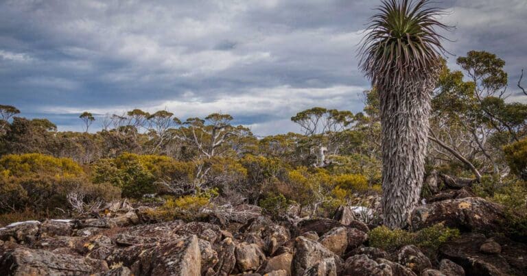
Beyond the logbook, the terrain begins to shift. The open plains give way to low, twisted eucalypts and the bleached skeletons of long-dead banksias. The track, though narrow, remains mostly clear until it reaches a small creek. From here, the character of the walk changes again. A steep quartzite zigzag begins, etched into the pink rock that forms the base of the range. Cairns are scattered along this stretch, but many blend so well into the landscape that they can be difficult to spot, making careful attention essential.
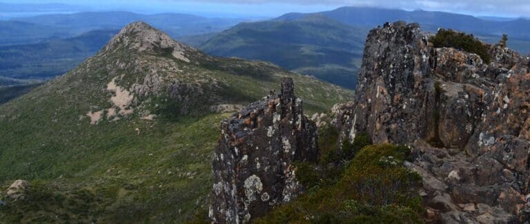
The climb hugs the cliffline, winding upwards along a natural path carved by weather and time. Despite the steep gradient, the ascent is surprisingly manageable. There are no big boulders or technical scrambles—just a steep, rocky path through slightly overgrown bush. Eventually, the summit reveals itself without fanfare. What it lacks in drama underfoot, it more than makes up for in the views.
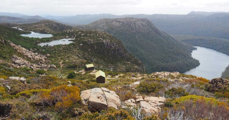
From the top, the surrounding wilderness unfolds in all directions. You’ll catch sweeping views across Lake Gordon and Lake Pedder, with Mt Wedge rising nearby and the Franklin Range stretching off into the distance. The exposed ridgeline and endless sky offer a rare sense of stillness and space—a real contrast to the tightly woven vegetation below.
The range itself runs east to west for about six kilometres. Most walkers opt for the summit at the eastern end, but for those with more time, skill, and determination, a traverse along the full ridgeline is possible. It’s worth noting, however, that the terrain is dense and progress is slow. There are few, if any, footpads, and little evidence of previous travellers. It’s a route best reserved for experienced parties willing to tackle a demanding day in remote country.
The return is by the same path, descending carefully back through the zigzag and across the plains to the river crossing. With its raw beauty and lack of signage, the Sentinel Range Summit track offers a genuine wilderness experience. It's a route that rewards preparedness, patience, and a keen eye for finding your way in a landscape that feels almost entirely untouched.
Content use
Please don’t copy GPX files or content from this site to AllTrails or other platforms. Each trail has been personally mapped, documented, and refined to support Australia’s bushwalking and hiking community. While some details come from land managers, every listing reflects significant personal effort. This is a free, community-driven initiative—your respect helps keep it that way.
Walk map and GPX file
Max elevation: 915 m
Min elevation: 336 m
Total climbing: 607 m
Total descent: -607 m
Getting there
Getting to the trailhead: Southwest National Park.
To reach the trailhead at Wedge River Picnic Area, begin in the township of Maydena and follow Gordon River Road west for approximately 45 kilometres. Along the way, you’ll pass Mt Wedge on your left, a prominent peak that signals you’re getting close. Keep an eye out for a small, unsealed pull-off on the left-hand side of the road just before you cross the Wedge River. This is the Wedge River Picnic Ground, a modest clearing that marks the start of the Sentinel Range Summit walk. There is no clear signage, so it’s easy to miss; watch carefully for the river crossing to help guide you.
Closest towns to this walk: Cygnet, Derwent Bridge, Dover, Franklin, Geeveston, Gordon, Gordon River, Huonville, Kingston, Lake Pedder, Macquarie Harbour, Maydena, Queenstown, Strathgordon, Tullah
About the region
Tasmania’s largest expanse of wilderness is in Southwest National Park – a remote and rugged landscape in the heart of the Tasmanian Wilderness World Heritage Area. Home to majestic Huon pine, sassafras, celery top and myrtle, the region is awash with the distinctive fragrances of the Tasmanian forest.
The Gordon River Road is a narrow ribbon through the largely untracked region of forests, imposing mountain ranges and buttongrass plains, providing access to the vast expanses of Lake Pedder and Lake Gordon.
In Southwest National Park, you’ll find one of Tasmania’s most challenging wilderness walks, the multi-day South Coast Track. There are also endless shorter walks to take you up and over mountains and out to the coast. For a real ‘ends-of-the-Earth’ experience, travel to Australia’s southernmost point accessible by road, Cockle Creek, where a day walk to South Cape Bay allows walkers to immerse themselves in the raw power of this wilderness landscape.
Southwest National Park is vast, wild and spectacular. Rocky coastline, windswept beaches, dramatic mountain ranges, deep harbours and extensive buttongrass plains are home to unique plant and animal species.
Similar walks nearby
Looking for more walks in or near Southwest National Park? Try these trails with a similar difficulty grade.
Track grade
Grade 4 (Hard) - Challenging Walks for Experienced Walkers: Grade 4 on the AWTGS signifies challenging walking tracks. Bushwalking experience is recommended for these tracks, which may be long, rough, and very steep. Directional signage may be limited, requiring a good sense of navigation. These walks are suited for experienced walkers who are comfortable with steeper inclines, rougher terrain, and potentially longer distances.
Explore safe
Plan ahead and hike safely! Carry enough water, pack layers for changing conditions, and bring safety gear like a torch, PLB, and reliable communication device. Check official sources for trail updates, closures, and access requirements, and review local weather and bushfire advice. Most importantly, share your plans with someone before you go. Being prepared makes for a safer and more enjoyable hike! Stay Safe, Explore More, and Always #ExploreSafe.
Packing checklists
What you carry in your pack depends on factors like weather, terrain, and your adventure type. Not sure what to bring? My free planning, food, and packing checklists are a great starting point, covering day hikes, overnight trips, and multi-day adventures. Use them to customise your kit and always prioritise safety.
Let someone know
Before heading out, take a moment to fill out your trip intentions form. It’s a quick way to share your hike details with family or friends. If something goes wrong, they can notify emergency services, ensuring a faster response and peace of mind. Stay safe and enjoy your adventure
Suggest an edit
Spotted a change on this trail? Maybe there are new features, the route has shifted, or the trail is permanently closed. Whatever the update, I’d love your input. Your feedback helps fellow hikers stay informed and ensures that our trail info stays fresh and reliable.
Acknowledgement of Country
Trail Hiking Australia acknowledges the Traditional Owners of the lands on which we hike and pay respects to their Elders, past and present, and we acknowledge the First Nations people of other communities who may be here today.
/Sentinels-Summit-Track-Tasmania%20(6).jpg)
/Sentinels-Summit-Track-Tasmania%20(58).jpg)
/Sentinels-Summit-Track-Tasmania%20(19).jpg)
/Sentinels-Summit-Track-Tasmania%20(5).jpg)
/Sentinels-Summit-Track-Tasmania%20(33).jpg)
/Sentinels-Summit-Track-Tasmania%20(2).jpg)
/Sentinels-Summit-Track-Tasmania%20(12).jpg)
/Sentinels-Summit-Track-Tasmania%20(50).jpg)
/Sentinels-Summit-Track-Tasmania%20(51).jpg)
/Sentinels-Summit-Track-Tasmania%20(34).jpg)
/Sentinels-Summit-Track-Tasmania%20(52).jpg)
/Sentinels-Summit-Track-Tasmania%20(17).jpg)
/Sentinels-Summit-Track-Tasmania%20(11).jpg)
/Sentinels-Summit-Track-Tasmania%20(23).jpg)
/Sentinels-Summit-Track-Tasmania%20(9).jpg)


1 Review on “Sentinels Summit Track (3.5km)”
A bit of an unexpected surprise this hike. We were heading into the Southwest to undertake a couple of walks and stumbled across this one by accident when we pulled over for the evening to camp. What looked ominous from the picnic area, proved to be an incredible hike. We thought about traversing to the next peak but after half an hour of walking, decided the vegetation didn’t want us to get through and we didn’t really have time to spend a full day up there. Certainly an adventure with incredible views.