Sorry, no records were found. Please adjust your search criteria and try again.
Sorry, unable to load the Maps API.
Explore stunning hiking trails of Rainbow Valley Conservation Reserve
Discover the diverse trails of Rainbow Valley Conservation Reserve, Northern Territory, offering hikes and walks for all skill levels and interests. Find your perfect adventure today.
Discover 2 hiking trails in Rainbow Valley Conservation Reserve

Where Desert Claypans Meet Rainbow-Coloured Cliffs
Overview
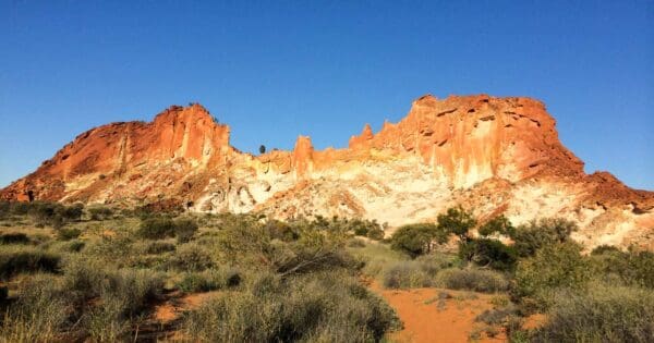
Rainbow Valley Conservation Reserve sits at the eastern end of the James Range, about 100 kilometres south of Alice Springs. For a relatively small reserve, it packs in a striking mix of coloured sandstone, claypans, sandplains and low dunes, which is why it stands out so strongly in Central Australia. The place is best known for the bands of red, orange and purple running through its cliffs and bluffs, with the colours shifting noticeably as the light changes through the day.
The reserve also has recognised landscape, flora conservation and aesthetic value at a national level. Beyond the famous escarpment, it is the contrast between the hard sandstone edge and the open claypan country in front of it that gives the place its character.
Highlights
The defining feature here is the line of brilliantly coloured sandstone cliffs and bluffs, backed by the James Range and fronted by broad claypans. In softer morning and late afternoon light, the rock bands deepen from ochre red into orange and purple, which is when the reserve feels most vivid.
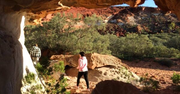
There is more going on in the rock than colour alone. The sandstone is very soft and shows off details such as curved and vertical joints, white erosion surfaces, iron staining, honeycomb weathering and even fossils. Nearby formations including Mushroom Rock add to that sculpted, weathered look, giving the reserve a scenic character that feels quite different from the bigger mountain parks around Alice Springs.
Best Time to Visit
The most pleasant time to visit is during the cooler months from April to September. This is also when the lower-angle light tends to bring out the strongest colour in the sandstone, especially early and late in the day.
If there has been rain, the claypans can add another dimension to the landscape. They are intermittent freshwater wetlands rather than permanently wet country, so the reserve can look quite different depending on the season.
Plants and Animals
For such a compact reserve, the plant life is unusually varied, with more than 400 plant species recorded. The western side combines claypans, sandplains and dunes with acacia shrublands, spinifex and pockets of coolibah, while mulga and hill mulga grow along the sandstone edge. Desert oak becomes more common in the sandy country east of Wurre, and there are also creek-line, mallee and cypress-pine communities.
Several plants here have special conservation value, including Eremophila Rainbow Valley, a vulnerable shrub with a highly restricted range, along with species tied to the claypan margins and dunes. The claypans themselves are important habitat after rain, attracting nomadic waterbirds such as grey teal, Australasian grebe, black-winged stilt and red-necked avocet. The reserve also supports a rich reptile fauna, including thorny devils, and records include black-flanked rock-wallaby, centralian carpet python and the trilling frog, which emerges on the claypans after rain.
Culture and Heritage
Rainbow Valley is on the traditional lands of the Upper Southern Arrernte people and is known to them as Wurre. It is part of Imarnte, and the Traditional Owners identify themselves as Twertentyeye. This is a living cultural landscape rather than simply a scenic reserve, with strong continuing connections to country.
The reserve also contains important archaeological sites and artefacts that show ancient Aboriginal connections to the area. Joint management has shaped the reserve’s modern care, with cultural values, natural values and visitor experience all understood as part of the same place.
Find more places to explore…
Help expand the trail collection!
Know of an official trail not listed on Trail Hiking Australia? I’m focused on showcasing the best tracks managed by land managers, and I’d love your help! Sharing a trail adds to our community and helps others discover safe, new adventures.
Submit your trail here

