Hike at a Glance
Max elevation: 2217m
Min elevation: 1720m
Total Ascent: 914m
Important info
This walk is snowbound in winter, between June and October. In winter, this hike is graded as a grade 5 hike and should only be undertaken by those experienced in wilderness navigation and snow camping. Weather in this area can be extreme and unpredictable. Come well prepared and read our alpine safety tips before you set out.
Hike overview
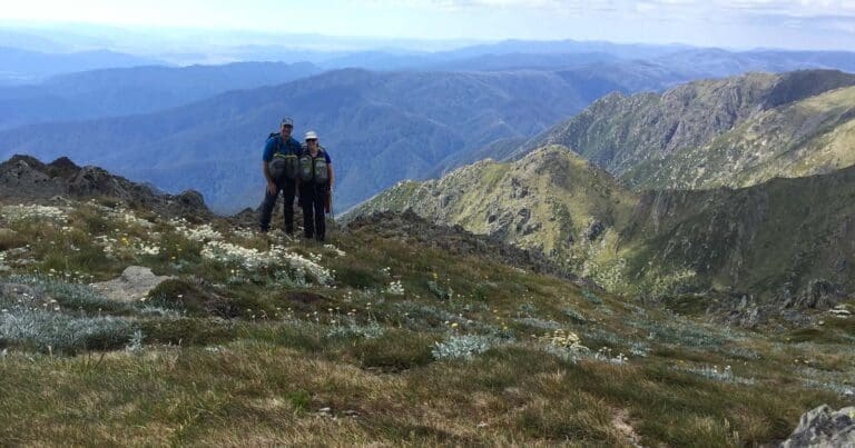
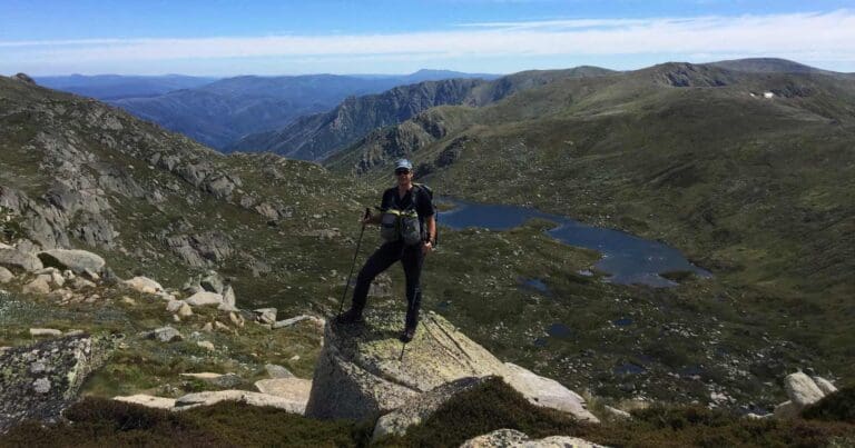
Intrepid hikers can tackle the challenging Mount Kosciuszko Traverse, which takes in glacial lakes, historic huts, and the summit of Mount Kosciuszko, across alpine high country in Kosciuszko National Park. This spectacular, long alpine track is suited to adventurous hikers eager to explore some the highest reaches of Kosciuszko National Park on foot.
Set out from Charlotte's Pass on the 26km track, which takes you through the glacier-carved landscapes of this protected UNESCO Biosphere Reserve. You'll cross the fabled Snowy River, journey past Hedley Tarn and Blue Lake, and be dazzled by wildflower meadows in early summer. Then it's high up along the rugged Main Range to the very rooftop of Australia, Mount Kosciuszko (2,228m), where the views across the Australian Alps stretch as far as the eye can see.
From here, the track loops back to join the Kosciuszko walk (Mount Kosciuszko to Thredbo). Along this section you'll travel past the rocky granite outcrops of Ramshead Range, and through alpine wildflowers (spring). Make sure you stop at the Kosciuszko lookout for views of the country's highest mountain. The track traverses Rawson Pass before climbing above Lake Cootapatamba and on to the headwaters of the Snowy River.
The track typically ends at the top of the Kosciuszko Express Chairlift which takes 15mins back to Thredbo. You can also walk down Merritts Nature Track to Thredbo Village from the top of the chairlift. This will add approximately 3km to the overall length of the traverse. For chairlift opening hours and prices visit the Thredbo website.
If you're well-equipped, and prepared for an overnight back country camping, the walk can be spread over a couple of days.
Tips
- You can also walk down Merritts Nature Track to Thredbo Village from the top of the chairlift.
- Steel mesh walking platforms have been installed along the trail between the Kosciuszko Express Chairlift and the summit to protect the environment.
- Park entry fees apply
Gallery
Got some great shots from this hike? Upload your photos here to inspire others and show off the beauty of the trail!
Click to view form >>
Submitting your photos doesn’t mean you lose ownership. You can be credited for your contributions, and you can request removal at any time.
Content use
Please don’t copy GPX files or content from this site to AllTrails or other platforms. Each trail has been personally mapped, documented, and refined to support Australia’s bushwalking and hiking community. While some details come from land managers, every listing reflects significant personal effort. This is a free, community-driven initiative—your respect helps keep it that way.
Walk map and GPX file
Max elevation: 2217 m
Min elevation: 1720 m
Total climbing: 914 m
Total descent: -800 m
Getting there
Getting to the trailhead: Kosciuszko National Park.
The Mount Kosciuszko Traverse is in the Alpine precinct of Kosciuszko National Park. To get there, drive along Kosciuszko Road from Jindabyne past the ski resorts of Smiggin Holes, Perisher Valley and Charlotte Pass Village 40km to Charlotte Pass. Parking outside the 20-minute only area. All 2WD vehicles need to carry snow chains in winter, between June and October long weekends, on Kosciuszko Road (to Perisher), Guthega Road, Alpine Way between Thredbo and Tom Groggin. Snow chains are recommended for all vehicles driving in the park, including 4WD and AWD, in the event of extreme weather. Street parking is available nearby to the trackhead on Kosciuszko Road. Bus parking is also available.
Closest towns to this walk: Adaminaby, Cabramurra, Cooma, Crackenback, Dalgety, Jindabyne, Khancoban, Perisher Valley, Thredbo, Tumbarumba, Tumut
About the region
Kosciuszko National Park spoils you with snow sports, walks and mountain biking in the Snowy Mountains. Go camping, explore caves, climb Australia's highest mountain, or stay in heritage accommodation. There are 7 areas in this park:
1. Thredbo-Perisher area is your gateway to Mount Kosciuszko. Find NSW's favourite ski resorts, top alpine hikes, mountain bike trails, and endless adventures in the Snowy Mountains.
2. The Lower Snowy River area embraces the wild south of Kosciuszko National Park. Camp by the Snowy River and explore the scenic trails on a walk, bike or horse ride.
3. Khancoban area is the western gateway to Kosciuszko National Park. Discover Geehi and Tom Groggin's camp spots, fishing, and riding. Marvel at the Western Fall views or explore huts and hikes in the Jagungal Wilderness.
4. The Selwyn area is your perfect base to explore the walks, rides, and top fishing spots of central Kosciuszko National Park. Selwyn Snow Resort and historic Kiandra are closed due to severe fire damage.
5. The Yarrangobilly area is a highlight of northern Kosciuszko National Park. Explore jaw-dropping caves on a guided tour and swim in the thermal pool. Stay at historic Caves House and enjoy the walks and wildlife.
6. The Tumut area is your launch pad into northern Kosciuszko National Park. Discover water sports and wildlife at Blowering Reservoir. Camp and explore hidden walks and waterfalls in the foothills of the Snowy Mountains.
7. The High Plains area spoils you with summer walks, horse rides and bike trails to mountain huts, caves, and gorges. Camp, stay in Currango's heritage cottages, and discover Kosciuszko's wild north-east corner.
Similar walks nearby
Looking for more walks in or near Kosciuszko National Park? Try these trails with a similar difficulty grade.
Track grade
Grade 4 (Hard) - Challenging Walks for Experienced Walkers: Grade 4 on the AWTGS signifies challenging walking tracks. Bushwalking experience is recommended for these tracks, which may be long, rough, and very steep. Directional signage may be limited, requiring a good sense of navigation. These walks are suited for experienced walkers who are comfortable with steeper inclines, rougher terrain, and potentially longer distances.
Explore safe
Plan ahead and hike safely! Carry enough water, pack layers for changing conditions, and bring safety gear like a torch, PLB, and reliable communication device. Check official sources for trail updates, closures, and access requirements, and review local weather and bushfire advice. Most importantly, share your plans with someone before you go. Being prepared makes for a safer and more enjoyable hike! Stay Safe, Explore More, and Always #ExploreSafe.
Packing checklists
What you carry in your pack depends on factors like weather, terrain, and your adventure type. Not sure what to bring? My free planning, food, and packing checklists are a great starting point, covering day hikes, overnight trips, and multi-day adventures. Use them to customise your kit and always prioritise safety.
Let someone know
Before heading out, take a moment to fill out your trip intentions form. It’s a quick way to share your hike details with family or friends. If something goes wrong, they can notify emergency services, ensuring a faster response and peace of mind. Stay safe and enjoy your adventure
Suggest an edit
Spotted a change on this trail? Maybe there are new features, the route has shifted, or the trail is permanently closed. Whatever the update, I’d love your input. Your feedback helps fellow hikers stay informed and ensures that our trail info stays fresh and reliable.
Acknowledgement of Country
Trail Hiking Australia acknowledges the Traditional Owners of the lands on which we hike and pay respects to their Elders, past and present, and we acknowledge the First Nations people of other communities who may be here today.


