Hike at a Glance
Max elevation: 2218m
Min elevation: 1720m
Total Ascent: 743m
Important info
This park is remote, so come well-prepared with appropriate clothing and equipment, and inform someone of your travel plans. Weather in the Snowy Mountains can change rapidly, with snow possible year-round. Walking notes, grades, and times apply to summer conditions only. Between June and October, the track is likely snowbound—carry snowshoes or cross-country skis and be ready to use them.
Hike overview
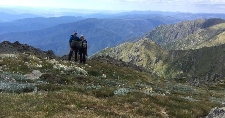
The Main Range Track offers one of Australia’s most rewarding alpine experiences, weaving through dramatic landscapes shaped by glaciers, rivers, and time. This iconic walk begins at Charlotte Pass, where a wide, paved path gently descends into a valley dotted with snow gums and accompanied by interpretive signs that provide insight into the area’s natural history. The sound of the Snowy River soon grows louder, signalling the first notable crossing of the trail. This stretch is both tranquil and dynamic, with water levels that can vary significantly depending on the season, so caution is advised when stepping across the stones.
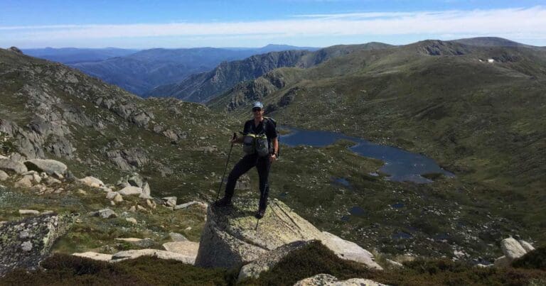
As the trail ascends from the valley floor, the landscape opens up, offering sweeping views of Hedley Tarn and beyond. The path transitions between gravel and rock, guiding hikers past geological markers and information points that detail the formation of the region’s unique features. Blue Lake, a short side trip from the main track, is an unmissable highlight. This glacial lake, with its striking clarity and dramatic backdrop, provides a moment of stillness and a chance to reflect on the immense forces that shaped the land.
Further along, the track climbs to Carruthers Peak, a vantage point that rewards the effort with breathtaking panoramas of Club Lake and the surrounding valleys. The journey continues with a series of gentle descents and ascents, traversing ridges that afford views of the sparkling waters of Albina Lake and the rugged peaks beyond. Each turn reveals new perspectives, and the ever-changing scenery makes this section of the trail particularly engaging.
As you near Mount Kosciuszko, the terrain becomes more expansive, and the path begins its steady climb to Australia’s highest peak. At 2,228 metres, the summit offers unparalleled 360-degree views across the Snowy Mountains. On clear days, the sense of standing atop the continent is exhilarating. Interpretive signs provide context to the area’s history, including its naming by the Polish explorer Count Paul Edmund Strzelecki, who honoured General Tadeusz Kościuszko.
Descending from the summit, the track leads to Rawson Pass, home to Australia’s highest public toilet and a key junction for cyclists and hikers alike. From here, the trail meanders towards Seamans Hut, a poignant reminder of the alpine environment’s unpredictability and a place of refuge for those exploring this remote wilderness.
This hike is as much about connection as it is about discovery. The Main Range Track invites you to immerse yourself in the alpine environment, tread carefully through its fragile ecosystems, and take moments to appreciate the grandeur and intricacy of nature. Whether you’re captivated by the geological wonders, the history etched into the landscape, or simply the challenge of the hike itself, this walk is an unforgettable journey through one of Australia’s most extraordinary regions.
You can also experience Main Range Walk as part of Snowies Alpine Walk, a 56km multi-day hike that can be completed over 4 days.
Tips
- Let someone know where you're going by filling in a trip intention form to share important details with your emergency contact.
- You can hire a Personal Locator Beacon (PLB) for free at the Snowy Region Visitor Centre in Jindabyne, Perisher Valley Office, Tumut Visitor Centre, or Khancoban Visitor Centre.
- This walk is snowbound in winter (June to October). You can cross-country ski or snowshoe, but note that there are no snow poles marking the route. Private vehicle access is closed between Perisher and Charlotte Pass during this time.
- Weather in this area can be extreme and unpredictable. Be well prepared and read our alpine safety tips before setting out.
- Steel mesh walking platforms have been installed along the trail to protect the environment. These surfaces can be sharp, so running is not recommended.
- Park entry fees apply.
- Take advantage of toilets where provided, including Rawson Pass. If you've got to go, preferably plan to bag your toilet waste, especially at high use areas without toilets.
- Help protect the sensitive alpine environment by carrying out your waste and rubbish to deposit in an appropriate facility within the resort areas or outside the park.
Content use
Please don’t copy GPX files or content from this site to AllTrails or other platforms. Each trail has been personally mapped, documented, and refined to support Australia’s bushwalking and hiking community. While some details come from land managers, every listing reflects significant personal effort. This is a free, community-driven initiative—your respect helps keep it that way.
Walk map and GPX file
Max elevation: 2218 m
Min elevation: 1720 m
Total climbing: 743 m
Total descent: -740 m
Getting there
Getting to the trailhead: Kosciuszko National Park.
The Main Range walking track is located in the Alpine precinct of Kosciuszko National Park. To reach the trailhead, drive along Kosciuszko Road from Jindabyne, passing the ski resorts of Smiggin Holes, Perisher Valley, and Charlotte Pass Village. Continue for approximately 40km until you arrive at Charlotte Pass.
When parking, avoid the 20-minute-only zone. Ample street parking is available near the trackhead on Kosciuszko Road, and there are designated bus parking areas as well.
Road conditions vary, and during winter (from the June long weekend to the October long weekend), all 2WD vehicles must carry snow chains on Kosciuszko Road (to Perisher), Guthega Road, and the Alpine Way between Thredbo and Tom Groggin. Snow chains are also recommended for 4WD and AWD vehicles in case of extreme weather. Be sure to review our snow driving tips for Kosciuszko National Park to ensure a safe journey.
Closest towns to this walk: Adaminaby, Cabramurra, Cooma, Crackenback, Dalgety, Jindabyne, Khancoban, Perisher Valley, Thredbo, Tumbarumba, Tumut
About the region
Kosciuszko National Park spoils you with snow sports, walks and mountain biking in the Snowy Mountains. Go camping, explore caves, climb Australia's highest mountain, or stay in heritage accommodation. There are 7 areas in this park:
1. Thredbo-Perisher area is your gateway to Mount Kosciuszko. Find NSW's favourite ski resorts, top alpine hikes, mountain bike trails, and endless adventures in the Snowy Mountains.
2. The Lower Snowy River area embraces the wild south of Kosciuszko National Park. Camp by the Snowy River and explore the scenic trails on a walk, bike or horse ride.
3. Khancoban area is the western gateway to Kosciuszko National Park. Discover Geehi and Tom Groggin's camp spots, fishing, and riding. Marvel at the Western Fall views or explore huts and hikes in the Jagungal Wilderness.
4. The Selwyn area is your perfect base to explore the walks, rides, and top fishing spots of central Kosciuszko National Park. Selwyn Snow Resort and historic Kiandra are closed due to severe fire damage.
5. The Yarrangobilly area is a highlight of northern Kosciuszko National Park. Explore jaw-dropping caves on a guided tour and swim in the thermal pool. Stay at historic Caves House and enjoy the walks and wildlife.
6. The Tumut area is your launch pad into northern Kosciuszko National Park. Discover water sports and wildlife at Blowering Reservoir. Camp and explore hidden walks and waterfalls in the foothills of the Snowy Mountains.
7. The High Plains area spoils you with summer walks, horse rides and bike trails to mountain huts, caves, and gorges. Camp, stay in Currango's heritage cottages, and discover Kosciuszko's wild north-east corner.
Similar walks nearby
Looking for more walks in or near Kosciuszko National Park? Try these trails with a similar difficulty grade.
Track grade
Grade 4 (Hard) - Challenging Walks for Experienced Walkers: Grade 4 on the AWTGS signifies challenging walking tracks. Bushwalking experience is recommended for these tracks, which may be long, rough, and very steep. Directional signage may be limited, requiring a good sense of navigation. These walks are suited for experienced walkers who are comfortable with steeper inclines, rougher terrain, and potentially longer distances.
Explore safe
Plan ahead and hike safely! Carry enough water, pack layers for changing conditions, and bring safety gear like a torch, PLB, and reliable communication device. Check official sources for trail updates, closures, and access requirements, and review local weather and bushfire advice. Most importantly, share your plans with someone before you go. Being prepared makes for a safer and more enjoyable hike! Stay Safe, Explore More, and Always #ExploreSafe.
Packing checklists
What you carry in your pack depends on factors like weather, terrain, and your adventure type. Not sure what to bring? My free planning, food, and packing checklists are a great starting point, covering day hikes, overnight trips, and multi-day adventures. Use them to customise your kit and always prioritise safety.
Let someone know
Before heading out, take a moment to fill out your trip intentions form. It’s a quick way to share your hike details with family or friends. If something goes wrong, they can notify emergency services, ensuring a faster response and peace of mind. Stay safe and enjoy your adventure
Suggest an edit
Spotted a change on this trail? Maybe there are new features, the route has shifted, or the trail is permanently closed. Whatever the update, I’d love your input. Your feedback helps fellow hikers stay informed and ensures that our trail info stays fresh and reliable.
Acknowledgement of Country
Trail Hiking Australia acknowledges the Traditional Owners of the lands on which we hike and pay respects to their Elders, past and present, and we acknowledge the First Nations people of other communities who may be here today.
/Main-Range-Walking-Track%20(27).jpg)
/Main-Range-Walking-Track%20(4).jpg)
/Main-Range-Walking-Track%20(1).jpg)
/Main-Range-Walking-Track%20(26).jpg)
/Main-Range-Walking-Track%20(13).jpg)
/Main-Range-Walking-Track%20(5).jpg)
/Main-Range-Walking-Track%20(17).jpg)
/Main-Range-Walking-Track%20(19).jpg)
/Main-Range-Walking-Track%20(24).jpg)
/Main-Range-Walking-Track%20(18).jpg)
/Main-Range-Walking-Track%20(25).jpg)
/Main-Range-Walking-Track%20(6).jpg)
/Main-Range-Walking-Track%20(22).jpg)
/Main-Range-Walking-Track%20(3).jpg)
/Main-Range-Walking-Track%20(12).jpg)


