Hike at a Glance
Max elevation: 914m
Min elevation: 565m
Total Ascent: 333m
Important info
Access to the Mount Gillen climb is officially closed off as March 2020. A newly installed fence has been erected across the beginning of the climb, and signage installed to inform people of the closure.
Hike overview
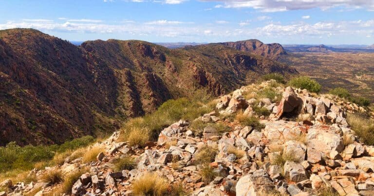
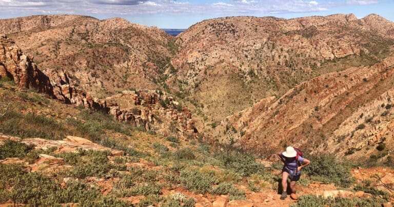
This spectacular, un-formalised and un-signposted Mount Gillen and the Heavitree Range hike takes you to the summit of Mount Gillen; the prominent ridge standing sentry over Alice Springs to the west of the main gap.
It's a steep walk for fit walkers beginning at the Flynn's Grave car park 7km west of town on Larapinta Drive. Around 50m west of the Flynn Grave memorial locate the walkers gate and head south along the well trodden path toward the obvious Mount Gillen peak. Soon the track takes a sharp right turn and narrows. Follow the eroded track steeply up to saddle and then on until you reach the rock face where you'll need to do some scrambling to find your way on to the top of the Heavitree Range. From here follow the track east for about 500m to the trig point where you will be rewarded with wonderful 360 degree views of the surrounding ranges, valleys and the western parts of town.
This hike continued over the Heavitree Range onto the valley below then turned east to end just beyond the Todd River and Heavitree Gap.
Alternative and shorter hike is to return from the summit to Flynn's Grave car park via the same route.
Tips
- Carry water, particularly in summer.
- Poles will be useful on bot the ascent and descent as they trail is loose and rocky in parts.
- Take care on the scramble to gain the summit.
Content use
Please don’t copy GPX files or content from this site to AllTrails or other platforms. Each trail has been personally mapped, documented, and refined to support Australia’s bushwalking and hiking community. While some details come from land managers, every listing reflects significant personal effort. This is a free, community-driven initiative—your respect helps keep it that way.
Walk map and GPX file
Max elevation: 914 m
Min elevation: 565 m
Total climbing: 333 m
Total descent: -377 m
Getting there
Getting to the trailhead: West MacDonnell National Park.
From Alice Springs, head west along Larapinta Drive to the John Flynn Historical Reserve. Park your vehicle here and locate the trail-head on the south west corner of the carpark.
Closest towns to this walk: Alice Springs, Glen Helen, Hermannsburg
About the region
The Heavitree Gap, or Ntaripe in the Arrernte language, is a water gap in the Northern Territory of Australia in the MacDonnell Ranges. It is the southern entrance to the city of Alice Springs and in addition to the Todd River it carries the main road and rail access to the south.
Nestled between the East and West MacDonnell Ranges, The Alice' (Alice Springs) is famous for its beautiful desert landscapes, colourful outback characters, opportunities for adventure and a strong Aboriginal culture. Alice Springs is a remote town in Australia's Northern Territory, halfway between Darwin and Adelaide, both 1,500km away. It's a popular gateway for exploring the Red Centre, the country's interior desert region.
Similar walks nearby
Looking for more walks in or near West MacDonnell National Park? Try these trails with a similar difficulty grade.
Track grade
Grade 4 (Hard) - Challenging Walks for Experienced Walkers: Grade 4 on the AWTGS signifies challenging walking tracks. Bushwalking experience is recommended for these tracks, which may be long, rough, and very steep. Directional signage may be limited, requiring a good sense of navigation. These walks are suited for experienced walkers who are comfortable with steeper inclines, rougher terrain, and potentially longer distances.
Explore safe
Plan ahead and hike safely! Carry enough water, pack layers for changing conditions, and bring safety gear like a torch, PLB, and reliable communication device. Check official sources for trail updates, closures, and access requirements, and review local weather and bushfire advice. Most importantly, share your plans with someone before you go. Being prepared makes for a safer and more enjoyable hike! Stay Safe, Explore More, and Always #ExploreSafe.
Packing checklists
What you carry in your pack depends on factors like weather, terrain, and your adventure type. Not sure what to bring? My free planning, food, and packing checklists are a great starting point, covering day hikes, overnight trips, and multi-day adventures. Use them to customise your kit and always prioritise safety.
Let someone know
Before heading out, take a moment to fill out your trip intentions form. It’s a quick way to share your hike details with family or friends. If something goes wrong, they can notify emergency services, ensuring a faster response and peace of mind. Stay safe and enjoy your adventure
Suggest an edit
Spotted a change on this trail? Maybe there are new features, the route has shifted, or the trail is permanently closed. Whatever the update, I’d love your input. Your feedback helps fellow hikers stay informed and ensures that our trail info stays fresh and reliable.
Acknowledgement of Country
Trail Hiking Australia acknowledges the Traditional Owners of the lands on which we hike and pay respects to their Elders, past and present, and we acknowledge the First Nations people of other communities who may be here today.
/Mount-Gillen-&-the-Heavitree-Range-Hike_16.jpg)
/Mount-Gillen-&-the-Heavitree-Range-Hike_17.jpg)
/Mount-Gillen-&-the-Heavitree-Range-Hike_8.jpg)
/Mount-Gillen-&-the-Heavitree-Range-Hike_11.jpg)
/Mount-Gillen-&-the-Heavitree-Range-Hike_19.jpg)
/Mount-Gillen-&-the-Heavitree-Range-Hike_22.jpg)
/Mount-Gillen-&-the-Heavitree-Range-Hike_12.jpg)
/Mount-Gillen-&-the-Heavitree-Range-Hike_18.jpg)
/Mount-Gillen-&-the-Heavitree-Range-Hike_23.jpg)
/Mount-Gillen-&-the-Heavitree-Range-Hike_13.jpg)
/Mount-Gillen-&-the-Heavitree-Range-Hike_20.jpg)
/Mount-Gillen-&-the-Heavitree-Range-Hike_10.jpg)
/Mount-Gillen-&-the-Heavitree-Range-Hike_1.jpg)
/Mount-Gillen-&-the-Heavitree-Range-Hike_4.jpg)
/Mount-Gillen-&-the-Heavitree-Range-Hike_3.jpg)


11 Reviews on “Mount Gillen & the Heavitree Range Hike (11km)”
Mt Gillen trail is closed- Jan 24
Yes, there is a large warning at the top of this trail description that says…. Access to the Mount Gillen climb is officially closed off as March 2020. A newly installed fence has been erected across the beginning of the climb, and signage installed to inform people of the closure.
I decided to leave this trail on my site so people would know it is closed.
This is a short bit fun hike. I was lucky enough to have done it many years ago before it closed.