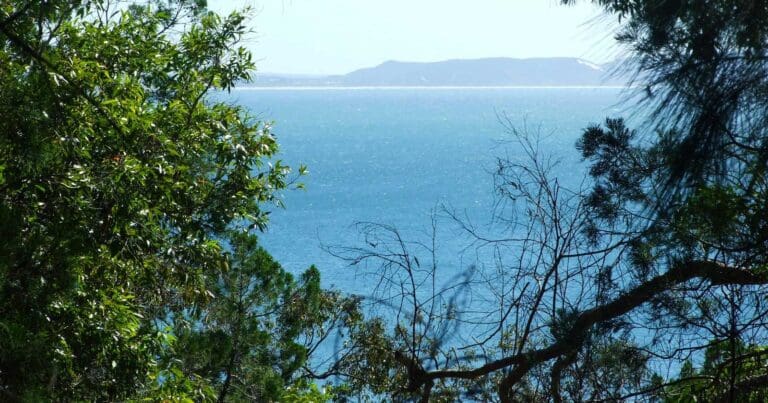
Did you know that Mount Coolum is the second largest rock in the world after Uluru? This impressive dome-shaped rock is 208 metres high and offers spectacular views of the coast and hinterland. There are several sets of stone steps to help you reach the summit. The walk takes about twenty minutes and is certain to get your blood pumping. Apart from the amazing view, you'll also find interesting plant species around the summit of the mountain including Xanthorrea, Casuarinas, Scribbly Gums and a variety of ferns.
The name of the mountain is said to be derived from an Aboriginal word meaning 'headless', which is assumed to relate to the flat top of the rock. According to dreamtime stories, Ninderry knocked off Coolum's head and it fell into the ocean - creating Mudjimba Island.
The first part of the track is a pleasant stroll through native bushland and forest. The path then becomes quite steep as it traverses the rock face, so pause for a while to catch your breath and snap a photo of the breathtaking coastal views. Take care when the rocky part of the track towards the top of the mountain - it can be very slippery when wet. Stay on the designated tracks and stay clear of the cliff edges.
Got some great shots from this hike? Upload your photos here to inspire others and show off the beauty of the trail!
Uploading your photos doesn’t mean you lose ownership. You can be credited for your contributions, and you can request removal at any time.
Please don’t copy GPX files or content from this site to AllTrails or other platforms. Each trail has been personally mapped, documented, and refined to support Australia’s bushwalking and hiking community. While some details come from land managers, every listing reflects significant personal effort. This is a free, community-driven initiative—your respect helps keep it that way.
Total distance: 2141 m
Max elevation: 197 m
Min elevation: 19 m
Total climbing: 202 m
Total descent: -201 m
Getting there
Getting to the trailhead: Mount Coolum National Park.
Head to the Mount Coolum Car Park which is accessed from Tanah Street West (off David Low Way). It’s just 3.5 km south of Coolum Beach. Off road parking is available on the corner of Jarnahill Drive and Tanan Street West. Follow the National Parks and Wildlife signs and directions to the walking track.
Closest towns to this walk: Coolum Beach, Marcoola, Mount Pleasant, Peregian Springs, Yaroomba
About the region
Mount Coolum is a mountain in a national park in a suburb of the same name in Queensland, Australia. Mount Coolum is located on the Sunshine Coast, 101 km north of Brisbane. It lies between the Sunshine Motorway to the west, the shoreline to the east, Coolum Beach township to the north and Marcoola township to the south.
Created about 26 million years ago, Mount Coolum is a laccolith, formed when a dome-shaped bulge of magma cooled below the Earth's surface, roughly circular in plan with tall cliffs on the eastern and southern side. It rises abruptly from the coastal plain to a 208 m peak, resembling the Glasshouse Mountains to the south. Mount Coolum is largely formed from 26 million year old rhyolite which forms regular columns and jointing patterns. A disused quarry occupies the eastern foothills of the mountain. After heavy rain there are a number of waterfalls on the cliffs.
For more information on this hiking trail, please visit Queensland.com
Similar walks nearby
Looking for more walks in or near Mount Coolum National Park? Try these trails with a similar difficulty grade.
Favourite

Favourite

Favourite

Favourite

Track grade
Grade 4 (Hard) -
Challenging Walks for Experienced Walkers: Grade 4 on the
AWTGS signifies challenging walking tracks. Bushwalking experience is recommended for these tracks, which may be long, rough, and very steep. Directional signage may be limited, requiring a good sense of navigation. These walks are suited for experienced walkers who are comfortable with steeper inclines, rougher terrain, and potentially longer distances.
Explore safe
Plan ahead and hike safely! Carry enough water, pack layers for changing conditions, and bring safety gear like a torch, PLB, and reliable communication device. Check official sources for trail updates, closures, and access requirements, and review local weather and bushfire advice. Most importantly, share your plans with someone before you go. Being prepared makes for a safer and more enjoyable hike! Stay Safe, Explore More, and Always #ExploreSafe.
Packing checklists
What you carry in your pack depends on factors like weather, terrain, and your adventure type. Not sure what to bring? My free planning, food, and packing checklists are a great starting point, covering day hikes, overnight trips, and multi-day adventures. Use them to customise your kit and always prioritise safety.
Let someone know
Before heading out, take a moment to fill out your trip intentions form. It’s a quick way to share your hike details with family or friends. If something goes wrong, they can notify emergency services, ensuring a faster response and peace of mind. Stay safe and enjoy your adventure
Suggest an edit
Spotted a change on this trail? Maybe there are new features, the route has shifted, or the trail is permanently closed. Whatever the update, I’d love your input. Your feedback helps fellow hikers stay informed and ensures that our trail info stays fresh and reliable.


