Trail Fast Facts
Lenah Valley to the Pinnacle Loop is a 17.5km, grade 4 hike in Lenah Valley, Tasmania. This hike typically takes 8 hours to complete.
Hike Overview
Explore the scenic Lenah Valley to the Pinnacle Loop, a challenging 17.5km hike nestled in the beauty of Tasmania. This grade 4 trail promises an adventure of approximately 8 hours, offering breathtaking views and a captivating journey.
Your hike begins with the invigorating ascent to kunanyi / Mount Wellington's summit, treating you to panoramic vistas on clear days. The murmuring melody of the New Town Rivulet accompanies your footsteps as you trace its upstream path. Upon reaching Pinnacle Road, the route transitions into road walking segments, connected by the scenic Panorama Track, leading to the often breezy summit.
As you descend via the aptly named Zig Zag Track, nature unfolds around you, guiding you gently along the Pinnacle Track to The Springs. Along this trail, encounter landmarks like Sphinx Rock, Lone and Junction cabins, and the captivating New Town Falls.
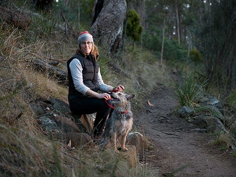
Given the rich fauna and the importance of the area as a drinking water catchment, dogs are respectfully prohibited from traversing the entirety of this track.
Track Grade
Grade 4 (Hard) - Challenging Walks for Experienced Walkers: Grade 4 on the AWTGS signifies challenging walking tracks. Bushwalking experience is recommended for these tracks, which may be long, rough, and very steep. Directional signage may be limited, requiring a good sense of navigation. These walks are suited for experienced walkers who are comfortable with steeper inclines, rougher terrain, and potentially longer distances.
Tips
- Due to the park's unpredictable weather, including potential snowfalls year-round, it's essential to pack ample warm, waterproof clothing, as well as provisions for the journey.
- Be cautious of slippery conditions caused by snow and ice, and remain mindful of the risk of falling rocks, particularly around the Organ Pipes.
- No dogs are allowed on Panorama, Zig Zag, or Pinnacle Tracks.
Map and GPX file
Max elevation: 1263 m
Min elevation: 253 m
Total climbing: 1227 m
Total descent: -1227 m
For more information on this trail, visit Greater Hobart Trails
Trail Location (trailhead)
Sorry, no records were found. Please adjust your search criteria and try again.
Sorry, unable to load the Maps API.
Photo gallery
If you have any photos from this hike and are happy to share them, please upload your .jpg files here.
Please note: Uploading photos does not transfer ownership of copyright away from you. If requested, you will be credited for any photos you provide and can ask they be deleted at any time.
About the region
The summit of kunanyi / Mount Wellington offers breathtaking views of Hobart and much of southern Tasmania. On the west side of the summit, you can gaze deep into the Southwest wilderness. Boardwalks and lookout platforms, along with the Pinnacle observation shelter, provide prime vantage points. The shelter is open from 7am to 10pm from September to April, and from 7am to 5.30pm from May to August.
Few cities can rival Hobart for the natural splendor of its backdrop, with kunanyi / Mount Wellington towering 1,271 meters above the city—almost 200 meters taller than Cape Town’s famed Table Mountain. For Hobartians, "the mountain" is integral to daily life: a place to walk, ride mountain bikes, play in the winter snow, and reconnect with nature, all just a half-hour drive from the city center. The mountain dominates the cityscape; stand almost anywhere in Hobart and you’ll see its forested slopes.
Much of the mountain is within Wellington Park reserve, which features the Organ Pipes escarpment running like ribs across the slopes, and numerous trails threading throughout. Wellington Park is an 18,011-hectare reserve on the doorstep of nipaluna / Hobart in southern lutruwita / Tasmania. The Park stretches west from the 1,271-meter summit of kunanyi / Mount Wellington and includes spectacular lookouts, dramatic cliff faces, boulder fields, waterfalls, fern glades, and stunning dolerite rock formations.
kunanyi / Mount Wellington is accessible to walkers via a network of recreational trails, a shuttle bus from the Hobart waterfront, or by car or bike on a sealed but winding road to the summit (the Pinnacle). Note that car parking in the Park is limited, and the road may be closed due to ice and snow—check the Pinnacle Road status on the City of Hobart or Wellington Park Management Trust website before departing. Be prepared for extreme and changeable weather.
Lookouts and observation decks at the Pinnacle provide spectacular views over Hobart towards the east coast, the World Heritage Area of southern Tasmania to the west, and Bruny Island to the south. Parking and toilet facilities are available.
The Park supports a network of tracks for walking, running, mountain biking, horse riding (permit required), and recreational 4WDs (permit required). Popular locations in the Park include The Springs picnic area and Lost Freight Cafe, Cathedral Rock, Myrtle Forest picnic area, the Octopus Tree, Sphinx Rock, the Organ Pipes, and Glenorchy Mountain Bike Park.
Similar trails nearby
Explore Safe
While planning your hike, it’s important to check official government sources for updated information, temporary closures and trail access requirements. Before hitting the trail, check local weather and bushfire advice for planned burns and bushfire warnings and let someone know before you go. Plan ahead and hike safely.
Let someone know
Adventure with peace of mind: Fill out your trip intentions form. Before you hit the trail, fill out an online form to privately send important details about your hike to your family or friends. If you don’t return on time, they can easily alert emergency services, preventing worry and ensuring a swift response. Hike with peace of mind and enjoy your outdoor adventure to the fullest. Be smart, be safe: Register your plans here.
Gear to consider
What you carry in your pack will depend on the weather, terrain, time of year, type of adventure, and personal preferences. Having trouble deciding what gear’s right for you? My free planning, food and packing checklists provide an introduction to things your could consider (as well as the Ten Essentials) on your day, overnight and multi-day adventures. Customise your kit according to your personal needs, always considering safety first.
Suggest an edit
Trail changed? New features discovered? Has the route changed? Trail permanently closed? Help fellow hikers by suggesting edits! Click above to update route descriptions, GPX file, trail features (like boardwalks), or access conditions (like parking availability). Help me keep the trails info fresh!
Weather
Acknowledgement of Country
Trail Hiking Australia acknowledges the Traditional Owners of the lands on which we hike and pay respects to their Elders, past and present, and we acknowledge the First Nations people of other communities who may be here today.


