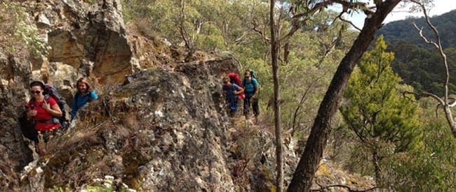
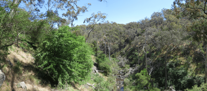
The journey from Lake Daylesford to Castlemaine Station covers 58 kilometers and traverses through Australia's first National Heritage Park, the Castlemaine Diggings National Heritage Park, designated in 2002 to honor its association with the Victorian gold rush era.
Following old 1850s gold rush water races, the track leads from the wet temperate forests atop the Great Dividing Range in Daylesford to the dry northern plains surrounding the Forest Creek gold diggings near Castlemaine. Along the way, travelers encounter various sections with distinct characteristics and historical significance.
The Tipperary Walk offers a gentle journey through bushland, providing insights into the gold rush and mineral spa towns of Daylesford and Hepburn Springs. For those seeking a glimpse into the gold rush era, both the Golden Mountain and Cry Joe walks/rides navigate narrow gullies dotted with mine shafts and stone ruins.
Alternatively, adventurers can choose to bypass Castlemaine and directly connect with the Leanganook Track via a designated link route starting north of The Monk and passing through Chewton.
The Dry Diggings Track, segmented into four Walks/Rides, winds through steep slopes and narrow tracks above streams, showcasing the natural beauty and historical remnants of the region. Notably, the section from Breakneck Gorge to Golden Springs offers breathtaking views and encounters with the Hepburn Mineral Springs Reserve.
Throughout the journey, travelers can immerse themselves in the diverse landscapes and rich history of the gold rush era, from the distinctive cone of Mt Franklin to the winding paths of the Poverty Gully water race. Whether on foot or bike, the route offers a captivating exploration of the region's past and natural beauty.
Please don’t copy GPX files or content from this site to AllTrails or other platforms. Each trail has been personally mapped, documented, and refined to support Australia’s bushwalking and hiking community. While some details come from land managers, every listing reflects significant personal effort. This is a free, community-driven initiative—your respect helps keep it that way.
Total distance: 58103 m
Max elevation: 563 m
Min elevation: 277 m
Total climbing: 1258 m
Total descent: -1507 m
Getting there
Getting to the trailhead: Castlemaine Diggings National Heritage Park.
Closest towns to this walk: Campbells Creek, Castlemaine, Chewton, Elphinstone, Fryerstown, Guildford, Maldon, Newstead, Vaughan
About the region
The Castlemaine Diggings National Heritage Park is near the town of Castlemaine, Victoria, Australia. The park protects a nationally significant historic cultural landscape of heritage value and relics of the Victorian gold rush. The Castlemaine Diggings National Heritage Park was added to the Victorian Heritage Register in December 2003. It is the largest non-indigenous protected cultural landscape in Australia. In January 2005 the park was added to the Australian National Heritage List recognizing its outstanding heritage value and importance in the course of Australia's migration history.
Similar walks nearby
Looking for more walks in or near Castlemaine Diggings National Heritage Park? Try these trails with a similar difficulty grade.
Favourite

Favourite

Favourite

Favourite

Track grade
Grade 3 (Moderate) - Walks for Most Fitness Levels: Grade 3 on the
AWTGS represents moderate walking tracks. These are ideal for walkers with some fitness who are comfortable with some hills and uneven terrain. While suitable for most ages, some bushwalking experience is recommended to ensure a safe and enjoyable experience. Tracks may have short, steep hill sections, a rough surface, and many steps. The total distance of a Grade 3 walk can be up to 20 kilometers.
Explore safe
Plan ahead and hike safely! Carry enough water, pack layers for changing conditions, and bring safety gear like a torch, PLB, and reliable communication device. Check official sources for trail updates, closures, and access requirements, and review local weather and bushfire advice. Most importantly, share your plans with someone before you go. Being prepared makes for a safer and more enjoyable hike! Stay Safe, Explore More, and Always #ExploreSafe.
Packing checklists
What you carry in your pack depends on factors like weather, terrain, and your adventure type. Not sure what to bring? My free planning, food, and packing checklists are a great starting point, covering day hikes, overnight trips, and multi-day adventures. Use them to customise your kit and always prioritise safety.
Let someone know
Before heading out, take a moment to fill out your trip intentions form. It’s a quick way to share your hike details with family or friends. If something goes wrong, they can notify emergency services, ensuring a faster response and peace of mind. Stay safe and enjoy your adventure
Suggest an edit
Spotted a change on this trail? Maybe there are new features, the route has shifted, or the trail is permanently closed. Whatever the update, I’d love your input. Your feedback helps fellow hikers stay informed and ensures that our trail info stays fresh and reliable.
/Great-Dividing-Trail-Dry-Diggings-Track_10.jpg)
/Great-Dividing-Trail-Dry-Diggings-Track_6.jpg)
/Great-Dividing-Trail-Dry-Diggings-Track_7.jpg)
/Great-Dividing-Trail-Dry-Diggings-Track_12.jpg)
/Great-Dividing-Trail-Dry-Diggings-Track_2.jpg)
/Great-Dividing-Trail-Dry-Diggings-Track_8.jpg)
/Great-Dividing-Trail-Dry-Diggings-Track_4.jpg)
/Great-Dividing-Trail-Dry-Diggings-Track_5.jpg)
/Great-Dividing-Trail-Dry-Diggings-Track_3.jpg)
/Great-Dividing-Trail-Dry-Diggings-Track_1.jpg)
/Great-Dividing-Trail-Dry-Diggings-Track_9.jpg)
/Great-Dividing-Trail-Dry-Diggings-Track_11.jpg)


7 Reviews on “Great Dividing Trail: Dry Diggings Track (58km)”
Jessica Rainey Carl Johnston Matt Robert Daniel Pye Brent Hartnel