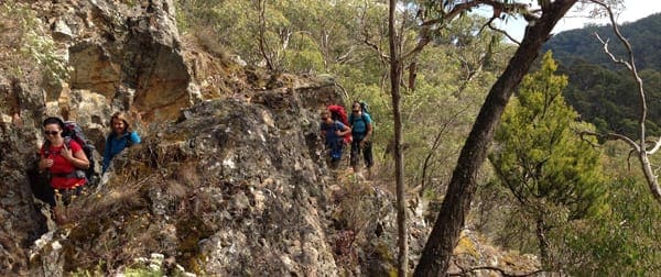
Tracing the route of the old water races cut by miners last century, the Tipperary Track passes disused goldfields, mineral springs and stands of deciduous trees that blaze with colour in autumn. Look out for the Blowhole, a tunnel built to divert water and allow sluicing for gold in the dry creek bed. Reward yourself with a relaxing spa and massage at journey's end in Hepburn Springs.
You can hike this trail in either direction, starting at Lake Daylesford or to Central Springs Reserve. The first section takes you to Twin Bridges where you cross the Midland Highway and walk to Tipperary Springs.The next section is from Tipperary Springs to Bryces Flat, then onto Breakneck Gorge and Liberty and Golden Springs. Then to Jackson's Lookout to finish at the Hepburn Mineral Springs Reserve.
Got some great shots from this hike? Upload your photos here to inspire others and show off the beauty of the trail!
Submitting your photos doesn’t mean you lose ownership. You can be credited for your contributions, and you can request removal at any time.
Please don’t copy GPX files or content from this site to AllTrails or other platforms. Each trail has been personally mapped, documented, and refined to support Australia’s bushwalking and hiking community. While some details come from land managers, every listing reflects significant personal effort. This is a free, community-driven initiative—your respect helps keep it that way.
Total distance: 15076 m
Max elevation: 547 m
Min elevation: 400 m
Total climbing: 358 m
Total descent: -431 m
Getting there
Getting to the trailhead: Hepburn Regional Park.
From Melbourne CBD travel over the Westgate Bridge and take the Western Ring Road until the left Western Highway exit with signs to Ballarat. Once on the Western Highway travel for about one hour until the Ballan/Daylesford turnoff. After taking this left exit turn right toward Daylesford and travel for around 30 kilometres then follow the signs to Lake Daylesford.
Closest towns to this walk: Bullarto, Castlemaine, Clunes, Daylesford, Dry Diggings, Eganstown, Glenlyon, Hepburn Springs, Lyonville, Musk, Trentham, Woodend
About the region
Hepburn Regional Park nestles around the famous mineral springs townships of Daylesford, Hepburn and Hepburn Springs. Rich with natural springs and relics from the gold mining era, the park abounds with opportunities for bushwalking, mountain bike and horse riding, picnicking and nature study. Mount Franklin is a small volcanic crater with basic camping set amid exotic trees.
Similar walks nearby
Looking for more walks in or near Hepburn Regional Park? Try these trails with a similar difficulty grade.
Favourite

Favourite

Favourite

Favourite

Track grade
Grade 3 (Moderate) - Walks for Most Fitness Levels: Grade 3 on the
AWTGS represents moderate walking tracks. These are ideal for walkers with some fitness who are comfortable with some hills and uneven terrain. While suitable for most ages, some bushwalking experience is recommended to ensure a safe and enjoyable experience. Tracks may have short, steep hill sections, a rough surface, and many steps. The total distance of a Grade 3 walk can be up to 20 kilometers.
Explore safe
Plan ahead and hike safely! Carry enough water, pack layers for changing conditions, and bring safety gear like a torch, PLB, and reliable communication device. Check official sources for trail updates, closures, and access requirements, and review local weather and bushfire advice. Most importantly, share your plans with someone before you go. Being prepared makes for a safer and more enjoyable hike! Stay Safe, Explore More, and Always #ExploreSafe.
Packing checklists
What you carry in your pack depends on factors like weather, terrain, and your adventure type. Not sure what to bring? My free planning, food, and packing checklists are a great starting point, covering day hikes, overnight trips, and multi-day adventures. Use them to customise your kit and always prioritise safety.
Let someone know
Before heading out, take a moment to fill out your trip intentions form. It’s a quick way to share your hike details with family or friends. If something goes wrong, they can notify emergency services, ensuring a faster response and peace of mind. Stay safe and enjoy your adventure
Suggest an edit
Spotted a change on this trail? Maybe there are new features, the route has shifted, or the trail is permanently closed. Whatever the update, I’d love your input. Your feedback helps fellow hikers stay informed and ensures that our trail info stays fresh and reliable.


3 Reviews on “Tipperary Track (15km)”
Parts of the Gold Fields Track from Twin Bridges to Bryce’s Flat were marked as closed 2 weeks ago. I did it anyway and there was absolutely no reason why that track should still be closed.
Al Morkans they have been closed for ages from what I understand. Slatey Creek was also still a mess last time I walked through there.
Liz Marr The tracks closed after the 2022 storms. I did a recon walk on that track last year but it was still very sketchy. Trees down across the track, which is narrow in places, bordered by a steep fall into Sailors Creek. Gave it away after a km or so.
There is absolutely no problem now. Heck, it is better condition than prior to the storm. The blackberries and spikey brambles have been slashed.
You may however encounter workers during the week. There are fresh blue paint lines in various places, for no reason obvious to me. A set of steps had been framed, but not completed in one place.