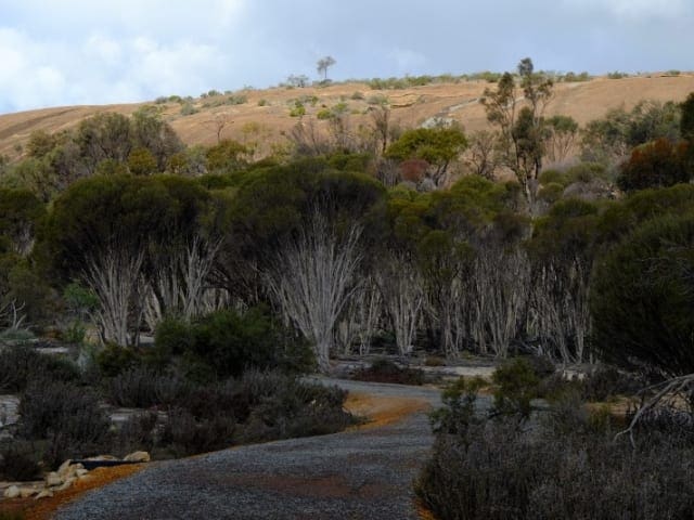
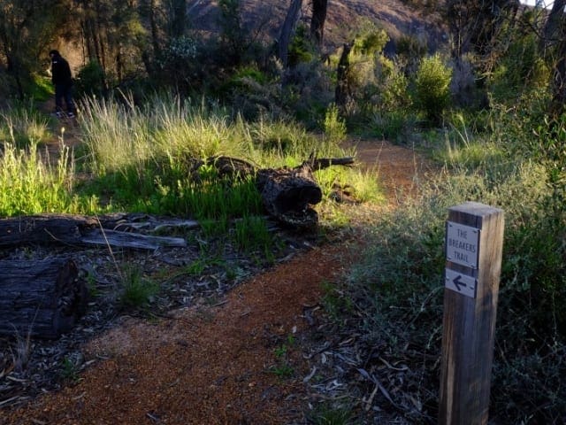
Nearby the Humps is the flat easy 1.2 kilometre Gnamma Trail. Ten interpretive panels help you understand this landscape using the woRoads and illustrations of local Noongar elders and artists. It features two Gnamma (rock holes) and a lizaRoad trap, all believed to have been used by Noongar people for centuries.
The Gnamma Trail takes you along an expansive flat slab of granite which is in stark contrast to the anything but flat Humps. Information panels along the way show the visitor the local Aboriginal (Noongar) interpretation of the plants and animals that thrive in the area. The significance to the Noongar people cannot be underestimated as they had a realiable source of freshwater from the gnamma holes, vital in the blistering hot dry summers. hese deceptively deep water holes in the rock have been used by local Aboriginal people for many generations For nature lovers. this trail goes through remnant bush land, rich with springtime wildflowers and numerous Birds.
Start Point: The Humps Car Park, 3km from Hyden, 334km (3.5 hours) east of Perth
End Point: The Humps Car Park, 3km from Hyden, 334km (3.5 hours) east of Perth
Region: The Humps, Golden Outback
For more information, a location map and GPS file please visit Trails WA.
Got some great shots from this hike? Upload your photos here to inspire others and show off the beauty of the trail!
Submitting your photos doesn’t mean you lose ownership. You can be credited for your contributions, and you can request removal at any time.
Please don’t copy GPX files or content from this site to AllTrails or other platforms. Each trail has been personally mapped, documented, and refined to support Australia’s bushwalking and hiking community. While some details come from land managers, every listing reflects significant personal effort. This is a free, community-driven initiative—your respect helps keep it that way.
It looks like I don’t have a GPX file for this trail yet. If you have one to share, please email it to me! I’ll verify it against official maps before adding it to help other hikers have a safer, easier experience. Thanks for contributing to a better hiking resource.
Getting there
Getting to the trailhead: The Humps Nature Reserve.
Closest towns to this walk: Coolgardie, Cue, Kalgoorlie, Kambalda, Menzies, Mount Magnet, Norseman, Paynes Find, Sandstone, Yalgoo
About the region
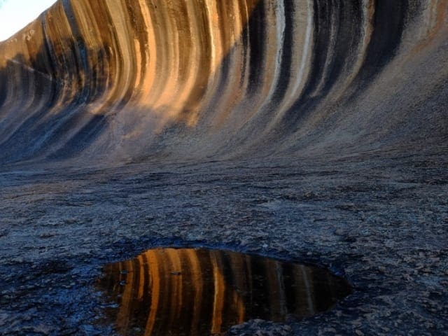
The Humps Nature Reserve is just under 4 hours drive east from Perth through WA's wheatbelt and farming country to the small community of Hyden and a short drive to the Hyden Wildlife Park a 160 hectare reserve which includes Hyden Rock and the Wave Rock. It is the 100m long and 15m high Wave Rock that is the highlight of the park with what is referred to as a flared slope' with the concave shape of the granitic rock. The shape is likely to be the result of chemical and groundwater erosion over millions of years.
Similar walks nearby
Looking for more walks in or near The Humps Nature Reserve? Try these trails with a similar difficulty grade.
Favourite

Favourite

Favourite

Favourite

Track grade
Grade 1 (All-abilities) - Perfect for Families and Beginners: Grade 1 on the
AWTGS represents the easiest walking tracks, perfect for families with young children or those new to bushwalking. No prior experience is required. These gentle walks feature a flat, even surface with no steps or steep sections. They are suitable for wheelchair users with assistance due to the even terrain. The total distance of a Grade 1 walk is typically no greater than 5 kilometers, making them a comfortable and manageable option for all ages and fitness levels.
Explore safe
Plan ahead and hike safely! Carry enough water, pack layers for changing conditions, and bring safety gear like a torch, PLB, and reliable communication device. Check official sources for trail updates, closures, and access requirements, and review local weather and bushfire advice. Most importantly, share your plans with someone before you go. Being prepared makes for a safer and more enjoyable hike! Stay Safe, Explore More, and Always #ExploreSafe.
Packing checklists
What you carry in your pack depends on factors like weather, terrain, and your adventure type. Not sure what to bring? My free planning, food, and packing checklists are a great starting point, covering day hikes, overnight trips, and multi-day adventures. Use them to customise your kit and always prioritise safety.
Let someone know
Before heading out, take a moment to fill out your trip intentions form. It’s a quick way to share your hike details with family or friends. If something goes wrong, they can notify emergency services, ensuring a faster response and peace of mind. Stay safe and enjoy your adventure
Suggest an edit
Spotted a change on this trail? Maybe there are new features, the route has shifted, or the trail is permanently closed. Whatever the update, I’d love your input. Your feedback helps fellow hikers stay informed and ensures that our trail info stays fresh and reliable.


