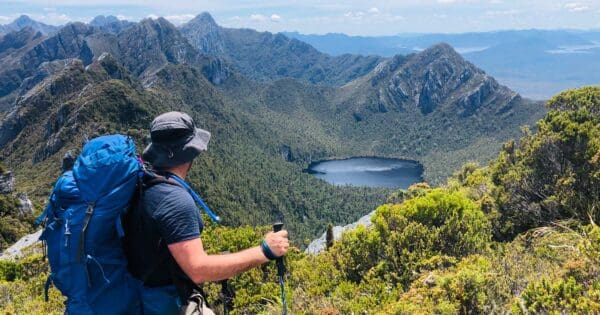
Australia boasts some of the world’s most breathtaking hiking trails. From the rugged beauty of the Outback to the lush rainforests of Tasmania, there’s a path waiting to be explored by every kind of adventurer. But with this growing popularity comes a responsibility to ensure our love for the outdoors doesn’t harm the very places we explore.
One way we can achieve this balance is by being mindful of the data we share online, particularly on trail mapping applications. Uploading inaccurate information can have unintended consequences, leading hikers astray and creating “social trails” that damage ecosystems and pose safety risks.
I’m passionate about promoting safe and responsible hiking practices. That’s why I want to share some key principles developed by Leave No Trace, a leading organisation dedicated to minimising the environmental impact of outdoor activities, in collaboration with the U.S. Forest Service. These guidelines offer a framework for uploading responsible trail data, ensuring our shared love for the outdoors translates into a positive impact.

Leave No Trace and Uploading Trail Data
- Accuracy is Key: Before uploading any trail data, be absolutely certain it leads to a designated trail maintained by a recognised land management authority. Double-check with official resources if unsure about a particular section.
- Use Official Trail Names: Using official or recognised trail names is crucial for clear communication and safety. This ensures clear communication, aids search and rescue, and promotes use of well-maintained trails. By using to recognised names, you contribute to a clear and reliable trail information network that benefits everyone who enjoys the outdoors.
- Respectful Waypoints: Waypoints can be incredibly helpful for marking campsites, points of interest, or trail reroutes. However, avoid marking sensitive areas like wildlife habitats, culturally significant sites, or closed camping zones.
- Geotag with Responsibility: Sharing your location on photos can be a fantastic way to inspire others. But remember, with great sharing comes great responsibility. Consider removing geotags from sensitive locations and include Leave No Trace information in your captions, encouraging others to research the area, plan ahead, and follow responsible practices.
- Consider Your Images: A picture can be worth a thousand words, and in the world of trail data, it can also influence behaviour. Showcase good Leave No Trace principles in your photos, promoting responsible trail use and setting a positive example for fellow hikers.
- Verify Before Sharing: Not all data online is created equal. Before sharing trail information uploaded by others, take a moment to review its accuracy. Don’t unknowingly promote unintended trails that could harm the environment or put people’s lives at risk.
- Give Back to the Trails You Love: One of the best ways to ensure healthy trails is by volunteering your time and effort. Many land managers and bushwalking organisations offer trail maintenance opportunities. Get involved and contribute to the ongoing health of the places you cherish.

Understanding User-Uploaded Data Limitations
While user-uploaded trail data can be a great starting point, it’s important to be aware of its limitations. Trail difficulty ratings might not align with established systems like the Australian Walking Track Grading System (AWTGS). Additionally, user-based difficulty ratings can be subjective and vary depending on individual fitness levels. Similarly, completion times uploaded by others may not reflect your own pace.
Planning Your Hike with Confidence
To ensure a safe and enjoyable experience, I recommend consulting official resources provided by land management authorities in each state or territory (refer to the list below). These resources often include the AWTGS rating for trails and more reliable estimates for completion times based on average pace.
For a deeper understanding of the AWTGS and its criteria, visit my dedicated page on the Australian Walking Track Grading System: As you will see, it can be quite nuanced, but this page explains the different AWTGS difficulty levels and the factors considered when assigning a rating.
Trail mapping applications may also allow users to submit AWTGS ratings alongside their uploads. If you’re contributing trail data, consider including this information where available. It’s also helpful to include realistic completion times based on your own experience, acknowledging that pace can vary.
If relying on data from someone else, remember, thorough research and planning are vital for a successful hike. Don’t rely solely on user-uploaded data. Consider your fitness level, experience, and the recommendations from official sources when preparing for your adventure.

Adapting the Guidelines for Australia
While the core principles outlined by Leave No Trace are universally applicable, it’s important to consider the specific context of Australian trails. Here in Australia, land management responsibilities vary depending on the region. For the most up-to-date information on designated trails and responsible practices, you can refer to resources provided by land managers in each State or Territory:
- Australian Capital Territory: Parks ACT
- New South Wales: NSW National Parks
- Northern Territory: Parks and Reserves NT
- Queensland: Queensland National Parks
- South Australia: National Parks and Wildlife Service South Australia
- Tasmania: Tasmania Parks and Wildlife Service
- Victoria: Explore Outdoors, Parks Victoria
- Western Australia: Explore Parks WA
By following these simple guidelines, we can all contribute to a thriving online trail community that fosters responsible exploration and protects the Australian wilderness for generations to come. Remember, sharing is caring, and when it comes to trail data, let’s make sure we’re sharing information that leads to a positive impact on our environment.
For a more detailed look at the Leave No Trace Uploading Trail Data Guidelines, you can download their free PDF here: Uploading Trail Data Guidelines


