What are the parts of a compass?
There are many different types of compasses, but for hiking/bushwalking, it’s important to purchase a unit that can reliably measure bearings and help you determine your route of travel. Beware of cheap substitutes such as a compass on a your knife or integrated cleverly into your outdoor gear. They are novelties only and should never be relied on for accurate navigation. Spend your money wisely on something that is robust, lightweight, compact and of course, reliable.
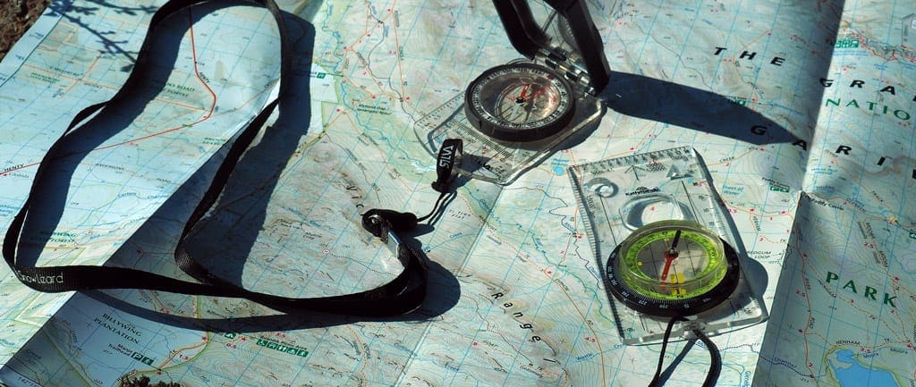
Many modern compasses incorporate a baseplate and protractor tool, and are referred to variously as “orienteering”, “baseplate”, “map compass” or “protractor” designs. This type of compass uses a separate magnetized needle inside a rotating capsule, an orienting “box” or gate for aligning the needle with magnetic north, a transparent base containing map orienting lines, and a bezel (outer dial) marked in degrees or other units of angular measurement. The capsule is mounted in a transparent baseplate containing a direction-of-travel (DOT) indicator for use in taking bearings directly from a map.
Other features found on modern orienteering compasses are map and romer scales for measuring distances and plotting positions on maps, luminous markings on the face or bezels, various sighting mechanisms (mirror, prism, etc.) for taking bearings of distant objects with greater precision, gimbal-mounted, “global” needles for use in differing hemispheres, special rare-earth magnets to stabilize compass needles, adjustable declination for obtaining instant true bearings without resorting to arithmetic, and devices such as inclinometers for measuring gradients. The sport of orienteering has also resulted in the development of models with extremely fast-settling and stable needles utilizing rare-earth magnets for optimal use with a topographic map, a land navigation technique known as terrain association.
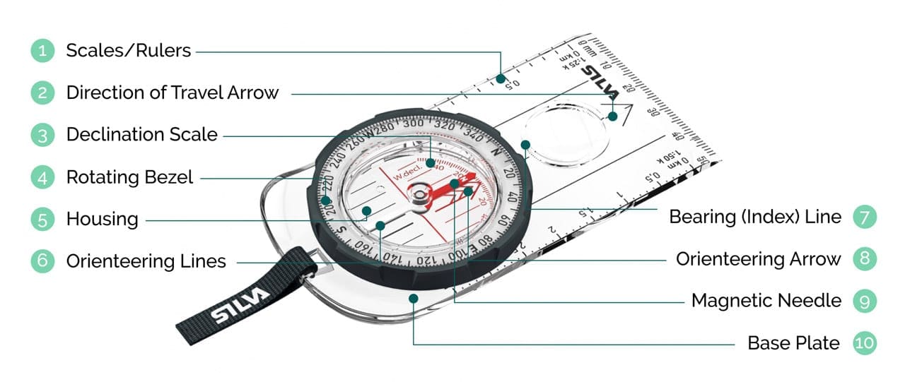
Parts & purpose of a modern compass
1. Scales/Rulers
Each edge of a compass may have different rulers for use with different map scales. In Australia, a compass with scales of 1:25k and 1:50k will work best. Use the scale that corresponds with your map’s scale to determine distances.
2. Direction of Travel Arrow
Marked on the base plate. Tells you which direction to point the compass when you’re taking or following a bearing.
3. Declination Scale
Used to orient the compass in an area with known declination and is also used for easily adding or subtracting the known declination in your area of travel.
4. Rotating Bezel
Also called the ‘azimuth ring’, this outer circle has 360 degree markings. You hold the dial and rotate it to rotate the entire housing.
5. Housing
The main part of the compass. It is a round plastic container filled with liquid and has the compass needle inside. A bubble of air in the housing liquid is useful for making sure you are holding the compass fairly level
6. Orienteering Lines
Series of parallel lines marked on the floor of the housing and on the base plate. Correctly aligning these with the north-south lines on a map aligns your orienting arrow with north.
7. Bearing (Index) Line
Located directly above the bezel, it’s also called a “read bearing here” mark.
8. Orienteering Arrow
Marked on the floor of the housing. It rotates with the housing when the dial is turned. You use it to orient a compass to a map. It has an outline shaped to exactly fit the magnetized end of the needle.
9. Magnetic Needle
Magnetized piece of metal that has one end painted red to indicate North. It sits on a fine point that is nearly frictionless so it rotates freely when the compass is held fairly level and steady.
10. Base Plate
Hard, transparent, flat surface on which the rest of the compass is mounted. It has a rulers on its edges for measuring distances on maps. It’s edge is straight and is used for taking bearings and transferring them to your map.
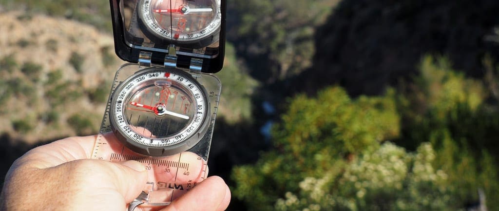
Additional compass features
Magnifier: For more detailed reading of map features.
Mirror: Lets you see the compass face and distant objects at the same time (using the sight) which provides more accurate readings. The mirror can also double as an emergency signalling aid.
Sight: Can be helpful to aim more precisely at a distant landmark, especially in open terrain.
Global needle: Standard compasses only work in one hemisphere, so they are either northern or southern hemisphere specific. More expensive models can work in both hemispheres and therefore function well worldwide. This is worth keeping in mine if you are travelling to other countries.
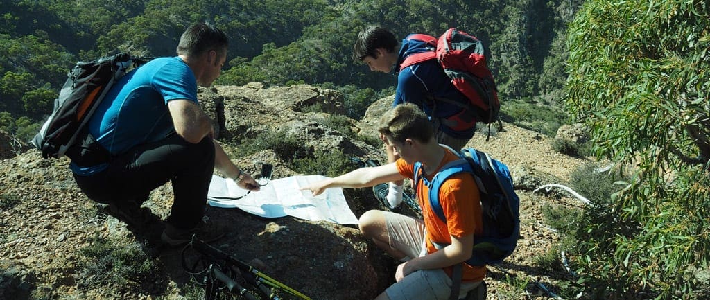
Practice, practice, practice
Get to know your compass and practice using it on every hike. The more familiar you are with the parts of your compass, the more confident you will be using it. Learning how to use your compass could just save your life one day so it is a skill every adventure should master.
I often meet other hikers on the trail who seem confused about their location or direction of travel. Most are not carrying a map and simply expect that their will be an obvious trail or markers to define the way. Other people I meet have a map but simply cannot read it. Knowing how to read a map isn’t difficult, for most people, given training, a bit of practice and continual use. The symbols, topography lines and direction helpers all might require a little understanding, but the answers are all right there! We’ll show you how to find the key to finding your way!


What’s your go-to feature in a compass that you can’t live without when you’re out in the bush?
Trail Hiking Australia That it points North consistently 😂
But seriously, a lensatic compass is good but just a basic Silva with a transparent base plate is enough. Just make sure it’s one meant for the Southern Hemisphere.
A good map on the other hand, is a different story entirely.
Murky Murk ahhh. You laugh that it must point north consistently. One of ours decided to start pointing south. Lucky it was an easy fix with a magnet
Trail Hiking Australia I’ve seen it happen too. 😂
Imagine a drawer full of compasses and one is pointed 180 from the rest.
Murky Murk that’s ones the keeper.
Trail Hiking Australia That’s the one you give the 2LT that does his map reading on the bonnet of a Land Rover 😅
Trail Hiking Australia someone who can use it properly
Sue Evans that’s a good tip and reminder to keep practicing.
Sue Evans Yep. Definitely make sure you pack one of those 😂
Up to date map a standard old Silva Prismatic, a notepad and pencil.
Yes I use my GPS, but in the event of a failure, these items would see me get home.Media: https://www.facebook.com/photo.php?fbid=2487661531592988&set=p.2487661531592988&type=3
Dan McNab nice one.
Dan McNab I always take a map and silva just in case. Old habits die hard.
Phil Brooks it’s a pretty good habit not to break. Mines always in my pack too.