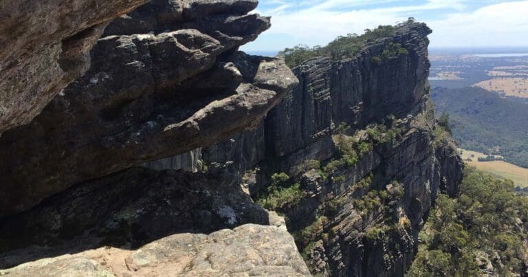
Wonderland Loop is a 25km, grade 4 hike located in Grampians National Park, Victoria. The hike should take around 1-2 days to complete. It can be done as a day or overnight hike.
Hike overview
The Wonderland Loop is a hike I pieced together many years ago from a series of Grampians trails. After exploring most of the Grampians, I thought it would be great to have a longer day or overnight option. This was before the Grampians Peaks Trail was developed. My original plan was to do this as an overnight hike but I ended up completing it in a day. You could do either but would need to research appropriate campsites.
Commencing in Halls Hap, along School Road, this loop first allows you to summit Chatauqua Peak north west of Halls Gap before making your way along the creek via Venus Baths, Splitter and Stoney Falls before arriving at the Wonderland Carpark.
After traversing the Wonderland Forest, you will then commence a steady climb via Cool Chamber to the famed Pinnacle Lookout where you will be rewarded with stunning views over Halls Gap and the valley below. From the Pinnacle, continue to make your way south via Bellfield Park and Devils Gap to the Sundial Turntable carpark.
It covers most of the Wonderland Loop including the Pinnacle and Sundial Peak before crossing the valley to the opposite ridge. Following a short side trip to Lakeview Lookout, continue to follow the trail south east towards Eagan Point and the breathtaking Sundial Peak where you can gain access to a number of view points.
After leaving Sundial, continue south east along the trail as it slowly descends to the valley below. You will reach the valley at Bellfield Settlement where you can spend some time exploring the dam wall of Lake Bellfield. From this point, you simply follow the walking track that runs parallel to the Grampians Pipeline and main road into Halls Gap and the end of the trail.
Variation to extend the hike
If you wanted to extend the hike (by approximately 5km), you can cross the dam wall at Lake Bellfield to pick up the Baronia trail on the eastern side of Fyanns Creek. When I did this hike, the section from Lake Bellfield to Boronia Peak was extensively overgrown and took a long time and a lot of effort to navigate. Just before reaching Mount Ida, you can take a quick side trip to the summit of Baronia Peak for great views of the range you traversed earlier. Complete the circuit hike by continuing north along Fyanns Creek to Grampians Road. Cross the bridge over the creek and make your way back into Halls Gap and the end of the trail.
You will find the GPX file for this variation below.
Route and GPX file
Wonderland Loop - 25km
Max elevation: 779 m
Min elevation: 233 m
Total climbing: 1254 m
Total descent: -1256 m
Wonderland Loop via Baronia Peak - 30km
Max elevation: 779 m
Min elevation: 228 m
Total climbing: 1775 m
Total descent: -1776 m
Trail location
Sorry, no records were found. Please adjust your search criteria and try again.
Sorry, unable to load the Maps API.
Getting there
Grampians National Park is in western Victoria, 260km from Melbourne and 460km from Adelaide. Halls Gaps is 253km west of Melbourne.
About the region
Renowned for rugged mountain ranges, rich cultural heritage and breathtaking scenic views, the 168,000 hectare park is ideal for a wide range of outdoor activities. The many walking tracks will take you on a journey to waterfall vistas, ancient geological rock features and forests. There are guided tours, and with a large network of roads available, car touring is a great way to explore. Renowned as the major attraction in the region, the Grampians National Park is a must-visit destination for all travellers, backpackers and day-trippers in Victoria. The spectacular setting of the mountainous landscape boasts a wide array of attractions and activities for visitors to the region. The Grampians National Park (also Gariwerd), commonly referred to as The Grampians, is a national park located in the Grampians region of Victoria, Australia. The 167,219-hectare (413,210-acre) national park is situated between Stawell and Horsham on the Western Highway and Dunkeld on the Glenelg Highway, 260 kilometres west of Melbourne and 460 kilometres east of Adelaide.
Similar trails nearby
Explore Safe
While planning your hike, it’s important to check official government sources for updated information, temporary closures and trail access requirements. Before hitting the trail, check local weather and bushfire advice for planned burns and bushfire warnings and let someone know before you go. Plan ahead and hike safely.
Let someone know
Adventure with peace of mind: Fill out your trip intentions form. Before you hit the trail, fill out an online form to privately send important details about your hike to your family or friends. If you don’t return on time, they can easily alert emergency services, preventing worry and ensuring a swift response. Hike with peace of mind and enjoy your outdoor adventure to the fullest. Be smart, be safe: Register your plans here.
Gear to consider

My free planning, food and packing checklists provide an introduction to things your could consider (as well as the Ten Essentials) on your day, overnight and multi-day adventures. Customise your kit according to your personal needs, always considering safety first.
Suggest an edit
Does this hikes information need updating? Sometimes the route, trail features or access conditions change.
Acknowledgement of Country
Trail Hiking Australia acknowledges the Traditional Owners of the lands on which we hike and pay respects to their Elders, past and present, and we acknowledge the First Nations people of other communities who may be here today.


