Hike at a Glance
Max elevation: 691m
Min elevation: 423m
Total Ascent: 317m
Hike overview
There are a number of walking options to reach The Pinnacle, varying in distance and difficulty. While this hike commences at the Wonderland Carpark, the easiest route to The Pinnacle departs from the Sundial carpark within the national park and ascends to The Pinnacle via Devils Gap. This is the best route to use if young children or unconfident walkers are part of your walking group. The 4.2km walk will take one and a half to two hours for the return trip. It does include some water crossings and rock-hopping, so good sturdy shoes are essential.
A more challenging walk departs from the aptly named Wonderland carpark and ascends via the impressive Grand Canyon. It does not resemble the American canyon of the same name but is equally impressive with its unique Australian rock formations, albeit on a smaller scale! The walk continues through the Silent Street before rising up to The Pinnacle.
For the really adventurous, you can walk to The Pinnacle from the base of the mountains, starting at the Halls Gap caravan park. This extended walk will take around five hours return so is suitable for fit and experienced walkers.
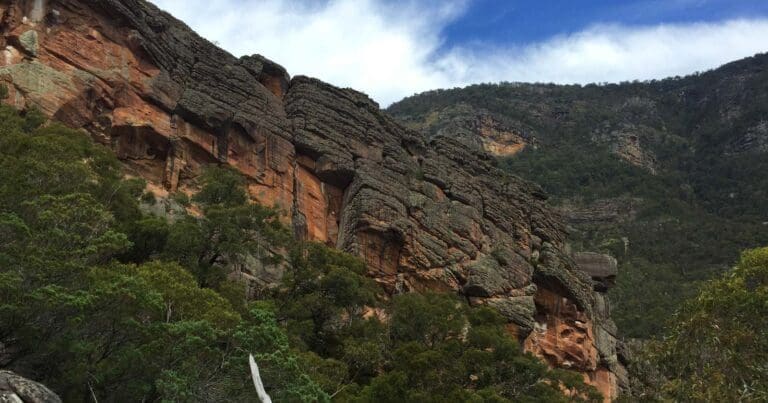
All these walks offer a variety of incredible rock formations to see and negotiate, as well as lush vegetation that has recovered from bushfires with fresh spurts of new growth. In springtime, wildflowers burst into life with their brilliant bright colours. With an abundance of wildlife living in the park, your walk may also include glimpses of koalas, kangaroos, snakes, skinks and maybe even an echidna or two.
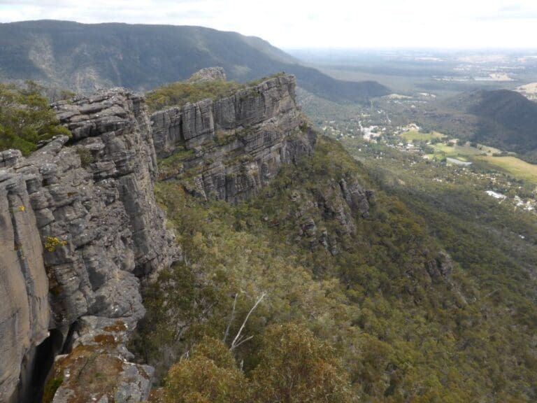
Whichever way you get there, the view from The Pinnacle lookout will astound you. While you get your breath back after your ascent, you will be able to see Halls Gap far below you, as well as Lake Bellfield. Plus you will get a close-up look at the irregular and fascinating rock formations for which the Grampians are so well-known.
Gallery
Got some great shots from this hike? Upload your photos here to inspire others and show off the beauty of the trail!
Click to view form >>
Submitting your photos doesn’t mean you lose ownership. You can be credited for your contributions, and you can request removal at any time.
Content use
Please don’t copy GPX files or content from this site to AllTrails or other platforms. Each trail has been personally mapped, documented, and refined to support Australia’s bushwalking and hiking community. While some details come from land managers, every listing reflects significant personal effort. This is a free, community-driven initiative—your respect helps keep it that way.
Walk map and GPX file
Max elevation: 691 m
Min elevation: 423 m
Total climbing: 317 m
Total descent: -317 m
Getting there
Getting to the trailhead: Grampians National Park.
Grampians National Park is in Western Victoria, a three-hour (260km) drive from Melbourne and a five-hour (460km) drive from Adelaide. The central Grampians is easily accessed from the villages of Halls Gap and Wartook and is a scenic day trip from the regional towns of Hamilton, Horsham, Stawell and Ararat. It is also a key destination on the internationally renowned Great Southern Touring Route.
Closest towns to this walk: Ararat, Cavendish, Dadswells Bridge, Dunkeld, Halls Gap, Horsham, Landsborough, Pomonal, Stawell, Warracknabeal, Wartook, Wartook Valley
About the region
Renowned for rugged mountain ranges, rich cultural heritage and breathtaking scenic views, the 168,000 hectare park is ideal for a wide range of outdoor activities. The many walking tracks will take you on a journey to waterfall views, ancient geological rock features and forests. There are guided tours, and with a large network of roads available, car touring is a great way to explore. Renowned as the major attraction in the region, the Grampians National Park is a must-visit destination for all travellers, backpackers and day-trippers in Victoria. The spectacular setting of the mountainous landscape boasts a wide array of attractions and activities for visitors to the region. The Grampians National Park (also Gariwerd), commonly referred to as The Grampians, is a national park in the Grampians region of Victoria, Australia. The 167,219-hectare (413,210-acre) national park is situated between Stawell and Horsham on the Western Highway and Dunkeld on the Glenelg Highway, 260 kilometres west of Melbourne and 460 kilometres east of Adelaide.
Similar walks nearby
Looking for more walks in or near Grampians National Park? Try these trails with a similar difficulty grade.
Track grade
Grade 3 (Moderate) - Walks for Most Fitness Levels: Grade 3 on the AWTGS represents moderate walking tracks. These are ideal for walkers with some fitness who are comfortable with some hills and uneven terrain. While suitable for most ages, some bushwalking experience is recommended to ensure a safe and enjoyable experience. Tracks may have short, steep hill sections, a rough surface, and many steps. The total distance of a Grade 3 walk can be up to 20 kilometers.
Explore safe
Plan ahead and hike safely! Carry enough water, pack layers for changing conditions, and bring safety gear like a torch, PLB, and reliable communication device. Check official sources for trail updates, closures, and access requirements, and review local weather and bushfire advice. Most importantly, share your plans with someone before you go. Being prepared makes for a safer and more enjoyable hike! Stay Safe, Explore More, and Always #ExploreSafe.
Packing checklists
What you carry in your pack depends on factors like weather, terrain, and your adventure type. Not sure what to bring? My free planning, food, and packing checklists are a great starting point, covering day hikes, overnight trips, and multi-day adventures. Use them to customise your kit and always prioritise safety.
Let someone know
Before heading out, take a moment to fill out your trip intentions form. It’s a quick way to share your hike details with family or friends. If something goes wrong, they can notify emergency services, ensuring a faster response and peace of mind. Stay safe and enjoy your adventure
Suggest an edit
Spotted a change on this trail? Maybe there are new features, the route has shifted, or the trail is permanently closed. Whatever the update, I’d love your input. Your feedback helps fellow hikers stay informed and ensures that our trail info stays fresh and reliable.
Acknowledgement of Country
Trail Hiking Australia acknowledges the Traditional Owners of the lands on which we hike and pay respects to their Elders, past and present, and we acknowledge the First Nations people of other communities who may be here today.


