Trail Fast Facts
Chatauqua Peak Circuit is a 6.5km, grade 3 circuit or return hike in Grampians National Park, Victoria. This hike typically takes 3 hours to complete.
Hike Overview
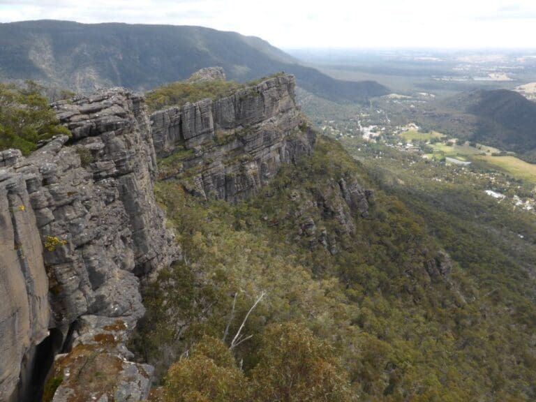
Chatauqua Peak is one of the most popular locations to visit in the Grampians, due to its beautiful panoramic views and its close proximity to Halls Gap. Chatauqua Peak is in the Grampians National Park with the loop walk commencing at the Halls Gap Botanic Gardens, with access through the Caravan Park.
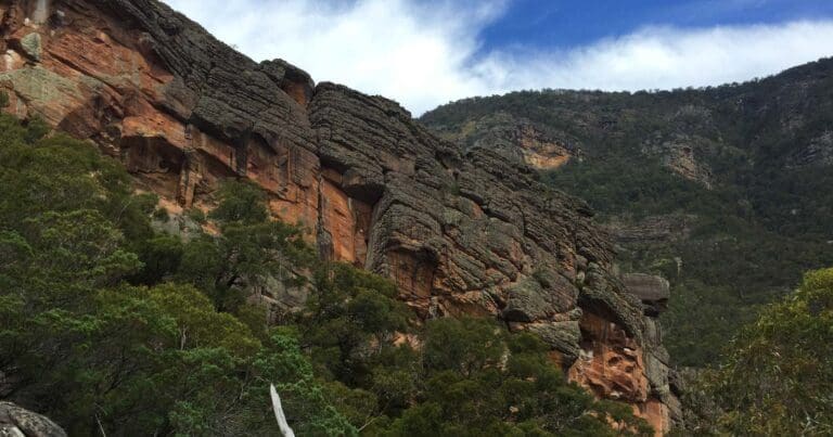
The walking track is a 6.5km circuit loop which takes most hikers between 2-3 hours to complete. At 200 metres elevation, the track is very steep and is considered moderate difficulty. As you get closer to the summit, some basic climbing over rocks will be required, therefore it is not suitable for those with mobility issues or for young children.
Once at the peak, you will be rewarded with stunning views of the Grampians National Park and Mount Gar Ranges. Make your way back down the way you came. There are signposts along the way, but hikers should make sure to get a detailed map before setting out on any hikes in the Grampians. This walk will take you past Clematis Falls which is best viewed in the rainy season between May-August.
You do not need a permit or make a booking to do this hike, but please note that no dogs or other animals are permitted in the Grampians National Park. Make sure to wear appropriate footwear and carry plenty of water and warm clothing during the winter months.
You can also complete 6.5km a return hike to Chatauqua Peak if you do not wish to complete the entire circuit.
Track Grade
Grade 3 (Moderate) - Walks for Most Fitness Levels: Grade 3 on the AWTGS represents moderate walking tracks. These are ideal for walkers with some fitness who are comfortable with some hills and uneven terrain. While suitable for most ages, some bushwalking experience is recommended to ensure a safe and enjoyable experience. Tracks may have short, steep hill sections, a rough surface, and many steps. The total distance of a Grade 3 walk can be up to 20 kilometers.
Tips
A good map should always be carried. Wonderland Walking Brochures are available from Brambuk the National Park and Cultural Centre Halls Gap, or from a local Grampians Visitor Information Centre.
Map and GPX file
Chatauqua Peak Circuit
Max elevation: 398 m
Min elevation: 244 m
Total climbing: 313 m
Total descent: -313 m
Chatauqua Peak
Max elevation: 398 m
Min elevation: 244 m
Total climbing: 275 m
Total descent: -275 m
Trail Location (trailhead)
Sorry, no records were found. Please adjust your search criteria and try again.
Sorry, unable to load the Maps API.
Getting there
Situated in Halls Gap Victoria, near the start of the walk to Venus Baths, the small but picturesque Grampians Flora Botanic Garden displays a range of local flora. It is a community garden, with no paid staff. It is wheelchair and child friendly.
Access conditions
- 2WD Access
- Bitumen Road
- Large Car Park
- Accessible Parking
- Accessible Toilet
- Public Toilets
- Drinking Water
- Picnic Shelter
- Picnic Table
- BBQ Facilities
About the region
Renowned for rugged mountain ranges, rich cultural heritage and breathtaking scenic views, the 168,000 hectare park is ideal for a wide range of outdoor activities. The many walking tracks will take you on a journey to waterfall vistas, ancient geological rock features and forests. There are guided tours, and with a large network of roads available, car touring is a great way to explore. Renowned as the major attraction in the region, the Grampians National Park is a must-visit destination for all travellers, backpackers and day-trippers in Victoria. The spectacular setting of the mountainous landscape boasts a wide array of attractions and activities for visitors to the region. The Grampians National Park (also Gariwerd), commonly referred to as The Grampians, is a national park in the Grampians region of Victoria, Australia. The 167,219-hectare (413,210-acre) national park is situated between Stawell and Horsham on the Western Highway and Dunkeld on the Glenelg Highway, 260 kilometres west of Melbourne and 460 kilometres east of Adelaide.
Similar trails nearby
Explore Safe
While planning your hike, it’s important to check official government sources for updated information, temporary closures and trail access requirements. Before hitting the trail, check local weather and bushfire advice for planned burns and bushfire warnings and let someone know before you go. Plan ahead and hike safely.
Let someone know
Adventure with peace of mind: Fill out your trip intentions form. Before you hit the trail, fill out an online form to privately send important details about your hike to your family or friends. If you don’t return on time, they can easily alert emergency services, preventing worry and ensuring a swift response. Hike with peace of mind and enjoy your outdoor adventure to the fullest. Be smart, be safe: Register your plans here.
Gear to consider
What you carry in your pack will depend on the weather, terrain, time of year, type of adventure, and personal preferences. Having trouble deciding what gear’s right for you? My free planning, food and packing checklists provide an introduction to things your could consider (as well as the Ten Essentials) on your day, overnight and multi-day adventures. Customise your kit according to your personal needs, always considering safety first.
Suggest an edit
Trail changed? New features discovered? Has the route changed? Trail permanently closed? Help fellow hikers by suggesting edits! Click above to update route descriptions, GPX file, trail features (like boardwalks), or access conditions (like parking availability). Help me keep the trails info fresh!
Weather
Acknowledgement of Country
Trail Hiking Australia acknowledges the Traditional Owners of the lands on which we hike and pay respects to their Elders, past and present, and we acknowledge the First Nations people of other communities who may be here today.


3 Reviews on “Chatauqua Peak Circuit Hike (6.5km)”
Jodie Knowles let’s do this
Stacey Webb ????
Peter I reckon we could handle this one distance wise?
Stephen
Great views