Trip Report by Jackson Gee – November 2021
An Epic Grade 5 Challenge
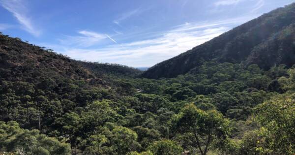
The difficult route to Tali Karng via Mount Margaret is unmaintained and poorly defined for much of its length between Tamboritha Road and Dolodrook River. Remote navigation skills are required, and thick vegetation makes progress slow. From the Dolodrook River it follows a 4WD track past the Chromite Mine then Brandy Pinch Track to join the Clive Lanigan Walking Track below the Valley of Destruction. This is a pretty spot on description of this section of the track.
Day 1: Overgrown Trails and Off-Track Navigation
We just completed the walk along the Mt Margaret Walking Track (closed track but still accessible) to the Lake via Clive Lanigan Track returning via Riggall Spur then out via Wellington River Walking Track to Tamboritha Rd. We had no GPS – just compass and map for this trip.
It was a tough hike especially on the first 2 days along the Mount Margaret track. The track starts okay following the creek with some tape markers. Once off the creek it is quickly very overgrown and you’re bashing most of the way through. There is a section with tape that makes it easy to follow but we lost both it and the trail quickly and then had to bash all the way to the first 4×4 track using our bearing set to this point. Took us about 7 hours to do 5.5km in the rain and we were knackered – it’s mostly climbing and bashing – definitely grade 5.
We ended up about 700m to the left from the track exit onto the 4×4 track and we scouted around, found the entry point on the other side a little further up and planned the next day’s hike, camping on the side of the road for the night. This was awesome – a true hiking/camping experience. Loved it.
Day 2: Navigating Ridgelines and Finding the Trail
We decided to continue to Chromite Mine and Brady Pinch on the same Mount Margaret walking track. The going was really tough, and we took our time, which meant we didn’t get lost too much except at 2 critical turning points where we took our time to get it right having to back track and scout options a bit until finding the trail. There is no tape, and you really have to rely on the compass and map and check every 100m or so. But you’re mostly along ridge lines so it is fairly stress free as long as you keep that in mind and make a strong continual effort to check for the trail. A really hard but rewarding walk. (Note there are some spray-painted markers and also a few cut logs which indicate the trail). Once you see the big square yellow marker with the arrow on the tree – pointing in the wrong (confusing) direction – you need to head directly to the right along a faint overgrown trail and then make a sharp right turn and it almost feels like you’re heading back in the wrong direction, but the trail quickly becomes visible – it is crucial you get this part right.
Once at Chromite Mine it is easy to follow the Brady Pinch track to the campsite. This track is along a parks maintenance track and is steep and long. Arrival at the campsite is the junction for the rest of the trails – a nice clay rich, swampy site along the river and really serene and pleasant. We stayed here for 2 nights. It is wet but you can have big fires, so it is worth it.
Day 3: Into the Valley of Destruction
We left the packs and took the Clive Lanigan track to Lake Tali Karng via the Valley of Destruction. The first km is 4×4 and easy walking. The next 1.5km of the track was easy to follow, but lots of tough walking here as it is really overgrown, and it was also very wet due to the rains, and we were soaked due to the fact that you’re bashing through wet bushes. Then once you cross the creek/river the last 2-3km is the Valley of Destruction and this is hard slog up hill to the lake – but by far one of the most beautiful rainforest walks I have done. Feels really wild and very isolated and is really quite magical (reminded me of parts of the Overland). Arrival at the lake is exceptional and I won’t ruin it for anyone with my bad descriptions. Suffice to say this is totally worth the effort and I recommend Clive Lannigan to get there.
The return back to the campsite at the junction was via Echo Point from the Lake for a km and then west via Riggal Spur – a very easy and well-maintained slow descent – a welcomed change from what we had done thus far.
Day 4: River Crossings and Road Walking
Last day was out to Tamboritha Rd via Wellington River Track 13km. Easy to follow so a pleasant walk but there are something like 13-14 waste deep river crossings and they are all really fun. So, expect to be walking with wet boots the whole way. We then walked the full 13-14km back to the car at the entry to Mt Margaret along the road (I wouldn’t recommend this, but we wanted to get into Licola General Store for a beer – closes at 5pm). Mostly a safe walk except for a few crazy 4×4’s.
Final Notes and Tips
- The Mt Maragert track is officially closed, but you can still walk it. (Trail Hiking Australia note. If a track is officially closed, you should not access the area. If it is just no longer maintained, then proceed with caution)
- A very hard grade 5 slog but super rewarding – you need good fitness and strong experience and navigational skills (unless using a GPS) and I would not recommend doing this part of the hike alone
- It is mostly wet so prepare for that (start of November)
- Gaiters recommended
- Heaps of water along the way so we got away with having a half to 1 litre at a time making the packs much lighter.
- I highly recommend this if you want a – for lack of a better word – truly hardcore hike. It is not a 2–3-day hike – more like a 3-4 day hike if you want to visit the lake too.
Hope more people do this trail. It is so much fun.
Find out more about this hike at https://www.trailhiking.com.au/lake-tali-karng-tamboritha-road-and-mt-margaret/


