Trip Report – March 2022
Trip Report by David Brewster
A Six Day Hike – April 2021
The Carnarvon Great Walk is an 87 kilometre six-day circuit around the Carnarvon Gorge section of the Carnarvon National Park. It takes in the famous gorge itself on the first day, with most of the remainder of the walk high up on the Great Dividing Range above the gorge. I wouldn’t suggest it as a first multi-day walk. I’m fairly fit but wasn’t fully ‘hike fit’ and found it quite challenging in some sections. That said, the climb early in day 2 is the most taxing part of the walk so once you’re past that, it’s generally much easier. However it is both satisfying and rewarding.
Before you start, you need to book the series of campsites along the walk online at the Queensland National Parks Booking Service. It’s inexpensive: only $6.75 per person per night. It was school holidays when we went, which made things fairly busy in the gorge itself but beyond that there were only half a dozen of us at each campsite.
Also, before you leave, check the park’s website for any alerts on current site closures, etc. We dodged another bullet here as the whole park was closed until the end of March due to damage from heavy rains in February.
Getting there (and back)
The walk starts and finishes at the Carnarvon Gorge Visitors Centre, roughly a nine-hour drive north-west of Brisbane, so driving up and starting the walk on the same day is impractical. Accommodation near the start is either at the adjacent national park camping area or one of a few private places just outside the park.
We ruled out the camping area as it has no food options and only basic facilities and we figured we were going to get enough of that over the coming week. The other places were busy due to the holidays and required a minimum two-night stay which didn’t suit us. So in the end we opted to stay a couple of hours south in the small town of Injune.
The Injune Motel has basic but very clean rooms and after booking nights at each end of our walk the helpful owners were happy to keep a bag for us so we didn’t need to leave valuables in the car. Injune has an old-school pub, a small roadhouse and a small supermarket (closed Sundays). Even if you don’t stay there, Injune is the last opportunity for a coffee, ice cream or anything else. The Visitor Centre/ranger station at Carnarvon Gorge has free wifi but nothing for sale at all in the way of meals, drinks, snacks or anything else.
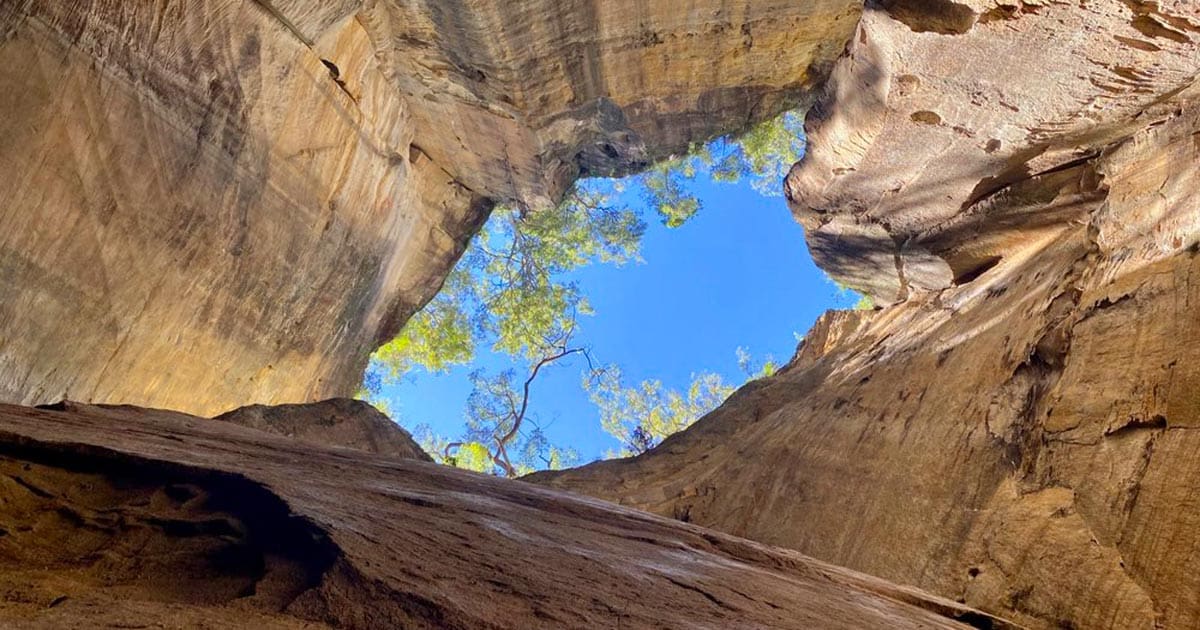
Day One: Visitor Centre to Big Bend Campsite
(10 km plus side tracks)
We woke to a crisp, clear morning and, after a bacon-and-egg burger at the Injune Roadhouse, headed north for 110 km before turning off towards Carnarvon Gorge. We arrived at the national park at about 9.30 am. Some older maps suggest the last 15 km or so into the park is on dirt, but this is no longer the case. The road is paved right up until perhaps the last 500 metres, after which it’s a stable gravel road. So to answer one common question: you can easily do this trip in an ordinary 2WD car.
As you arrive there’s a long carpark on the left. This is where you leave your vehicle. Multi-day walkers and day visitors all park in the same area. The visitor centre is about 200 metres further on. You pass the last toilet block you’re going to see for a week, and near that is a water tap where you might want to top up your bottles. (Here, as everywhere else in the park, the water is untreated rain water. It’s clean and clear, and probably fine to drink, but for extra safety we used water purification tablets.) I also dropped into the visitor centre to say g’day to a ranger. There’s no need to register with them (as long as at least someone knows what you’re up to), but it’s worthwhile checking on the condition of the track, water availability, etc.
We finally hauled our packs onto our backs and headed into the gorge. At this point, and for the rest of this day, we were not alone. It being school holidays there were lots of families on the trail, with kids of varying levels of enthusiasm.
The day one walk is essentially flat. After passing the Boolimba Bluff turnoff (don’t take that – you’ll visit on the last day), you track Carnarvon Creek up into the gorge, crossing it a number of times via nicely spaced stepping stones. Nevertheless, with 20 kilograms on my back they were a good test of my balance!
Rule number one of day one is to take every side track. There are five in all, each stunning in its own way. They really are worth it. We dropped our packs at each junction rather than hauling them into the sites. (There aren’t many reports of animals or birds breaking into packs in this area, but make sure they’re zipped up properly to be on the safe side.)
Not far past the last side track, to Cathedral Cave, you’ll pass Boowinda Gorge (part of tomorrow’s route), and few hundred metres on you’ll come to the Big Bend walkers’ camp. This site was relatively busy, though as it turned out most of the campers were just overnighters. Set on, as you might guess, a big bend in the river, it’s a spectacular setting under an enormous wall of rock. There are composting toilets and a water tank, though there was plenty of running water in the creek.
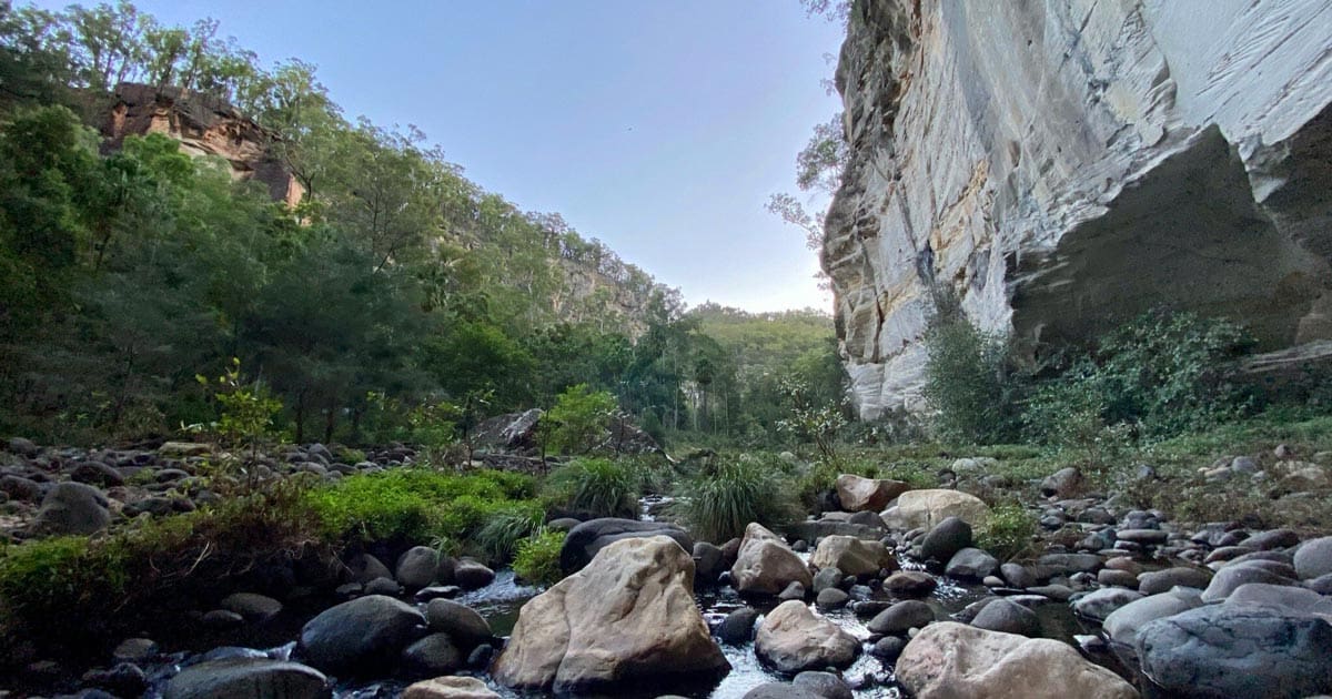
Day Two: Big Bend to Gadd’s
(14.8 km)
Gird your loins for this second day – definitely the hardest of the week. The mistake I made was to not eat breakfast. At home I’m in the habit of exercising first thing most mornings, then eating, so I figured I’d apply that same approach on this day. I knew the walk started with a steep climb, so why not get that out of the way and enjoy breakfast with the view? Not a good idea. The climb was harder than I expected and took longer than I expected, so that about three-quarters of the way up I was flagging.
Bottom line: eat, and have a good drink of water, before you leave. Then make sure your water bottles are full because unless it has rained very recently, there’ll be nowhere to refill until you get to Gadd’s camp.
After backtracking along Carnarvon Creek for a couple of hundred metres, you turn right up into Boowinda Gorge. There is a sign pointing the way, but what isn’t clear is that there is no path as such and it looks a bit like a dead-end. Nevertheless, that’s the way you go, rock-hopping along the creek bed. It’s easy enough, if slow going. But it is worth every step, because before very long you’ll come upon a stunning canyon. Of all the side tracks off Carnarvon Creek, this was the winner for me, and ironically it’s one that I suspect a lot of day visitors miss.
After passing through the canyon the gorge opens up a bit. Keep walking along the creek bed until, at around the 1.5 km mark since Big Bend, you need to look out for the orange arrows pointing up a ‘gap’ on the right. (See pictures above.) This turnoff can be missed – we met a couple of day walkers who had walked a kilometre or two past it before realising their error.
And yes, the way up is as shown in the picture on the right. It’s basically a clamber, on hands and feet, straight up the hill for about 150 metres. It’s definitely doable, though an interesting challenge with a full pack on your back. And I’m glad it was dry because it would be more interesting in the rain!
Once you reach the top, take a breather before starting the rest of the climb up to Battleship Spur. There are about two kilometres to go, some of it very steep, though it is more conventional than that first part, with lots of switchbacks. All in all, from the creek to the top, you’ll climb about 450 vertical metres in the space of 2.5 km. It took us about three hours from camp to this point.
Then there’s the reward: a million-dollar view from Battleship Spur straight over the top of Carnarvon Gorge winding away in the distance. You’ve probably already seen some pictures, but no picture is going to be as good as the real thing in this case. From the Spur you can also make out Big Bend – below and to the left a bit – and get a sense of how far and fast you’ve just climbed.
Take your time enjoying this view. You’ve knocked off the biggest climb of the whole walk, and the 10 km left on this day are, bar one moderate climb, flat or a gentle downhill.
Not far from the end we crossed a small creek that still had some running water in it, which was welcome as I’d finished off my two litres and some of Rosie’s by now. However I wouldn’t count on this: it’s pretty high up and I imagine is totally dry most of the time. (This was the only running water we came across before the last day. Otherwise what you have to drink is what you carry with you.)
Gadd’s walkers’ camp is in a nice big flat area with plenty of shade and room to spread out. It was a nice surprise to discover that there’s a rain-catching roof feeding an underground tank so, I imagine, plenty of water available most of the time. This is the case at all the camping areas along this walk. Gadd’s has a composting toilet too.
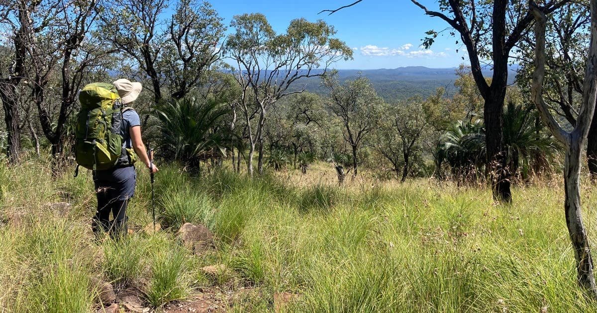
Day Three: Gadd’s to West Branch
(15.8 km)
Did I mention the grass? There had been a lot of (drought-breaking) rain across much of Queensland in the month or three before our walk. The result of that was that the grass was long … everywhere! I’m pretty sure this is not normally the case, but it sure was for us. For the most part this wasn’t an issue. It gave everywhere we went a really nice green glow, sometimes with a touch of red. It did make us a bit more wary of snakes, though we didn’t see any during our walking, and the seeds played havoc with our socks. We’d brought high gaiters with us and wore them most of the time after the first day. In some areas the grass hid rocks on the track which nearly tripped me up a few times. Thanks trekking poles for keeping me upright!
We woke to another perfectly clear day. Really we were blessed with the weather, which was sunny, still and not particularly hot (except during longer climbs) for almost the whole way.
The first few kilometres on this day was through a shallow valley, before the path follows a pretty rough access track up a fairly steep grade for about a kilometre. Nothing compared with yesterday but it did get the heart pumping. After that there were quite a few kilometres of fairly flat stuff before a descent along a ridge and spur to what, on the map, looks like a fairly creek but in reality was very dry. You’ll walk along the bed of this creek for a bit before the track bears off to the left.
It’s all quite pleasant walking. Just keep your eyes on the (mostly) ubiquitous orange arrows and/or your digital map. The arrows are usually pretty reliable though they had a habit of going missing at times when the path was less than clear. The last few kilometres are flat and easy going.
At the end of this day there’s a cable bridge over the creek that takes you to West Branch. According to the map, there are two separate camps here – one for walkers, and a vehicle accessible one (accessed via Carnarvon Park North Road). The tip is to turn left after you cross the bridge and walk down to the vehicle accessible camping area. It’s on a really large, grassy flat with shady trees, a number of water taps, a double composting toilet, and a handful of picnic tables. We and our four other walking companions had the place to ourselves – not counting a family of kangaroos – with ample room to spread out. The most pleasant camp site of the trip.
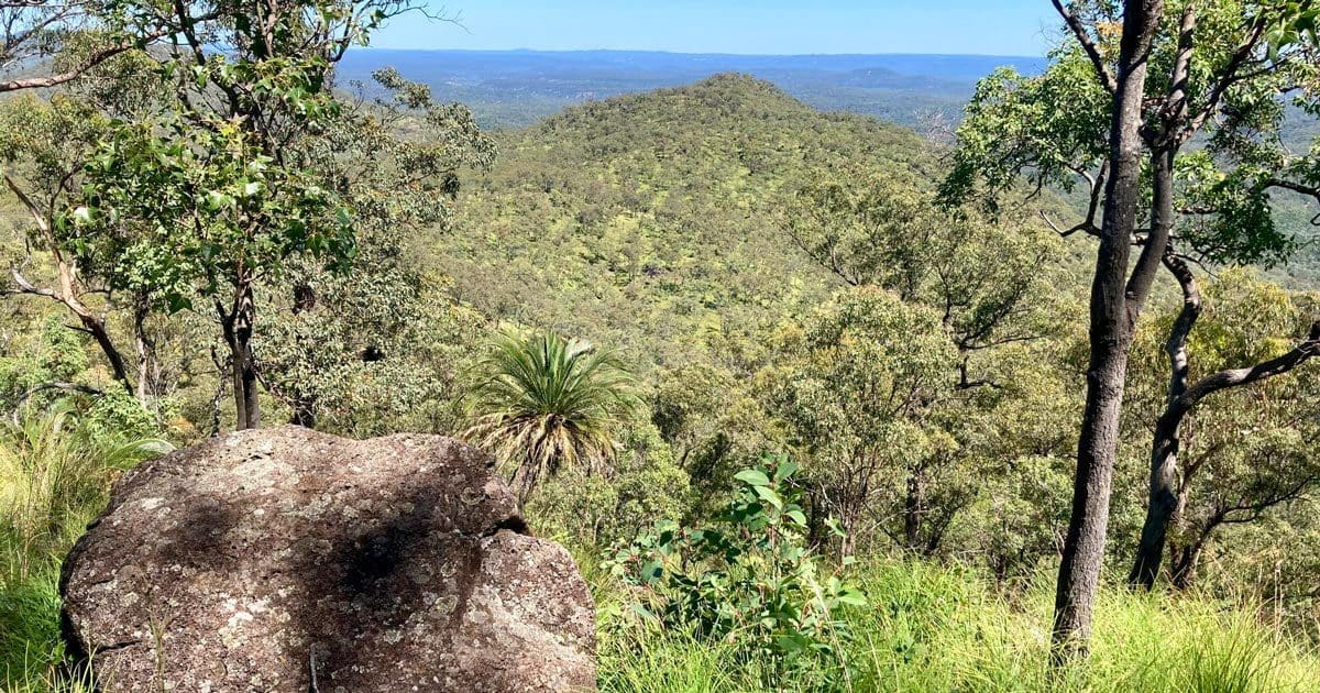
Day Four: West Branch to Consuelo
(17.3 km)
Day four is the longest leg of this walk and takes us to the highest point of the week as well. However mostly it’s a long, gentle climb rather than steep stuff.
Our weather was perfect once again. After packing up we headed back across the cable bridge, retracing our steps for a couple of hundred metres before the path branches left onto today’s route.
The first few kilometres are through fairly open bush. Like much of the park, there are plenty of young trees about – apparently fires through these areas are quite common. About halfway into the day there’s a short but steep climb up to plain that the top of this part of the world. The reward for this effort are some fantastic views towards the north and western ends of the national park.
From here you’re pretty much up on the plain. There’s an area marked on the map called the Mahogany Forest though I can’t say it really stood out from anything else. That could be a reflection on my poor knowledge of fauna. The high point of the walk is up here, so in terms of ‘peaks’ it’s a bit of an anti-climax. I had to keep an eye on the GPS to try and pick the right point.
The rest of the day is a gentle decline, the only challenge for us being that ensuring that we were still on the path as it was often hidden under the long grass.
Consuelo camping ‘zone’ is a reasonably flat area, though tent sites were a bit limited due to the long grass. There’s another shelter that doubles as a water collector, feeding an underground tank, but there is not toilet here. Time to dig out the spade. Once again a few roos kept us company, pretty nonplussed by having humans around.
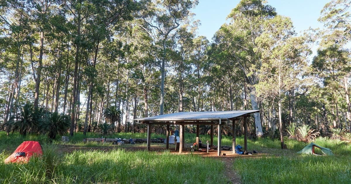
Day Five: Consuelo to Cabbage Tree
(13.8 km)
You can almost regard this fifth day as a rest day. Only 13.8 km and fairly much entirely flat. The track generally follows an (overgrown) fire trail through lightly timbered forest of eucalypts and cycads with a floor of bracken, grass and the occasional bush tomato. It’s easy going under foot. All you need to do is keep an eye out for the orange arrows – especially with the long grass the trail did disappear a couple of times – and enjoy the stroll. By now your backpack should be a bit lighter than what you started with.
The Cabbage Tree camping zone is in a forest clearing. I could see on the map that we were on a ridge, not far from a significant drop-off which, to me, signified a nice view. However, said view was masked by trees. I went on a bit of an explore to see if I could find a spot to see the view but after coming across a wild boar and then a snake I decided that perhaps the relative comfort of the proper camping area was the way to go. Like the last one, this camping area doesn’t have a toilet. On the up side, while we couldn’t see many there were lots of birds in this area which made for a lovely dawn chorus.
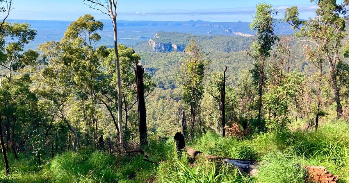
Day Six: Cabbage Tree to the Visitor Centre
(15.3 km)
Of the six days, this final day was probably my favourite from a pure bushwalking perspective. Where day one was spectacular but crowded and day two was spectacular but hard work, this last 15 kilometres we had to ourselves (the others in our loose group having left before us) and it provided good variety and some super views.
The first section is quite a steep descent, though it wasn’t as taxing as I had expected. And quite early on you get a glimpse of the cliffs running many miles down to the south. The ground levels off when you reach what is a sort of terrace (perhaps there’s a proper geological name for this) below the cliffs that drop down from the plain but at above the cliffs that eventually drop down to the bottom of Carnarvon Gorge.
The walking was through some vibrant grassy meadow, down and up a couple of steep gullies and eventually right to the edge of a cliff with awesome views to the east. This was the perfect spot for our last lunch spot.
Something you might notice in some of the pictures above are clouds – the first sign of actual weather we had seen all week!
After a few last kilometres of level walking you come to the Boolimba Bluff turnoff. Leave your backpacks here and take the good path about 500 metres to the lookout. Excellent views and as a bonus we ‘Great Walkers’ can enjoy without having had to climb up from the bottom of the gorge (we did that work back on day 2). You might find a friendly day visitor to take your picture as a last-stop souvenir.
From here it’s about a kilometre back to the top of the steep descent to the bottom, saying g’day to breathless day walkers as you drop down. As is the way of these things, the last couple kilometre or two from the bottom to the end seems to take longer than it should.
It’s time for that ice cream you’ve been craving … or would be if the visitor centre sold such things. For us it was a case of swapping boots for sandals, dusting off the car’s windscreen and hitting the road back to Injune for a beer, a feed and a good night’s sleep after a very satisfying six days in the bush.
Final Comments
All in all we found the Carnarvon Great Walk a really rewarding multi-day hike which I wouldn’t hesitate to recommend to experienced walkers. As mentioned at the outset, this is probably not the ideal walk to try as your first walk of this length, though with enough preparation I’m sure it’s doable.
Are you looking for a Carnarvon Gorge Great Walk map? Check out the hike details page.
This report (including images) was provided by David Brewster



Hi David I was thinking of doing the walk in 5 days, with an approach of maybe camping between Consuelo and Cabbage Tree camping areas. Any thoughts on that approach, or other suggestions? I’ve walked the whole gorge area previously and have done many multi day walks. The u
Also great write up really helpful thank u