Hike at a Glance
Max elevation: 0m
Min elevation: 0m
Total Ascent: 0m
Hike overview
In 1844, Captain Charles Sturt led the Central Australia Expedition from the streets of Adelaide, then along the Murray and Darling rivers before heading where no European had been before. The objective was to find the sea which Sturt and his supporters believed lay in the heart of Australia.
On his journey, Sturt left calling cards in the form of an S and an arrow, indicating that he had been there and the direction of travel. Sturt's Tree walk in Sturt National Park offers a unique opportunity to view a piece of Australian history; one of the trees marked by Charles Sturt all those years ago.
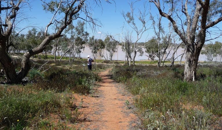
The walk takes you across Lake Pinaroo, so you can only walk when the lakebed is dry. If you can't take the walk because the lake is full, don't worry, you're still in for one of nature's treats. The lake is a vital habitat for countless waterbirds and waders as well as a range of mammals and reptiles, so you're bound to enjoy your visit to this internationally recognised wetland.
Tips
The walk across Lake Pinaroo is about 3km, with access via the Wells walk which is a 4km loop.
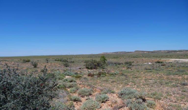
The landscape around Lake Pinaroo changes through the seasons. In times of plenty, when the lake is full, Sturt's Tree Walk is not accessible.
Remember to take your binoculars if you want to birdwatch and don't forget your camera.
Check the weather before you set out as roads within Sturt National Park may be closed during wet weather.
This park is in a remote location, please ensure you are thoroughly prepared, bring appropriate clothing and equipment and advise a family member or friend of your travel plans.
Visit NSW National Parks and Wildlife Service for more information on this trail.
The longitude and latitude of the start and end points are approximately only and should not be used for navigation purposes. Please contact me if you know the correct coordinates.
Gallery
Got some great shots from this hike? Upload your photos here to inspire others and show off the beauty of the trail!
Click to view form >>
Submitting your photos doesn’t mean you lose ownership. You can be credited for your contributions, and you can request removal at any time.
Content use
Please don’t copy GPX files or content from this site to AllTrails or other platforms. Each trail has been personally mapped, documented, and refined to support Australia’s bushwalking and hiking community. While some details come from land managers, every listing reflects significant personal effort. This is a free, community-driven initiative—your respect helps keep it that way.
Walk map and GPX file
It looks like I don’t have a GPX file for this trail yet. If you have one to share, please email it to me! I’ll verify it against official maps before adding it to help other hikers have a safer, easier experience. Thanks for contributing to a better hiking resource.
Getting there
Getting to the trailhead: Sturt National Park.
The walk starts half way along the Wells walk which starts at Fort Grey campground. Parking Parking is available at Fort Grey campground
Closest towns to this walk: Bourke, Broken Hill, Cobar, Menindee, Milparinka, Packsaddle, Tibooburra, Wanaaring, White Cliffs, Wilcannia
Similar walks nearby
Looking for more walks in or near Sturt National Park? Try these trails with a similar difficulty grade.
Track grade
Grade 5 (Difficult) - Walks for the Most Experienced: Grade 5 represents the most challenging walking tracks on the AWTGS. These are only recommended for very experienced and fit walkers with specialised skills, including navigation and emergency first aid. Tracks are likely to be very rough, very steep, and unmarked. Walks may be more than 20 kilometers. These challenging walks demand a high level of fitness and experience to navigate difficult terrain, significant elevation changes, and potentially unformed paths.
Explore safe
Plan ahead and hike safely! Carry enough water, pack layers for changing conditions, and bring safety gear like a torch, PLB, and reliable communication device. Check official sources for trail updates, closures, and access requirements, and review local weather and bushfire advice. Most importantly, share your plans with someone before you go. Being prepared makes for a safer and more enjoyable hike! Stay Safe, Explore More, and Always #ExploreSafe.
Packing checklists
What you carry in your pack depends on factors like weather, terrain, and your adventure type. Not sure what to bring? My free planning, food, and packing checklists are a great starting point, covering day hikes, overnight trips, and multi-day adventures. Use them to customise your kit and always prioritise safety.
Let someone know
Before heading out, take a moment to fill out your trip intentions form. It’s a quick way to share your hike details with family or friends. If something goes wrong, they can notify emergency services, ensuring a faster response and peace of mind. Stay safe and enjoy your adventure
Suggest an edit
Spotted a change on this trail? Maybe there are new features, the route has shifted, or the trail is permanently closed. Whatever the update, I’d love your input. Your feedback helps fellow hikers stay informed and ensures that our trail info stays fresh and reliable.
Acknowledgement of Country
Trail Hiking Australia acknowledges the Traditional Owners of the lands on which we hike and pay respects to their Elders, past and present, and we acknowledge the First Nations people of other communities who may be here today.


