Hike at a Glance
Max elevation: 1044m
Min elevation: 989m
Total Ascent: 154m
Hike overview
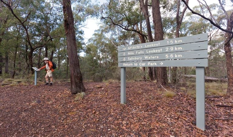
Craving a day trip near the New England area with stunning scenery and wildlife encounters? Look no further than the Oxley Walking Track. Nestled within Oxley Wild Rivers National Park in New South Wales, this moderate 3km (grade 3) hike offers a delightful escape for roughly 1.45 hours.
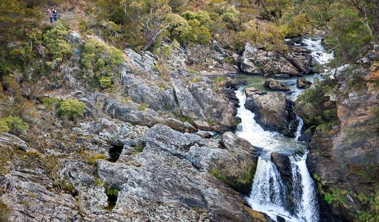
The Oxley Walking Track takes you on a captivating journey along the northern rim of the Apsley Gorge. Prepare to be mesmerised by cascading waterfalls visible from various vantage points throughout the trail. This makes it a perfect choice for a day trip or a refreshing break during a road trip.
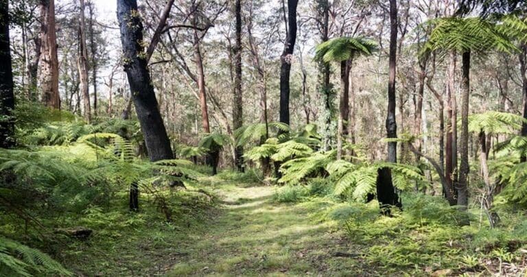
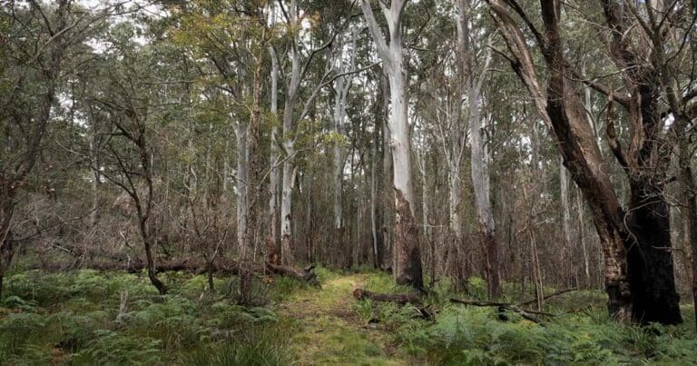
As you head out on the track, be greeted by the unique beauty of cliff-top woodlands. Towering snow gums and New England stringybark create a picturesque scene. Keep your eyes peeled for wildlife; you might be lucky enough to spot a platypus paddling in the Apsley River or water dragons basking on the rocks.
The highlight of the Oxley Walking Track is undoubtedly the series of lookouts offering dramatic panoramas of the gorge country. Watch out for brush-tailed rock wallabies with their distinctive white cheek stripes as you admire the breathtaking landscapes.
- Apsley Chasm Lookout: This lookout provides spectacular views of the lower falls and deep gorges, offering a unique perspective of the power of water erosion.
- Apsley Lower Falls Lookout: As the name suggests, this vantage point allows you to fully appreciate the beauty of the cascading Apsley Lower Falls.
- Apsley Slate Walls Lookout: Located at the end of the track, this lookout offers a breathtaking view of the lower waterfall and the impressive slate walls that form the gorge.
- Oxley Lookout: This lookout provides a stunning perspective of the rock amphitheatre surrounding the upper falls, allowing you to witness the grandeur of the entire waterfall system.
Make sure to stop by the Lower Falls lookout for a well-deserved break and to soak in the scenery. When you're ready to refuel, head to the Apsley Falls picnic area, equipped with excellent facilities, for a relaxing lunch break.
Gallery
Got some great shots from this hike? Upload your photos here to inspire others and show off the beauty of the trail!
Click to view form >>
Submitting your photos doesn’t mean you lose ownership. You can be credited for your contributions, and you can request removal at any time.
Content use
Please don’t copy GPX files or content from this site to AllTrails or other platforms. Each trail has been personally mapped, documented, and refined to support Australia’s bushwalking and hiking community. While some details come from land managers, every listing reflects significant personal effort. This is a free, community-driven initiative—your respect helps keep it that way.
Walk map and GPX file
Max elevation: 1044 m
Min elevation: 989 m
Total climbing: 154 m
Total descent: -153 m
Getting there
Getting to the trailhead: Oxley Wild Rivers National Park.
The Oxley Walking Track is situated within the Apsley River precinct of Oxley Wild Rivers National Park. This convenient location makes it easily accessible for those traveling through the region.
If you’re driving, accessing the trailhead is straightforward. Simply follow the Oxley Highway from either Walcha or Port Macquarie. Keep an eye out for signs directing you to the track.
Parking is available at the Apsley Falls picnic area, which serves as the starting point for the Oxley Walking Track. This picnic area offers ample parking spaces, including a designated accessible space for those who need it. However, be advised that the area can get crowded, particularly on weekends. So, if you’re planning a visit during peak times, arriving early might be a good idea to secure a parking spot.
Closest towns to this walk: Armidale, Bendemeer, Dorrigo, Ebor, Gloucester, Guyra, Tamworth, Uralla, Walcha
About the region
Immerse Yourself in Wild Beauty: Oxley Wild Rivers National Park. Oxley Wild Rivers National Park, a World Heritage-listed Gondwana rainforest sanctuary near Armidale, stuns visitors with its dramatic gorges, magnificent waterfalls, and rare dry rainforests. Explore scenic drives along the Waterfall Way, or delve deeper with multi-day hikes like the Green Gully walk, offering overnight stays in heritage-listed stockman's huts. For a touch of luxury, stay at East Kunderang Homestead.
Camping, walking, paddling, picnicking, cycling, horse riding – Oxley Wild Rivers National Park caters to every outdoor enthusiast. Hike through diverse landscapes – wet and dry eucalypt forests, grassy woodlands, and heathlands. Keep an eye out for native flora like olive trees, lacebarks, and towering stinging trees.
Dramatic ridges, towering rock formations, and cascading waterfalls create a breathtaking backdrop for your exploration. Gaze upon the majestic Wollomombi Falls, the highest in New South Wales, or spot a wedge-tailed eagle soaring on the thermals.
Make the most of your Oxley Wild Rivers National Park adventure by checking the park website for current conditions, permits, and specific activity details.
Similar walks nearby
Looking for more walks in or near Oxley Wild Rivers National Park? Try these trails with a similar difficulty grade.
Track grade
Grade 3 (Moderate) - Walks for Most Fitness Levels: Grade 3 on the AWTGS represents moderate walking tracks. These are ideal for walkers with some fitness who are comfortable with some hills and uneven terrain. While suitable for most ages, some bushwalking experience is recommended to ensure a safe and enjoyable experience. Tracks may have short, steep hill sections, a rough surface, and many steps. The total distance of a Grade 3 walk can be up to 20 kilometers.
Explore safe
Plan ahead and hike safely! Carry enough water, pack layers for changing conditions, and bring safety gear like a torch, PLB, and reliable communication device. Check official sources for trail updates, closures, and access requirements, and review local weather and bushfire advice. Most importantly, share your plans with someone before you go. Being prepared makes for a safer and more enjoyable hike! Stay Safe, Explore More, and Always #ExploreSafe.
Packing checklists
What you carry in your pack depends on factors like weather, terrain, and your adventure type. Not sure what to bring? My free planning, food, and packing checklists are a great starting point, covering day hikes, overnight trips, and multi-day adventures. Use them to customise your kit and always prioritise safety.
Let someone know
Before heading out, take a moment to fill out your trip intentions form. It’s a quick way to share your hike details with family or friends. If something goes wrong, they can notify emergency services, ensuring a faster response and peace of mind. Stay safe and enjoy your adventure
Suggest an edit
Spotted a change on this trail? Maybe there are new features, the route has shifted, or the trail is permanently closed. Whatever the update, I’d love your input. Your feedback helps fellow hikers stay informed and ensures that our trail info stays fresh and reliable.
Acknowledgement of Country
Trail Hiking Australia acknowledges the Traditional Owners of the lands on which we hike and pay respects to their Elders, past and present, and we acknowledge the First Nations people of other communities who may be here today.


6 Reviews on “Oxley Walking Track (3km)”
Why are you promoting a park that is closed due to Bush fires?