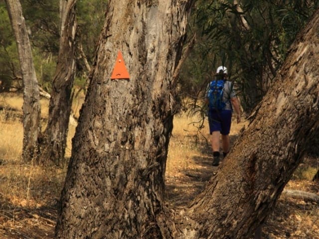
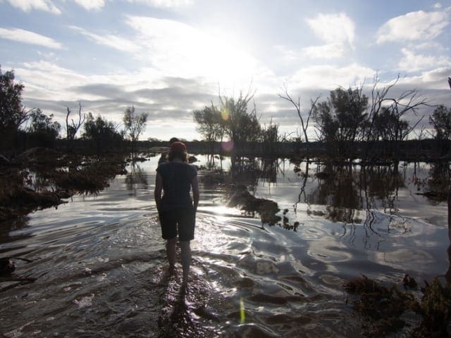
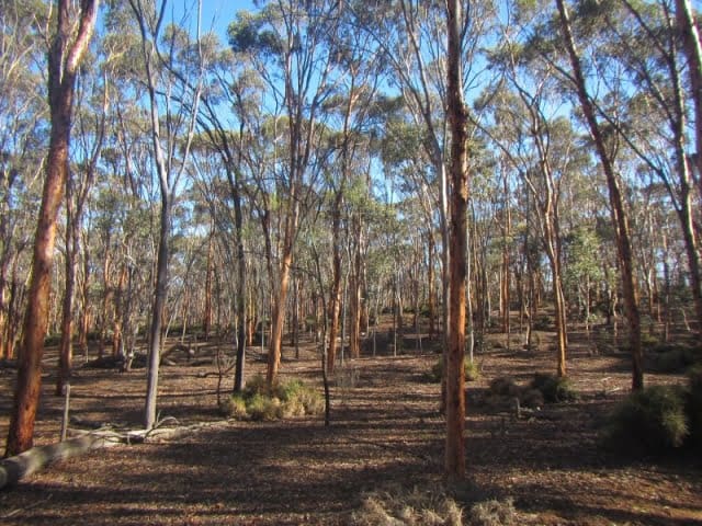
Merredin Peak is located off Benson Road in the townsite of Merredin. It offers two interpretive walks, the Rock Walk and the Bush Walk which can be joined to become one longer walk trail. Follow the rock walk for beautiful views over Merredin and the surrounding countryside and the bush walk to see native flora and fauna.
The Merredin Peak Trail provides an uninterrupted view across the town of Merredin and the surrounding rural area. As the highest peak in the area it offers spectacular panoramic views as far as the eye can see. Choose between two walk trails, depending on your level of fitness and stop to read the informative plaques indicating various points of interest along the trail. The Rock WalknThis trail offers scenic views of the town and adjacent bushland as well as interpretation on how granite rocks were used as water catchments from the 1890's. Water from the rock was collected via granite walled channels and feed into Railway Dam. From there it filled the water tower in town to supply the steam trains. Walking over the rock you look down on the site of World War 2 Army Field Hospital and over the town. Prospectors on their way to the Yilgarn Goldfields had their camps tucked away in the lee of the rock.nnThe Bush WalknThis trail traverses a variety of habitats from Wandoo woodland to tamma thickets. The bush to the east of the trail is the home of the rare Mallee Fowl. Kangaroos, echidna and a variety of snakes and lizaRoads are found in the reserve while most of the common bush Bird species of Wheatbelt can be seen seasonally over a year. This trail links with the Rock Trail or you can return directly to your starting point. The Merredin Peak Trail is one of many recommended stops along the Golden Pipeline Heritage Trail. Merredin is the largest regional town in the Central Eastern Wheatbelt and is a three hour drive east of Perth
Start Point: Benson Road 1.5 kilometers from Merredin CBD which is 260km (3 hours) east of Perth,
End Point: Benson Road 1.5 kilometers from Merredin CBD which is 260km (3 hours) east of Perth,
Region: Merredin, Golden Outback
For more information, a location map and GPS file please visit Trails WA.
Got some great shots from this hike? Upload your photos here to inspire others and show off the beauty of the trail!
Submitting your photos doesn’t mean you lose ownership. You can be credited for your contributions, and you can request removal at any time.
Please don’t copy GPX files or content from this site to AllTrails or other platforms. Each trail has been personally mapped, documented, and refined to support Australia’s bushwalking and hiking community. While some details come from land managers, every listing reflects significant personal effort. This is a free, community-driven initiative—your respect helps keep it that way.
It looks like I don’t have a GPX file for this trail yet. If you have one to share, please email it to me! I’ll verify it against official maps before adding it to help other hikers have a safer, easier experience. Thanks for contributing to a better hiking resource.
Getting there
Getting to the trailhead: Merredin Railway Dam.
Closest towns to this walk: Bodallin, Burracoppin, Merredin, Nangeenan, Southern Cross
About the region
The town of Merredin is situated approximately 260 kilometres east of Perth and is the major commercial and retail centre for the eastern Wheatbelt. Wildflowers and granite rocks are picturesque natural environmental features of the area.
Similar walks nearby
Looking for more walks in or near Merredin Railway Dam? Try these trails with a similar difficulty grade.
Favourite

Favourite

Favourite

Favourite

Track grade
Grade 2 (Easy) - A Gentle Introduction to Inclines: Grade 2 on the
AWTGS represents easy walking tracks that offer a slightly more challenging experience compared to Grade 1. Similar to Grade 1, no prior bushwalking experience is required. The track surface is typically hardened or compacted and may have gentle hill sections or occasional steps. The total distance of a Grade 2 walk is typically no greater than 10 kilometers. These walks are still suitable for families with a bit more experience or those seeking a gentle introduction to some inclines.
Explore safe
Plan ahead and hike safely! Carry enough water, pack layers for changing conditions, and bring safety gear like a torch, PLB, and reliable communication device. Check official sources for trail updates, closures, and access requirements, and review local weather and bushfire advice. Most importantly, share your plans with someone before you go. Being prepared makes for a safer and more enjoyable hike! Stay Safe, Explore More, and Always #ExploreSafe.
Packing checklists
What you carry in your pack depends on factors like weather, terrain, and your adventure type. Not sure what to bring? My free planning, food, and packing checklists are a great starting point, covering day hikes, overnight trips, and multi-day adventures. Use them to customise your kit and always prioritise safety.
Let someone know
Before heading out, take a moment to fill out your trip intentions form. It’s a quick way to share your hike details with family or friends. If something goes wrong, they can notify emergency services, ensuring a faster response and peace of mind. Stay safe and enjoy your adventure
Suggest an edit
Spotted a change on this trail? Maybe there are new features, the route has shifted, or the trail is permanently closed. Whatever the update, I’d love your input. Your feedback helps fellow hikers stay informed and ensures that our trail info stays fresh and reliable.


