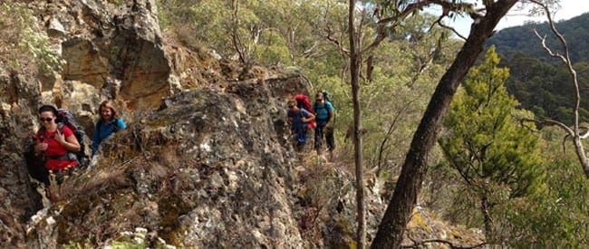
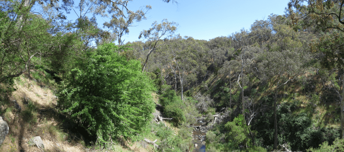
The Lower Sailors Falls Loop is a great hike for kids aged 6+ follow the Goldfields Track markers until you come to a sign for Sailors Falls Loop, I recommend following the loop in an anti clockwise direction as it means the return journey is less steep. It can get very slippery in wet weather.
The Sailors Falls carpark has steps lending down to the falls. These have in fact been closed to the public due to being unstable. But the car park is a good pit stop as it has public toilets and some trail info.
Got some great shots from this hike? Upload your photos here to inspire others and show off the beauty of the trail!
Submitting your photos doesn’t mean you lose ownership. You can be credited for your contributions, and you can request removal at any time.
Please don’t copy GPX files or content from this site to AllTrails or other platforms. Each trail has been personally mapped, documented, and refined to support Australia’s bushwalking and hiking community. While some details come from land managers, every listing reflects significant personal effort. This is a free, community-driven initiative—your respect helps keep it that way.
Total distance: 4088 m
Max elevation: 677 m
Min elevation: 590 m
Total climbing: 149 m
Total descent: -150 m
Getting there
Getting to the trailhead: Hepburn Regional Park.
From Melbourne take the M8 towards Ballarat. Take the 2nd Ballan exit and follow the signs for Dalyesford. You will see signs for Sailors Falls carpark. You can either park here and walk about .5km up telegraph Rd to the entrance of Hepburn Regional Park or drive up telegraph Rd and park on the side of the road. Linked train and coach services are available from Melbourne to Daylesford via Woodend or Ballarat. For timetable details call V/Line Country Information.
Closest towns to this walk: Bullarto, Castlemaine, Clunes, Daylesford, Dry Diggings, Eganstown, Glenlyon, Hepburn Springs, Lyonville, Musk, Trentham, Woodend
About the region
Hepburn Regional Park nestles around the famous mineral springs townships of Daylesford, Hepburn and Hepburn Springs. Rich with natural springs and relics from the gold mining era, the park abounds with opportunities for bushwalking, mountain bike and horse riding, picnicking and nature study. Mount Franklin is a small volcanic crater with basic camping set amid exotic trees.
Similar walks nearby
Looking for more walks in or near Hepburn Regional Park? Try these trails with a similar difficulty grade.
Favourite

Favourite

Castlemaine Diggings National Heritage Park
Favourite

Favourite

Track grade
Grade 3 (Moderate) - Walks for Most Fitness Levels: Grade 3 on the
AWTGS represents moderate walking tracks. These are ideal for walkers with some fitness who are comfortable with some hills and uneven terrain. While suitable for most ages, some bushwalking experience is recommended to ensure a safe and enjoyable experience. Tracks may have short, steep hill sections, a rough surface, and many steps. The total distance of a Grade 3 walk can be up to 20 kilometers.
Explore safe
Plan ahead and hike safely! Carry enough water, pack layers for changing conditions, and bring safety gear like a torch, PLB, and reliable communication device. Check official sources for trail updates, closures, and access requirements, and review local weather and bushfire advice. Most importantly, share your plans with someone before you go. Being prepared makes for a safer and more enjoyable hike! Stay Safe, Explore More, and Always #ExploreSafe.
Packing checklists
What you carry in your pack depends on factors like weather, terrain, and your adventure type. Not sure what to bring? My free planning, food, and packing checklists are a great starting point, covering day hikes, overnight trips, and multi-day adventures. Use them to customise your kit and always prioritise safety.
Let someone know
Before heading out, take a moment to fill out your trip intentions form. It’s a quick way to share your hike details with family or friends. If something goes wrong, they can notify emergency services, ensuring a faster response and peace of mind. Stay safe and enjoy your adventure
Suggest an edit
Spotted a change on this trail? Maybe there are new features, the route has shifted, or the trail is permanently closed. Whatever the update, I’d love your input. Your feedback helps fellow hikers stay informed and ensures that our trail info stays fresh and reliable.


8 Reviews on “Lower Sailors Falls Loop Walk (4km)”
no worries
Hi, do you know where I could find more hikes for 3 – 6 y.o. children? Around Sydney. I’m a pre-school teacher and would like to start a bush kindy one day 😉
I am slowly expanding my database of hikes into NSW so at this stage dont have any that I can recommend. If you do find any I would love it if you can share them with me for inclusion on my site.
Thank you Tracey Quinn for sharing this hike