Hike at a Glance
Max elevation: 0m
Min elevation: 0m
Total Ascent: 0m
Hike overview
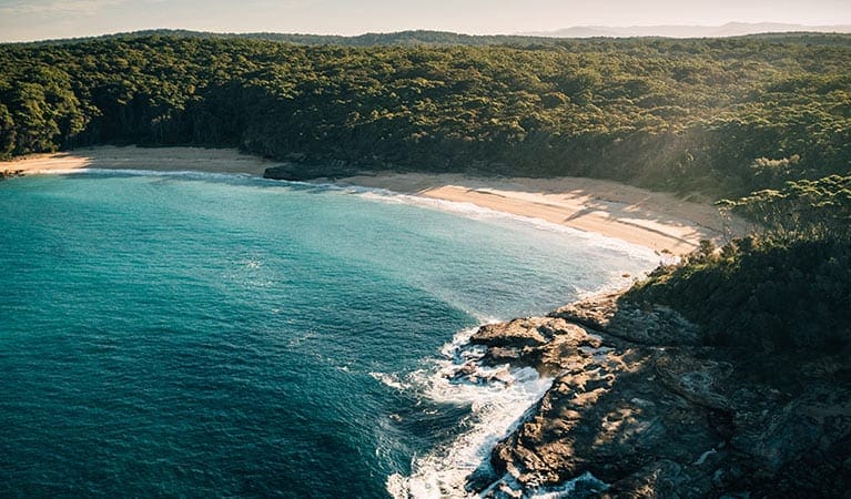
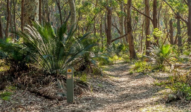
The Lake walking track in Murramarang National Park offers a tranquil escape through coastal forests and along the scenic shores of Durras Lake. This easy to moderate 8-kilometer (roundtrip) grade 3 hike is ideal for walkers seeking a relaxing immersion in nature, taking roughly 3.5 hours to complete.
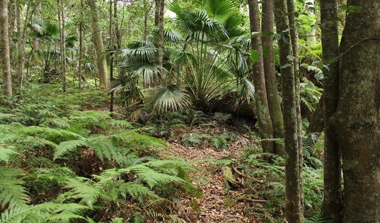
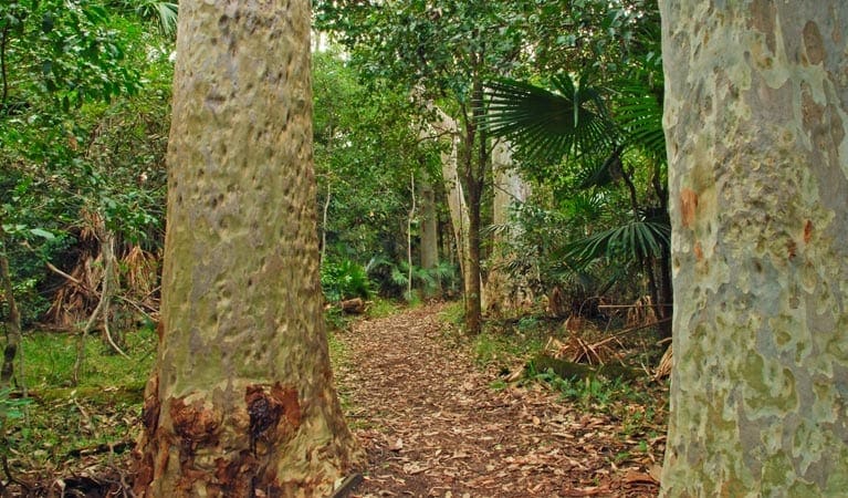
The track branches off from the Durras Lake Discovery trail and leads you along the lake's northern shore. Towering spotted gum trees dominate the landscape, providing a habitat for abundant birdlife. Be sure to keep your ears tuned for the calls of lyrebirds and wonga pigeons foraging in the undergrowth, and you might even hear the distinctive melody of the eastern whipbird hidden within the denser foliage.
As you traverse remnants of the original coastal rainforest, admire the diverse flora, where coachwood and lilly pillies mingle with the spotted gums. Take a moment to rest and enjoy a picnic lunch amidst the peaceful bush setting. Don't be surprised if you encounter some of the park's local residents – kangaroos, wallabies, and goannas are frequent visitors along the track.
Tips
- It's a good idea to put insect repellent on before you set out
- Remember to take your binoculars if you want to go birdwatching
Gallery
Got some great shots from this hike? Upload your photos here to inspire others and show off the beauty of the trail!
Click to view form >>
Submitting your photos doesn’t mean you lose ownership. You can be credited for your contributions, and you can request removal at any time.
Content use
Please don’t copy GPX files or content from this site to AllTrails or other platforms. Each trail has been personally mapped, documented, and refined to support Australia’s bushwalking and hiking community. While some details come from land managers, every listing reflects significant personal effort. This is a free, community-driven initiative—your respect helps keep it that way.
Walk map and GPX file
It looks like I don’t have a GPX file for this trail yet. If you have one to share, please email it to me! I’ll verify it against official maps before adding it to help other hikers have a safer, easier experience. Thanks for contributing to a better hiking resource.
Getting there
Getting to the trailhead: Murramarang National Park.
Accessible by car, the Lake walking track is situated within the central precinct of Murramarang National Park. Travelers can reach the trailhead by turning east off the Princes Highway onto Mount Agony Road at East Lynne. Follow this road for approximately 5 kilometers before turning right onto North Durras Road. Continue along until you see Lake Road, where you should turn and follow signage leading to the track.
It’s important to note that weather conditions can significantly impact road quality. Be sure to check the forecast before setting out, as Lake Road can become boggy after rainfall. Fortunately, parking is available along Lake Road near the trailhead.
Closest towns to this walk: Batemans Bay, Bawley Point, Kioloa, Maloneys Beach, Malua Bay, Milton, Moruya, Narooma, Nelligen, North Durras, Tomakin, Ulladulla
About the region
Murramarang National Park, a nature lover's paradise, stretches along 44 kilometers of dramatic coastline on the NSW south coast, near Batemans Bay. Here, visitors can camp under the shade of spotted gum trees that grow right down to the oceanfront, creating a stunning backdrop for a year-round escape. The park offers a variety of activities. Hike or bike along the trails, explore the cliffs and headlands, or relax on pristine beaches. Take a dip in the ocean, go surfing, or cast a fishing line for your dinner. Keep an eye out for eastern grey kangaroos and the abundant birdlife that call the park home.
The park is particularly famous for the multi-day Murramarang South Coast Walk, a spectacular 3-day adventure for experienced hikers. But there are options for all fitness levels. Explore the Durras Lake discovery trail, perfect for a family outing with children, or rent a canoe to paddle around the calm waters of Durras Lake. Whether you're looking for a day trip or a longer stay, Murramarang National Park has something for everyone. Choose from a variety of camping options, including caravan and motorhome sites with amenities, or book a cabin for a more comfortable stay.
Similar walks nearby
Looking for more walks in or near Murramarang National Park? Try these trails with a similar difficulty grade.
Track grade
Grade 3 (Moderate) - Walks for Most Fitness Levels: Grade 3 on the AWTGS represents moderate walking tracks. These are ideal for walkers with some fitness who are comfortable with some hills and uneven terrain. While suitable for most ages, some bushwalking experience is recommended to ensure a safe and enjoyable experience. Tracks may have short, steep hill sections, a rough surface, and many steps. The total distance of a Grade 3 walk can be up to 20 kilometers.
Explore safe
Plan ahead and hike safely! Carry enough water, pack layers for changing conditions, and bring safety gear like a torch, PLB, and reliable communication device. Check official sources for trail updates, closures, and access requirements, and review local weather and bushfire advice. Most importantly, share your plans with someone before you go. Being prepared makes for a safer and more enjoyable hike! Stay Safe, Explore More, and Always #ExploreSafe.
Packing checklists
What you carry in your pack depends on factors like weather, terrain, and your adventure type. Not sure what to bring? My free planning, food, and packing checklists are a great starting point, covering day hikes, overnight trips, and multi-day adventures. Use them to customise your kit and always prioritise safety.
Let someone know
Before heading out, take a moment to fill out your trip intentions form. It’s a quick way to share your hike details with family or friends. If something goes wrong, they can notify emergency services, ensuring a faster response and peace of mind. Stay safe and enjoy your adventure
Suggest an edit
Spotted a change on this trail? Maybe there are new features, the route has shifted, or the trail is permanently closed. Whatever the update, I’d love your input. Your feedback helps fellow hikers stay informed and ensures that our trail info stays fresh and reliable.
Acknowledgement of Country
Trail Hiking Australia acknowledges the Traditional Owners of the lands on which we hike and pay respects to their Elders, past and present, and we acknowledge the First Nations people of other communities who may be here today.


