Hike at a Glance
Max elevation: 161m
Min elevation: 39m
Total Ascent: 313m
Hike overview
The Yul-yan-man Track, aptly named "walk slowly" in the Kabi Kabi language, is a challenging 9-kilometer loop hike within the Glass House Mountains National Park, Queensland. This grade 5 circuit is not for the faint of heart and requires a good level of fitness and some technical skills. Expect to spend 3-4 hours completing the trail, taking your time to soak in the breathtaking scenery and navigate the demanding sections.
Finding the Trailhead: From the Beerburrum State School car park, follow the cemetery sign for 20 meters. You'll see a sign pointing towards the Soldiers Settlers track (your return route) and another marker with an arrow leading straight ahead. Take the straight path.
Initial Climb and Technical Sections: This first section leads you up towards the car park for Mount Beerburrum's summit walk. Cross the wooden bridge behind the information sign. Be prepared, as the trail quickly transitions into a challenging grade 5 track. It's a long, uphill climb with a rocky, rough path (follow the pink markers for direction). The highest point is near Mount Beerburrum's summit.
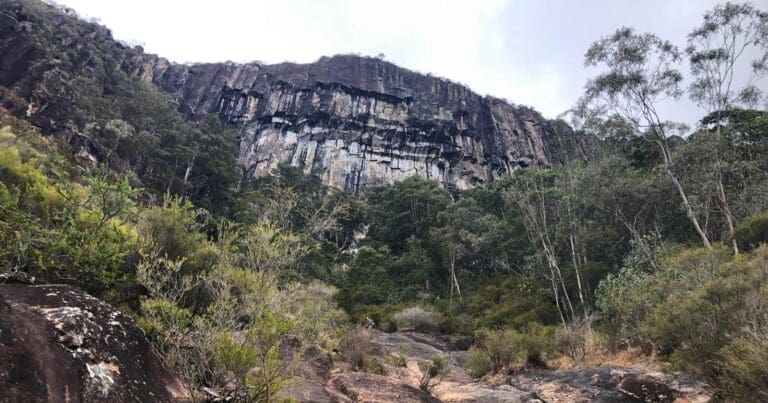
Descent and Gully Crossing: The trail then descends a long ridgeline before reaching a gully near the end. This gully leads to Dwarfland, a popular rock climbing area. The track takes you down into the gully, around the left side of the rocky outcrop, and then climbs to the top where a cairn marks the turn-off for rock climbing.
Joining the Trachyte Circuit: Continue straight from the cairn, and you'll soon join a well-formed track leading to the Trachyte Circuit (approximately 300 meters away). Turn right onto the Trachyte Circuit and follow it for about 600 meters.
Returning to the Trailhead: You'll reach an intersection with a fire trail marked by a large green sign indicating the Beerburrum trailhead 3.8 kilometers away (atop the Soldiers Settlers trail signage). Take this turn and follow the fire trail.
Final Stretch: After roughly 500 meters, turn off the fire trail onto a marked track designated for walkers and cyclists. Eventually, you'll reach a T-junction with another fire trail. Turn right here and pass the old Beerburrum Cemetery before arriving back at your starting point, the Beerburrum State School car park.
Remember: This hike requires a good level of fitness, proper footwear with good grip, and enough water for the entire duration. Be prepared for challenging sections and enjoy the rewarding experience of the Yul-yan-man Track.
From Tibrogargan trailhead
Alternatively you can commence this hike at Tibrogargan Trailhead to complete a 13.5km circuit via a section of the Trachyte Circuit track. This alternative route will take 4-5 hours to complete. See route variation below.
Gallery
Got some great shots from this hike? Upload your photos here to inspire others and show off the beauty of the trail!
Click to view form >>
Submitting your photos doesn’t mean you lose ownership. You can be credited for your contributions, and you can request removal at any time.
Content use
Please don’t copy GPX files or content from this site to AllTrails or other platforms. Each trail has been personally mapped, documented, and refined to support Australia’s bushwalking and hiking community. While some details come from land managers, every listing reflects significant personal effort. This is a free, community-driven initiative—your respect helps keep it that way.
Walk map and GPX file
Max elevation: 161 m
Min elevation: 39 m
Total climbing: 313 m
Total descent: -313 m
From Tibrogargan trailhead
Max elevation: 161 m
Min elevation: 32 m
Total climbing: 434 m
Total descent: -434 m
Getting there
Getting to the trailhead: Glass House Mountains National Park.
Reaching the Yul-yan-man Track’s starting point is straightforward. By car, travel south on Steve Irwin Way and turn right onto Beerburrum Road in the township of Beerburrum. Keep an eye out for Parrot Park and Beerburrum State School on your left. Right after passing the school, look for a blue cemetery sign and turn right there. Park your car conveniently in the designated car park at the school. The trailhead for your adventure awaits at the back of the school car park.
Closest towns to this walk: Beerwah, Elimbah, Glass House Mountains, Landsborough, Maleny, Moodlu, Mooloolah Valley, Woodford
About the region
Explore the Glass House Mountains National Park: A Land of Dramatic Beauty and Rich History.
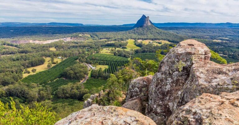
The Glass House Mountains National Park is a captivating landscape dominated by the craggy peaks that rise majestically from the surrounding plains. These volcanic plugs, formed millions of years ago, hold a significant place in Australian heritage and are listed on the Queensland and National Heritage Register.
Walking trails weave through open forests, leading you to lookouts boasting panoramic views of the mountains. Explore the base of Mount Tibrogargan for ever-changing perspectives, or conquer the summit of Mount Ngungun for breathtaking views of the surrounding peaks and landscapes.
For the adventurous, the Yul-yan-man track offers a challenging Grade 5 hike, perfect for experienced rock scramblers. Skilled climbers and abseilers will find other challenging routes and dedicated climbing areas to test their abilities.
Beyond the dramatic peaks, the park encompasses a scenic tapestry of pine plantations, bushland, and cultivated fields. Remnants of open eucalypt woodland and heath vegetation provide a habitat for diverse flora and fauna, including 20 plant species of high conservation value.
Lieutenant James Cook named these distinctive mountains during his voyage along Australia's east coast. Geologically, they are intrusive plugs formed by volcanic activity 26 to 27 million years ago.
The park holds deep cultural significance for the Aboriginal Traditional Owners. The Glass House Mountains served as a meeting place for ceremonies and trade, and many sacred sites are still protected within the park's boundaries.
Similar walks nearby
Looking for more walks in or near Glass House Mountains National Park? Try these trails with a similar difficulty grade.
Track grade
Grade 5 (Difficult) - Walks for the Most Experienced: Grade 5 represents the most challenging walking tracks on the AWTGS. These are only recommended for very experienced and fit walkers with specialised skills, including navigation and emergency first aid. Tracks are likely to be very rough, very steep, and unmarked. Walks may be more than 20 kilometers. These challenging walks demand a high level of fitness and experience to navigate difficult terrain, significant elevation changes, and potentially unformed paths.
Explore safe
Plan ahead and hike safely! Carry enough water, pack layers for changing conditions, and bring safety gear like a torch, PLB, and reliable communication device. Check official sources for trail updates, closures, and access requirements, and review local weather and bushfire advice. Most importantly, share your plans with someone before you go. Being prepared makes for a safer and more enjoyable hike! Stay Safe, Explore More, and Always #ExploreSafe.
Packing checklists
What you carry in your pack depends on factors like weather, terrain, and your adventure type. Not sure what to bring? My free planning, food, and packing checklists are a great starting point, covering day hikes, overnight trips, and multi-day adventures. Use them to customise your kit and always prioritise safety.
Let someone know
Before heading out, take a moment to fill out your trip intentions form. It’s a quick way to share your hike details with family or friends. If something goes wrong, they can notify emergency services, ensuring a faster response and peace of mind. Stay safe and enjoy your adventure
Suggest an edit
Spotted a change on this trail? Maybe there are new features, the route has shifted, or the trail is permanently closed. Whatever the update, I’d love your input. Your feedback helps fellow hikers stay informed and ensures that our trail info stays fresh and reliable.
Acknowledgement of Country
Trail Hiking Australia acknowledges the Traditional Owners of the lands on which we hike and pay respects to their Elders, past and present, and we acknowledge the First Nations people of other communities who may be here today.


10 Reviews on “Yul-yan-man Track (9km)”
This easy bushwalk offers a peaceful escape with plenty to enjoy. The well-worn path is clearly marked with pink markers, making navigation a breeze. While there’s a bit of rock scrambling and one steep descent, the overall difficulty remains beginner-friendly.