Hike at a Glance
Max elevation: 59m
Min elevation: 0m
Total Ascent: 1015m
Hike overview
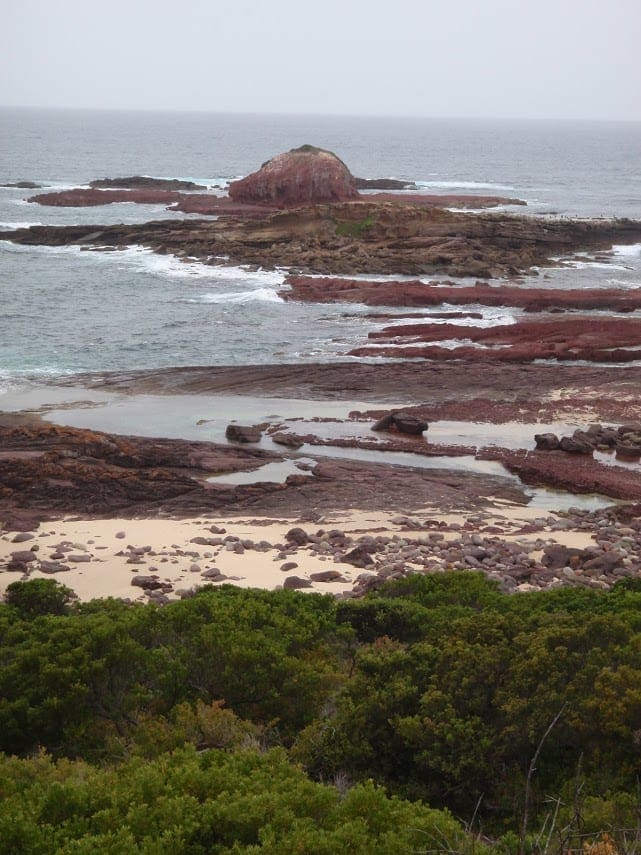
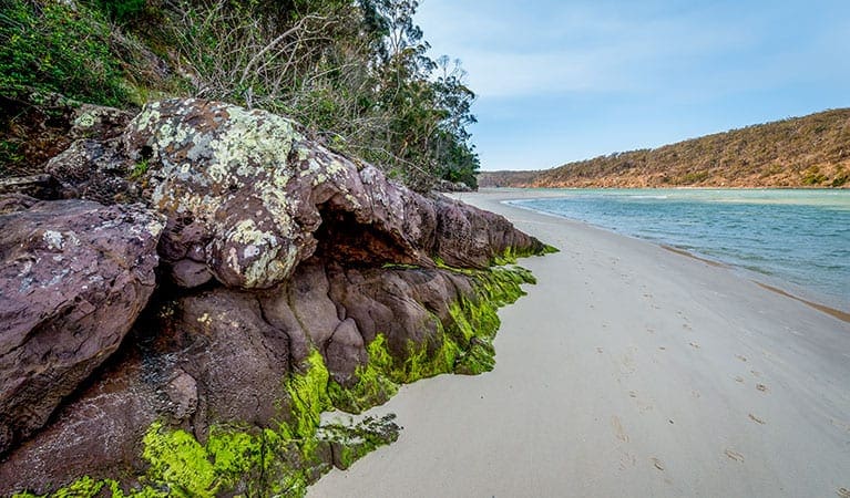
Wharf to Wharf Walk is a spectacular coastal walk from Merimbula to Tathra, linking existing trails through public coastal reserves, flora reserves, beaches and Bournda National Park.
It is a walk for coast lovers, nature enthusiasts and photographers. The trail follows a wild coastline, leading to hidden coastal lagoons, long isolated beaches, rugged headlands and secluded coves. Wildlife is abundant, and more than 200 species of birds have been observed in the region.
The walk can be undertaken as an overnight hike, day hike or section day hikes, with car access points available throughout the route.
The walk can be walked in either direction, beginning at either Merimbula Wharf or Tathra Wharf. Overnight hikers can stay at Hobart Beach Campground in Bournda National Park approximately halfway along the walk, or utilise car shuttles to stay in town.
Be mindful that there is limited parking at both Merimbula Wharf and Tathra Wharf so you may need to park elsewhere and walk to the beginning of the route.
The walk can be walked in either direction. Either way is enjoyable, though south to north takes you from the more populated areas to the solitude of Bournda National Park. There are more points of access in the southern half. The northern half has more of a ‘wilderness’ feel and is more challenging.
Overnight camping is available at Hobart Beach Campground in Bournda National Park, approximately halfway along the walk. There are 66 campsites and amenities include non-flush toilets, showers, picnic & barbeque facilities, vehicle access and parking. There is no fresh water available at this campground. Bookings must be made advance through NSW National Parks and Wildlife Service (camping fees apply).
Tips
Wharf to Wharf Walk is approximately 27km direct from Merimbula Wharf to Tathra Wharf with no side trails. It can be comfortably walked in 2 days, but very fit walkers can complete it in 1 day.
Surfaces vary from hard surface to rock scrambles and soft beach sand. In total, this is a challenging walk, but many sections are easy to moderate. As there are several points of vehicular access to the walk, it is possible to select a section with your desired degree of difficulty.
After periods of heavy rain, lakes along the Walk can open to the sea. Consider tides and big seas in crossing any outflow from Back Lake and Merimbula Creek at Short Point, Bournda Lagoon and Sandy Point Creek at south Bournda Beach, and Wallagoot Lake at north Bournda Beach. Alternate trail options can be found in the Track Notes if the outflows are not safe to cross. Additionally, side trips to Bournda should not be made during rough seas or when high tide covers the wide strip of sand joining the island to the beach.
All walkers should ensure they have a copy of the Wharf to Wharf Walk Track Notes before setting out. They should be carried while walking as well as stored on a mobile device. The Track Notes contain important navigational information as well as optional side trips, notes about flora and fauna as well as lake crossings.
Because Wharf to Wharf Walk connects pre-existing trails, there is not always clear signage along the walk. Track Notes are an important tool for navigating the walk. Mobile reception along the walk is unreliable, so be sure to print and download your Track Notes before setting out.
You can pick up a hard copy Track Notes Brochure at Merimbula Visitor Information Centre, Eden Visitor Information Centre, Bermagui Visitor Information Centre, Tathra Wharf Museum and Tathra Beachside. You can also download the digital Track Notes from www.wharftowharfwalk.com.au
Gallery
Got some great shots from this hike? Upload your photos here to inspire others and show off the beauty of the trail!
Click to view form >>
Submitting your photos doesn’t mean you lose ownership. You can be credited for your contributions, and you can request removal at any time.
Content use
Please don’t copy GPX files or content from this site to AllTrails or other platforms. Each trail has been personally mapped, documented, and refined to support Australia’s bushwalking and hiking community. While some details come from land managers, every listing reflects significant personal effort. This is a free, community-driven initiative—your respect helps keep it that way.
Walk map and GPX file
Max elevation: 59 m
Min elevation: 0 m
Total climbing: 1015 m
Total descent: -1007 m
Getting there
Getting to the trailhead: Bournda National Park.
Getting to Wharf to Wharf Walk is easy, with self-drive, flying and public transport options available. The closest airport is Merimbula Airport, conveniently located just over 5km from Merimbula Wharf. Qantas and Rex both offer flights from Sydney and Melbourne to Merimbula airport.
There is limited parking at Merimbula Wharf and Tathra Wharf. Walkers are encouraged to walk to the beginning of the trail, or get dropped off. If doing a car shuffle, cars can be parked at Spencer Park, Long Point or Middle Beach car parks in Merimbula. In Tathra, cars can be parked at Tathra Headland or the car park opposite the Tathra Hotel.
Wharf to Wharf Walk can be accessed by car at Short Point Reserve, Short Point Beach car park, Tura Headland car park, North Tura car park, Bournda Lagoon car park, Hobart Campground, Turingal Head car park and Kianinny Bay car park.
Closest towns to this walk: Bega, Bermagui, Brogo, Candelo, Cobargo, Eden, Kalaru, Merimbula, Pambula, Tathra, Tura Beach, Wolumla, Wyndham
About the region
Wharf to Wharf Walk crosses the ancient lands of the Yuin people, traditional custodians of the ancient land and sea country along which the walk follows. Natural landscapes provided sustenance, shelter and cultural importance, and the significance of these sites remain today.
European settlement in the 1800s marked the commencement of activity such as farming, logging and steam navigation, with evidence of these activities found along the walk.
More information can be found at the Wharf to Wharf website here: https://www.wharftowharfwalk.com.au/
Similar walks nearby
Looking for more walks in or near Bournda National Park? Try these trails with a similar difficulty grade.
Track grade
Grade 4 (Hard) - Challenging Walks for Experienced Walkers: Grade 4 on the AWTGS signifies challenging walking tracks. Bushwalking experience is recommended for these tracks, which may be long, rough, and very steep. Directional signage may be limited, requiring a good sense of navigation. These walks are suited for experienced walkers who are comfortable with steeper inclines, rougher terrain, and potentially longer distances.
Explore safe
Plan ahead and hike safely! Carry enough water, pack layers for changing conditions, and bring safety gear like a torch, PLB, and reliable communication device. Check official sources for trail updates, closures, and access requirements, and review local weather and bushfire advice. Most importantly, share your plans with someone before you go. Being prepared makes for a safer and more enjoyable hike! Stay Safe, Explore More, and Always #ExploreSafe.
Packing checklists
What you carry in your pack depends on factors like weather, terrain, and your adventure type. Not sure what to bring? My free planning, food, and packing checklists are a great starting point, covering day hikes, overnight trips, and multi-day adventures. Use them to customise your kit and always prioritise safety.
Let someone know
Before heading out, take a moment to fill out your trip intentions form. It’s a quick way to share your hike details with family or friends. If something goes wrong, they can notify emergency services, ensuring a faster response and peace of mind. Stay safe and enjoy your adventure
Suggest an edit
Spotted a change on this trail? Maybe there are new features, the route has shifted, or the trail is permanently closed. Whatever the update, I’d love your input. Your feedback helps fellow hikers stay informed and ensures that our trail info stays fresh and reliable.
Acknowledgement of Country
Trail Hiking Australia acknowledges the Traditional Owners of the lands on which we hike and pay respects to their Elders, past and present, and we acknowledge the First Nations people of other communities who may be here today.


