Trail Fast Facts
Waterfall walking track is a 6km, grade 3 hike in Kosciuszko National Park, New South Wales. This hike typically takes 2.5 hours to complete.
Hike Overview
Waterfall walking track is a great option for most weather conditions as it's a sheltered walk which is also conveniently close to Jindabyne.
You can start the walk at either Sawpit Creek picnic area or Kosciuszko Education Centre. Then, once you've taken the underpass beneath Kosciuszko Road, it's time to be blown away by the rugged beauty and diversity the Snowy Mountains region is renowned for.
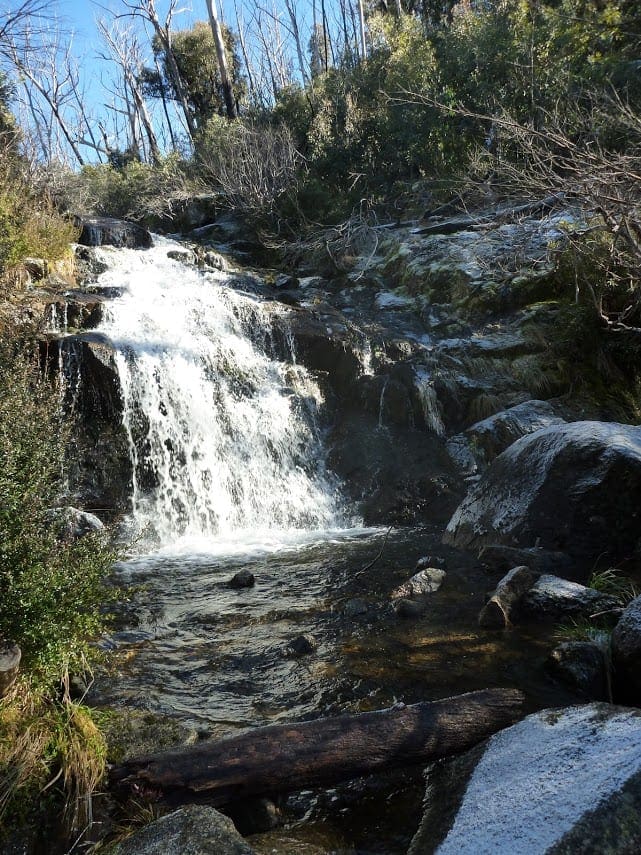
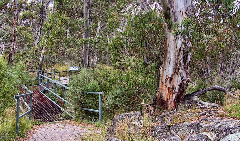
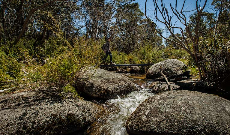
You'll pass through a variety of settings on this 6km hike, including tall eucalypt forest, outcrops of hefty granite boulders, and flowering and fruiting heathland. Then, of course, there's the waterfall itself, which is wonderfully peaceful. Head to the platform on the south side for great scenic views. Be sure to check out the tall, fibrous-barked alpine ash trees nearby, which were logged in the area late last century and can grow to 90m tall.
This easy track is equally great for an afternoon bushwalk, early morning run, or nature-spotting session in Kosciuszko National Park. Local wildlife includes wallabies, kangaroos and echidnas, along with a range of birdlife in the trees.
Take a virtual tour of Waterfall walking track captured with Google Street View Trekker.
Track Grade
Grade 3 (Moderate) - Walks for Most Fitness Levels: Grade 3 on the AWTGS represents moderate walking tracks. These are ideal for walkers with some fitness who are comfortable with some hills and uneven terrain. While suitable for most ages, some bushwalking experience is recommended to ensure a safe and enjoyable experience. Tracks may have short, steep hill sections, a rough surface, and many steps. The total distance of a Grade 3 walk can be up to 20 kilometers.
Map and GPX file
Help fellow hikers navigate with confidence. Share your GPX or KML file for this trail and help build a more comprehensive resource with precise waypoints and elevation profiles. Your contribution will empower adventurers with details they need for a safer and more enjoyable experience. I meticulously verify every file using official maps and surveys, ensuring the highest level of accuracy and reliability. Submit your file now and become a trailblazer for your fellow outdoor enthusiasts.
Trailhead
Sorry, no records were found. Please adjust your search criteria and try again.
Sorry, unable to load the Maps API.
Getting there
To Waterfall walk carpark. Waterfall walking track is in the southern precinct of Kosciuszko National Park. To get there from Jindabyne:Drive along Kosciuszko Road towards Perisher ValleyYou can either begin the walk from Kosciuszko Education Centre on Kosciuszko Road, or continue driving 400m past it, and then turn left into Kosciuszko Mountain Retreat.Take the first left down a short dirt road to reach Sawpit Creek picnic area - the other starting point for Waterfall walking track. Park entry points Waterfall walk carpark See on map Road quality All 2WD vehicles need to carry snow chains in winter, between June and October long weekends, on: Kosciuszko Road (to Perisher) Guthega Road Alpine Way between Thredbo and Tom Groggin Snow chains are recommended for all vehicles driving in the park, including 4WD and AWD, in the event of extreme weather. Read our snow driving in Kosciuszko tips. Parking Car parking is available at both Sawpit Creek picnic area and Kosciuszko Education Centre. Bus parking is only available at Kosciuszko Education Centre.
Visit NSW National Parks and Wildlife Service for more information on this trail.
The longitude and latitude of the start and end points are approximately only and should not be used for navigation purposes. Please contact me if you know the correct coordinates.
Photo gallery
If you have any photos from this hike and are happy to share them, please upload your .jpg files here.
Please note: Uploading photos does not transfer ownership of copyright away from you. If requested, you will be credited for any photos you provide and can ask they be deleted at any time.
About the region
Kosciuszko National Park spoils you with snow sports, walks and mountain biking in the Snowy Mountains. Go camping, explore caves, climb Australia's highest mountain, or stay in heritage accommodation. There are 7 areas in this park:
1. Thredbo-Perisher area is your gateway to Mount Kosciuszko. Find NSW's favourite ski resorts, top alpine hikes, mountain bike trails, and endless adventures in the Snowy Mountains.
2. The Lower Snowy River area embraces the wild south of Kosciuszko National Park. Camp by the Snowy River and explore the scenic trails on a walk, bike or horse ride.
3. Khancoban area is the western gateway to Kosciuszko National Park. Discover Geehi and Tom Groggin's camp spots, fishing, and riding. Marvel at the Western Fall views or explore huts and hikes in the Jagungal Wilderness.
4. The Selwyn area is your perfect base to explore the walks, rides, and top fishing spots of central Kosciuszko National Park. Selwyn Snow Resort and historic Kiandra are closed due to severe fire damage.
5. The Yarrangobilly area is a highlight of northern Kosciuszko National Park. Explore jaw-dropping caves on a guided tour and swim in the thermal pool. Stay at historic Caves House and enjoy the walks and wildlife.
6. The Tumut area is your launch pad into northern Kosciuszko National Park. Discover water sports and wildlife at Blowering Reservoir. Camp and explore hidden walks and waterfalls in the foothills of the Snowy Mountains.
7. The High Plains area spoils you with summer walks, horse rides and bike trails to mountain huts, caves, and gorges. Camp, stay in Currango's heritage cottages, and discover Kosciuszko's wild north-east corner.
Similar trails nearby
Looking for things to do in Kosciuszko National Park? Try these hikes or bushwalks.
Explore Safe
While planning your hike, it’s important to check official government sources for updated information, temporary closures and trail access requirements. Before hitting the trail, check local weather and bushfire advice for planned burns and bushfire warnings and let someone know before you go. Plan ahead and hike safely.
Let someone know
Adventure with peace of mind: Fill out your trip intentions form. Before you hit the trail, fill out an online form to privately send important details about your hike to your family or friends. If you don’t return on time, they can easily alert emergency services, preventing worry and ensuring a swift response. Hike with peace of mind and enjoy your outdoor adventure to the fullest. Be smart, be safe: Register your plans here.
Gear to consider
What you carry in your pack will depend on the weather, terrain, time of year, type of adventure, and personal preferences. Having trouble deciding what gear’s right for you? My free planning, food and packing checklists provide an introduction to things your could consider (as well as the Ten Essentials) on your day, overnight and multi-day adventures. Customise your kit according to your personal needs, always considering safety first.
Suggest an edit
Trail changed? New features discovered? Has the route changed? Trail permanently closed? Help fellow hikers by suggesting edits! Click above to update route descriptions, GPX file, trail features (like boardwalks), or access conditions (like parking availability). Help me keep the trails info fresh!
Weather
Acknowledgement of Country
Trail Hiking Australia acknowledges the Traditional Owners of the lands on which we hike and pay respects to their Elders, past and present, and we acknowledge the First Nations people of other communities who may be here today.


