Trail Fast Facts
Warren River Loop Walk is a 10.5km, grade 2 hike in Warren National Park, Western Australia. This hike typically takes 3 hours to complete.
Hike Overview
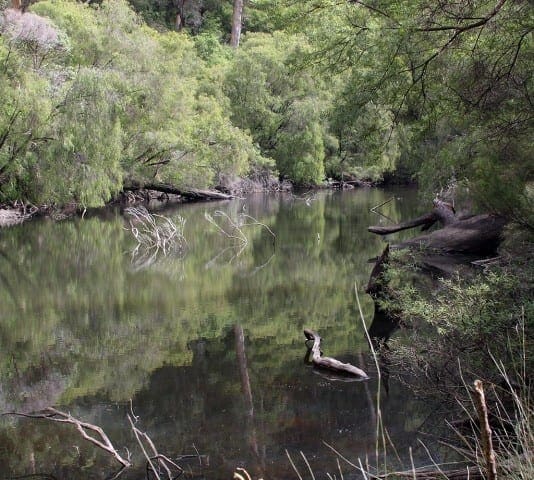
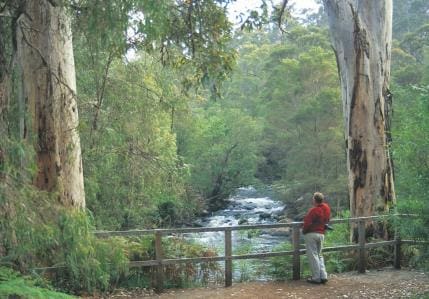
Starting at the Bicentennial Tree, an old bushfire lookout, the 10.5 kilometre Warren River Loop Walk wanders down through tall karri forest to the meandering Warren River, where you can enjoy a swim before heading up to the Warren lookout for superb views into the valley.
The Bicentennial Tree is one of three firelookout trees open to the public in the Pemberton/Manjimup area. It is 75m tall and provides an exciting challenge for those brave enough to climb to the top! From there, the trail travels through the tall timber to another Picnic Area. The beautiful karri forest is home to many different varieties of Birds including red capped parrots, blue wrens, robins, honeyeaters, silvereyes and crows. Generally it is downhill to the river, although some of the inclines are quite steep and require a moderate degree of fitness. Arriving at the river there are camping areas and platforms to allow swimming access. After following a narrow path for a few kilometres along the river, there is a steady climb up to the spectacular Warren River Lookout. This walk has a fine blend of large karri trees, quality forest, river bank walking and views into the valley; with interpretive sites along the way. Other trail access points exist at the information shelter at Heartbreak Trail, Maiden Bush Car Park, Drafty's Camp, Warren Camp and Warren Lookout. Local FM radio has indigenous stories from the area, broadcasting throughout the day. Whilst in the area try the many other walks and trails including the 200 metre Lorikeet Stroll.
Track Grade
Grade 2 (Easy) - A Gentle Introduction to Inclines: Grade 2 on the AWTGS represents easy walking tracks that offer a slightly more challenging experience compared to Grade 1. Similar to Grade 1, no prior bushwalking experience is required. The track surface is typically hardened or compacted and may have gentle hill sections or occasional steps. The total distance of a Grade 2 walk is typically no greater than 10 kilometers. These walks are still suitable for families with a bit more experience or those seeking a gentle introduction to some inclines.
Tips
Start Point: Dave Evans Bicentennial Tree, Old Vasse Road, near Pemberton which is 343km (4 hours) south of Perth
End Point: Dave Evans Bicentennial Tree, Old Vasse Road, near Pemberton which is 343km (4 hours) south of Perth
Region: Pemberton, South West
For more information, a location map and GPS file please visit Trails WA.
Map and GPX file
Help fellow hikers navigate with confidence. Share your GPX or KML file for this trail and help build a more comprehensive resource with precise waypoints and elevation profiles. Your contribution will empower adventurers with details they need for a safer and more enjoyable experience. I meticulously verify every file using official maps and surveys, ensuring the highest level of accuracy and reliability. Submit your file now and become a trailblazer for your fellow outdoor enthusiasts.
Trail Location (trailhead)
Sorry, no records were found. Please adjust your search criteria and try again.
Sorry, unable to load the Maps API.
Photo gallery
If you have any photos from this hike and are happy to share them, please upload your .jpg files here.
Please note: Uploading photos does not transfer ownership of copyright away from you. If requested, you will be credited for any photos you provide and can ask they be deleted at any time.
About the region
Centrally in the 'Southern Forests and Valleys" region the quaint timber towns of Pemberton and Northcliffe and the coastal settlement of Windy Harbour are, without a doubt, the green jewels in Australia's South West. With their towering Karri forests, rich agricultural lands and stunning Southern Ocean providing rich experiences and adventure options for every visitor. This Spring expect to see the forests veiled in a cascade of purple, white and yellow wildflowers.
Similar trails nearby
Explore Safe
While planning your hike, it’s important to check official government sources for updated information, temporary closures and trail access requirements. Before hitting the trail, check local weather and bushfire advice for planned burns and bushfire warnings and let someone know before you go. Plan ahead and hike safely.
Let someone know
Adventure with peace of mind: Fill out your trip intentions form. Before you hit the trail, fill out an online form to privately send important details about your hike to your family or friends. If you don’t return on time, they can easily alert emergency services, preventing worry and ensuring a swift response. Hike with peace of mind and enjoy your outdoor adventure to the fullest. Be smart, be safe: Register your plans here.
Gear to consider
What you carry in your pack will depend on the weather, terrain, time of year, type of adventure, and personal preferences. Having trouble deciding what gear’s right for you? My free planning, food and packing checklists provide an introduction to things your could consider (as well as the Ten Essentials) on your day, overnight and multi-day adventures. Customise your kit according to your personal needs, always considering safety first.
Suggest an edit
Trail changed? New features discovered? Has the route changed? Trail permanently closed? Help fellow hikers by suggesting edits! Click above to update route descriptions, GPX file, trail features (like boardwalks), or access conditions (like parking availability). Help me keep the trails info fresh!
Weather
Acknowledgement of Country
Trail Hiking Australia acknowledges the Traditional Owners of the lands on which we hike and pay respects to their Elders, past and present, and we acknowledge the First Nations people of other communities who may be here today.


