Hike at a Glance
Max elevation: 674m
Min elevation: 525m
Total Ascent: 398m
Hike overview
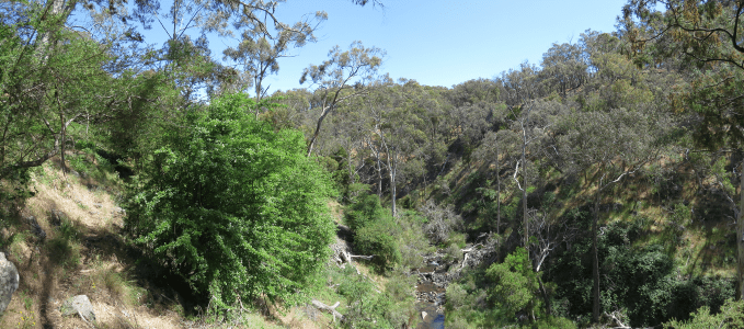
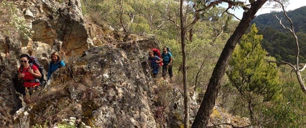
The Three Lost Children Walk commemorates the tragic story from Daylesford’s gold era when three small boys wandered away from their homes in Daylesford in 1867. Despite a massive and lengthy search effort the boys were not found alive. The Three Lost Children walk follows the approximate route the boys walked. The walk will take you through bush landscapes that were once active goldfields, and now part of the Wombat State Forest and the Hepburn Regional Park. Along the walk you will see the remnants of gold mines, water races and tramways.
The Lost Children Walk meets the Great Dividing Trail at Wombat Creek. North of the Lost Children Walk the Great Dividing Trail passes Tipperary Springs then continues through to Bendigo. The Great Dividing Trail follows The Lost Children Walk south-west through to Hogans Lane. At Hogans Lane an optional 2.5km return extension can be added to the Lost Children Walk to include the picturesque Sailors Falls Reserve. From Hogans Lane the Lost Children Walk heads east to again cross the Great Dividing Trail near Specimen Hill Dam. This is the Lerderderg section of the Great Divide Trail running from Daylesford through to Bacchus Marsh.
The Story
The call of adventure
It was Sunday morning, 30 June 1867, when a group of young children from Connells Gully, near Table Hill, Daylesford, wandered in the direction of Wombat Creek past familiar shallow gold diggings to look for wild goats.
Three children, William Graham, aged 6½, his brother Thomas, 4 years 3 months, and Alfred Burman, 5, responded to the call of adventure. They crossed Wombat Creek and headed towards Muskvale. When the boys failed to return home for lunch their fathers began to search, concentrating their efforts near the junctions of the Wombat, Stony and Sailors Creeks. That evening the police were notified, and the search went well into the night.
During the afternoon the boys had spoken to a Muskvale storekeeper, Mr Mutch, but failed to follow his instructions on how to reach Daylesford. After a short distance they unaccountably headed east to Specimen Hill.
Towards dusk the children then spoke to an older boy, John Quinn, near Specimen Hill gold mine. He told them they were lost, but they ignored his attempts to turn them back and vanished into thick bush to their impending doom.
Organised searches
At dawn on Monday 1 July, the search began in earnest. As news of the previous day’s sightings circulated, the search area widened. Community anxiety grew, and the next day more than 100 horsemen assembled near the Specimen Hill gold mine. By Wednesday 3 July, after a public meeting the previous night called by the Mayor, Cr Bleakley, sympathy for the distressed families was so heightened that almost 700 people turned out in cold, miserable weather to continue searching.
The sorrowful discovery
After eight successive public meetings and 25 days of searching it appeared that the tragedy of the Three Lost Children might never be solved. But on Friday 13 September a dog returned home to Wheelers Hill, some 10km from Daylesford, carrying in its mouth a small boot with a child’s foot in it. The following day a number of Wheelers Hill residents combed the area and found the bodies of the youngest boys in the hollow of a tree. The remains and clothing of the older boy were nearby. There was a large funeral, and the three children were buried together in the Daylesford Cemetery. An impressive monument was erected there by public subscription – you can see it today in the cemetery on the Daylesford-Trentham Road. In 1889, Mr Graham, the father of two of the lost boys, established a scholarship to be presented each year to the best boy and girl pupils at Daylesford State School. In this way the memory of the Lost Children has been kept alive in the Daylesford District.
Gallery
Got some great shots from this hike? Upload your photos here to inspire others and show off the beauty of the trail!
Click to view form >>
Submitting your photos doesn’t mean you lose ownership. You can be credited for your contributions, and you can request removal at any time.
Content use
Please don’t copy GPX files or content from this site to AllTrails or other platforms. Each trail has been personally mapped, documented, and refined to support Australia’s bushwalking and hiking community. While some details come from land managers, every listing reflects significant personal effort. This is a free, community-driven initiative—your respect helps keep it that way.
Walk map and GPX file
Max elevation: 674 m
Min elevation: 525 m
Total climbing: 398 m
Total descent: -298 m
Getting there
Getting to the trailhead: Wombat State Forest.
Located just over an hour northwest of Melbourne, getting to Daylesford is easy as it appears all roads from Melbourne lead to Dalyesford. In fact, there are a number of routes from Melbourne to Dalyesford that travel along the Hume, Calder and Western Highways and Tullamarine Freeway, all of which will get to you Dalyesford and the Macedon Ranges within an hour to an hour and a half.
The Three Lost Children’s Memorial Reserve is located on the corner of Midland Highway and Central Springs Road, and features several monuments, an information board, picnic tables and toilets.
Closest towns to this walk: Bacchus Marsh, Ballan, Barrys Reef, Blackwood, Clunes, Darley, Daylesford, Gisborne, Greendale, Hepburn Springs, Kyneton, Macedon, Maldon, Melton, Spargo, Trentham, Woodend
About the region
The beautiful country town of Daylesford is in the Goldfields Region of Victoria Australia, an hours drive north west of Melbourne, (the capital city of Victoria) and is nestled between the regional cities of Bendigo and Ballarat. Daylesford, Hepburn Springs and the surrounding area have many recognised walking trails that vary from ‘easy’ to the ‘experienced walker’. So there are tracks for all ages and abilities that are very interesting and adventurous. Most walks are in the bush or forests and are well sign posted and mapped.
Similar walks nearby
Looking for more walks in or near Wombat State Forest? Try these trails with a similar difficulty grade.
Track grade
Grade 3 (Moderate) - Walks for Most Fitness Levels: Grade 3 on the AWTGS represents moderate walking tracks. These are ideal for walkers with some fitness who are comfortable with some hills and uneven terrain. While suitable for most ages, some bushwalking experience is recommended to ensure a safe and enjoyable experience. Tracks may have short, steep hill sections, a rough surface, and many steps. The total distance of a Grade 3 walk can be up to 20 kilometers.
Explore safe
Plan ahead and hike safely! Carry enough water, pack layers for changing conditions, and bring safety gear like a torch, PLB, and reliable communication device. Check official sources for trail updates, closures, and access requirements, and review local weather and bushfire advice. Most importantly, share your plans with someone before you go. Being prepared makes for a safer and more enjoyable hike! Stay Safe, Explore More, and Always #ExploreSafe.
Packing checklists
What you carry in your pack depends on factors like weather, terrain, and your adventure type. Not sure what to bring? My free planning, food, and packing checklists are a great starting point, covering day hikes, overnight trips, and multi-day adventures. Use them to customise your kit and always prioritise safety.
Let someone know
Before heading out, take a moment to fill out your trip intentions form. It’s a quick way to share your hike details with family or friends. If something goes wrong, they can notify emergency services, ensuring a faster response and peace of mind. Stay safe and enjoy your adventure
Suggest an edit
Spotted a change on this trail? Maybe there are new features, the route has shifted, or the trail is permanently closed. Whatever the update, I’d love your input. Your feedback helps fellow hikers stay informed and ensures that our trail info stays fresh and reliable.
Acknowledgement of Country
Trail Hiking Australia acknowledges the Traditional Owners of the lands on which we hike and pay respects to their Elders, past and present, and we acknowledge the First Nations people of other communities who may be here today.


