Hike at a Glance
Max elevation: 0m
Min elevation: 0m
Total Ascent: 0m
Hike overview
The Green Gully Track, nestled within the World Heritage-listed Oxley Wild Rivers National Park, offers a challenging yet rewarding multi-day experience for adventurous hikers. This 65km (grade 5) hike takes roughly 4-5 days to complete and is considered one of the best walks in New South Wales.
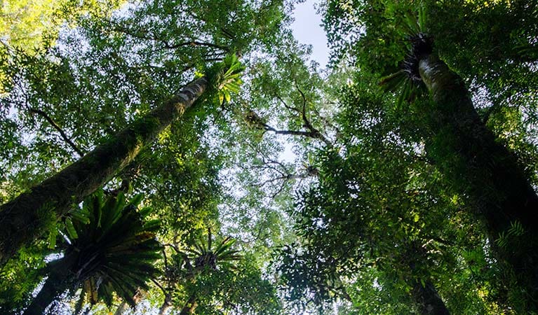
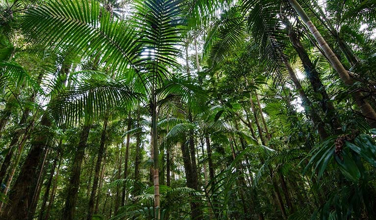
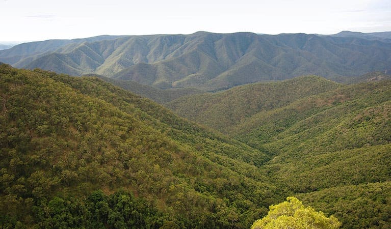
Prepare to be mesmerised by breathtaking scenery as you traverse fern-lined gullies, crystal-clear mountain streams, and high-elevation forests. Towering rocky outcrops will provide dramatic backdrops as you explore this diverse wilderness, venturing deep into the heart of the Apsley-Macleay gorges, one of Australia's largest gorge systems.
The Green Gully Track is a haven for wildlife enthusiasts. Keep your eyes peeled for endangered brush-tailed rock wallabies, majestic wedge-tailed eagles soaring overhead, and even native marsupial mice scurrying amongst the undergrowth.
Unlike typical multi-day hikes, the Green Gully Track eliminates the need to carry a tent. Restored stockman huts, strategically placed along the route, provide comfortable accommodation for weary walkers. Equipped with essentials like beds, rainwater tanks, solar lighting, non-flush toilets, and cooking equipment, these huts offer a welcome respite after a challenging day of exploration.
Important Note: A booking is required to experience the Green Gully Track. This ensures responsible management of this special environment and allows park authorities to provide support while you're on the trail.
Visit NSW National Parks and Wildlife Service for more information on this trail.
Bookings Required
The Green Gully Track requires a booking to ensure responsible management and support for hikers. Bookings are available online for groups between 2 and 4 hikers, with a maximum of 6 people allowed per reservation. Unfortunately, solo adventures are not permitted on the Green Gully Track.
The booking process is simple. Just select your desired arrival date (first night) and leave the number of nights at the default setting (1). Your booking includes accommodation at Cedar Creek Cottage the night before you begin the hike, with the trek itself taking 4 days to complete. Upon booking, you'll receive confirmation and a detailed itinerary for your entire 5-night stay.
Tips
- Be prepared for a challenging 4-day, 65km hike with some steep sections. This trek includes a 900m descent on day 2, creek bed crossings on day 3, and a 600m climb on day 4. A high level of fitness is required.
- Bookings include comfortable stays in 5 heritage huts over the course of the hike. The itinerary includes:
- Night 1: Cedar Creek Cottage
- Night 2: Birds Nest Hut
- Night 3: Green Gully Hut
- Night 4: Colwells Hut
- Night 5: Cedar Creek Lodge
- All bookings are made online for groups between 2 and 4 hikers, with a maximum of 6 people allowed. Solo adventures are not permitted. Upon booking, you'll receive a confirmation and a detailed itinerary for your entire 5-night stay.
- Everyone on the Green Gully Track must be over 12 years old.
- Due to the remote location of the park, thorough preparation is crucial.
- A comprehensive list of required gear and directions will be provided after booking as part of your information package.
- Be sure to pack appropriate clothing and equipment, and inform a family member or friend about your travel plans.
Gallery
Got some great shots from this hike? Upload your photos here to inspire others and show off the beauty of the trail!
Click to view form >>
Submitting your photos doesn’t mean you lose ownership. You can be credited for your contributions, and you can request removal at any time.
Content use
Please don’t copy GPX files or content from this site to AllTrails or other platforms. Each trail has been personally mapped, documented, and refined to support Australia’s bushwalking and hiking community. While some details come from land managers, every listing reflects significant personal effort. This is a free, community-driven initiative—your respect helps keep it that way.
Walk map and GPX file
It looks like I don’t have a GPX file for this trail yet. If you have one to share, please email it to me! I’ll verify it against official maps before adding it to help other hikers have a safer, easier experience. Thanks for contributing to a better hiking resource.
Getting there
Getting to the trailhead: Oxley Wild Rivers National Park.
The Green Gully Track is nestled in the southeastern corner of Oxley Wild Rivers National Park. The exact directions will be provided upon booking, as the starting point is Cedar Creek Cottage, a 2-hour drive from Walcha or 2.5 hours from Port Macquarie.
Rest assured, navigating the Green Gully Track is well-supported. After booking, you’ll receive a detailed z-card, a convenient pocket map that includes the route, contours, emergency information, and locations of huts and trails. While some sections venture off established management trails, the route is well-marked with signs at junctions and along creek beds. For these off-track sections, strong map reading, compass, and GPS skills are recommended, although a separate topographical map isn’t necessary.
Your booking includes access to Cedar Creek Cottage on your first night. A unique code will be provided in your confirmation email to access the cottage. Parking your car is easy – undercover parking is available at Cedar Creek Cottage during your first night. However, for the remainder of the hike, your vehicle will be securely parked behind a locked gate at Cedar Creek.
Closest towns to this walk: Armidale, Bendemeer, Dorrigo, Ebor, Gloucester, Guyra, Tamworth, Uralla, Walcha
About the region
Immerse Yourself in Wild Beauty: Oxley Wild Rivers National Park. Oxley Wild Rivers National Park, a World Heritage-listed Gondwana rainforest sanctuary near Armidale, stuns visitors with its dramatic gorges, magnificent waterfalls, and rare dry rainforests. Explore scenic drives along the Waterfall Way, or delve deeper with multi-day hikes like the Green Gully walk, offering overnight stays in heritage-listed stockman's huts. For a touch of luxury, stay at East Kunderang Homestead.
Camping, walking, paddling, picnicking, cycling, horse riding – Oxley Wild Rivers National Park caters to every outdoor enthusiast. Hike through diverse landscapes – wet and dry eucalypt forests, grassy woodlands, and heathlands. Keep an eye out for native flora like olive trees, lacebarks, and towering stinging trees.
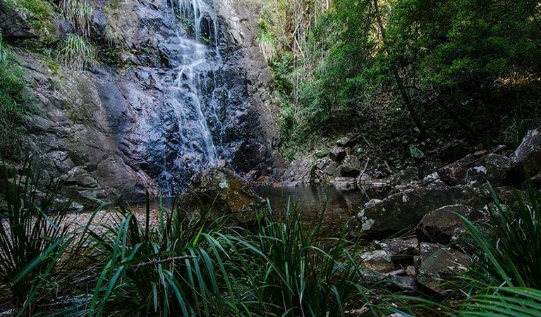
Dramatic ridges, towering rock formations, and cascading waterfalls create a breathtaking backdrop for your exploration. Gaze upon the majestic Wollomombi Falls, the highest in New South Wales, or spot a wedge-tailed eagle soaring on the thermals.
Make the most of your Oxley Wild Rivers National Park adventure by checking the park website for current conditions, permits, and specific activity details.
Similar walks nearby
Looking for more walks in or near Oxley Wild Rivers National Park? Try these trails with a similar difficulty grade.
Track grade
Grade 5 (Difficult) - Walks for the Most Experienced: Grade 5 represents the most challenging walking tracks on the AWTGS. These are only recommended for very experienced and fit walkers with specialised skills, including navigation and emergency first aid. Tracks are likely to be very rough, very steep, and unmarked. Walks may be more than 20 kilometers. These challenging walks demand a high level of fitness and experience to navigate difficult terrain, significant elevation changes, and potentially unformed paths.
Explore safe
Plan ahead and hike safely! Carry enough water, pack layers for changing conditions, and bring safety gear like a torch, PLB, and reliable communication device. Check official sources for trail updates, closures, and access requirements, and review local weather and bushfire advice. Most importantly, share your plans with someone before you go. Being prepared makes for a safer and more enjoyable hike! Stay Safe, Explore More, and Always #ExploreSafe.
Packing checklists
What you carry in your pack depends on factors like weather, terrain, and your adventure type. Not sure what to bring? My free planning, food, and packing checklists are a great starting point, covering day hikes, overnight trips, and multi-day adventures. Use them to customise your kit and always prioritise safety.
Let someone know
Before heading out, take a moment to fill out your trip intentions form. It’s a quick way to share your hike details with family or friends. If something goes wrong, they can notify emergency services, ensuring a faster response and peace of mind. Stay safe and enjoy your adventure
Suggest an edit
Spotted a change on this trail? Maybe there are new features, the route has shifted, or the trail is permanently closed. Whatever the update, I’d love your input. Your feedback helps fellow hikers stay informed and ensures that our trail info stays fresh and reliable.
Acknowledgement of Country
Trail Hiking Australia acknowledges the Traditional Owners of the lands on which we hike and pay respects to their Elders, past and present, and we acknowledge the First Nations people of other communities who may be here today.


