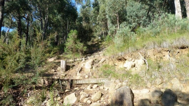
Is there a more enchanted forest than the Dandenongs? Tall mountain ash stretch to the sky whilst Gondwana ferns decorate the mossy gullies. With such Tolkien like scenery, the bushwalker soon becomes convinced that pixies must surely live among the ferns.
This hike follows little used trails from Upper Ferntree Gully Railway Station to Mt Dandenong Hotel. Mainly on track, with the occasional wombat trail, the route has a total elevation gain of over 1,000m. Thankfully, not all this elevation comes at once. Rather there's a little uphill, then a little downhill, and so it goes until you reach your destination.
On the way there are several sights. There's the Doongalla Picnic Ground, set in an English garden next to an historic homestead. It's probably the most romantic picnic ground you can find. There's also a number of hillbillies who live on the route and if you're lucky to get one talking, you will be spun a yarn about the history of the area.
From Mt Dandenong Hotel a bus will take you back to the start following a charming route that is worth the price of the Myki pass alone. On weekends buses leave hourly. However, I suggest you delay the bus trip and take advantage of a late lunch at the Pig and Whistle Tavern. The Lemon Meringue Pie is spectacular.
Trail and description contributed by Petras Surna
- The route follows many small tracks and is difficult to describe in a step by step way.
- You will need a GPS and load the GPX file and keep an eye on it as there are many subtle twists and turns.
- Ensure you have a Myki pass so you can catch a bus back to the start.
Got some great shots from this hike? Upload your photos here to inspire others and show off the beauty of the trail!
Submitting your photos doesn’t mean you lose ownership. You can be credited for your contributions, and you can request removal at any time.
Please don’t copy GPX files or content from this site to AllTrails or other platforms. Each trail has been personally mapped, documented, and refined to support Australia’s bushwalking and hiking community. While some details come from land managers, every listing reflects significant personal effort. This is a free, community-driven initiative—your respect helps keep it that way.
Total distance: 16651 m
Max elevation: 536 m
Min elevation: 130 m
Total climbing: 1146 m
Total descent: -768 m
Getting there
Getting to the trailhead: Dandenong Ranges.
Drive to Upper Ferntree Gully railway station, there is a large car park. Or you can catch a train there.
Closest towns to this walk: Belgrave, Emerald, Kallista, Kalorama, Monbulk, Montrose, Olinda, Sassafras, Tecoma, Upwey
Access conditions
- 2WD Access
- Public Transport
- Large Car Park
- Accessible Parking
- Accessible Toilet
- Public Toilets
About the region
Less than an hour from Melbourne, the Dandenong Ranges is a whole life experience away, offering breath-taking scenery, romantic hideaways and indulgent adventures. The Dandenong Ranges is a haven of hidden delights with scenic winding roads to quaint hilltop villages. There is an abundance of artist studios, craft stores and renowned gardens to explore as well as walking and cycling trails through mountain ash forests and clean, refreshing air.
Similar walks nearby
Looking for more walks in or near Dandenong Ranges? Try these trails with a similar difficulty grade.
Favourite

Favourite

Favourite

Favourite

Dandenong Ranges National Park
Track grade
Grade 3 (Moderate) - Walks for Most Fitness Levels: Grade 3 on the
AWTGS represents moderate walking tracks. These are ideal for walkers with some fitness who are comfortable with some hills and uneven terrain. While suitable for most ages, some bushwalking experience is recommended to ensure a safe and enjoyable experience. Tracks may have short, steep hill sections, a rough surface, and many steps. The total distance of a Grade 3 walk can be up to 20 kilometers.
Explore safe
Plan ahead and hike safely! Carry enough water, pack layers for changing conditions, and bring safety gear like a torch, PLB, and reliable communication device. Check official sources for trail updates, closures, and access requirements, and review local weather and bushfire advice. Most importantly, share your plans with someone before you go. Being prepared makes for a safer and more enjoyable hike! Stay Safe, Explore More, and Always #ExploreSafe.
Packing checklists
What you carry in your pack depends on factors like weather, terrain, and your adventure type. Not sure what to bring? My free planning, food, and packing checklists are a great starting point, covering day hikes, overnight trips, and multi-day adventures. Use them to customise your kit and always prioritise safety.
Let someone know
Before heading out, take a moment to fill out your trip intentions form. It’s a quick way to share your hike details with family or friends. If something goes wrong, they can notify emergency services, ensuring a faster response and peace of mind. Stay safe and enjoy your adventure
Suggest an edit
Spotted a change on this trail? Maybe there are new features, the route has shifted, or the trail is permanently closed. Whatever the update, I’d love your input. Your feedback helps fellow hikers stay informed and ensures that our trail info stays fresh and reliable.


