Hike at a Glance
Max elevation: 501m
Min elevation: 416m
Total Ascent: 99m
Hike overview
The Tara Cave walking track offers a gentle 3.8km return bushwalk through Warrumbungle National Park, providing a perfect opportunity to immerse yourself in both nature and local Aboriginal culture. This easy, grade 2 hike typically takes around two hours to complete and is ideal for those seeking a peaceful walk with the added benefit of learning about the area's rich history.
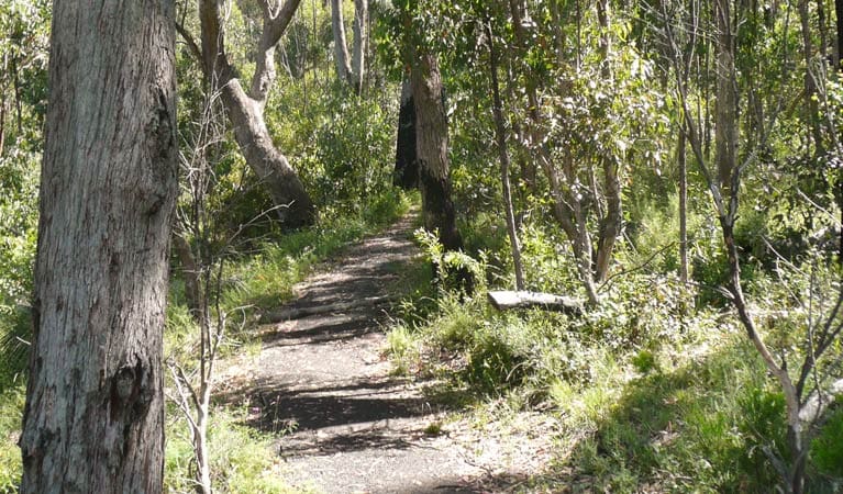
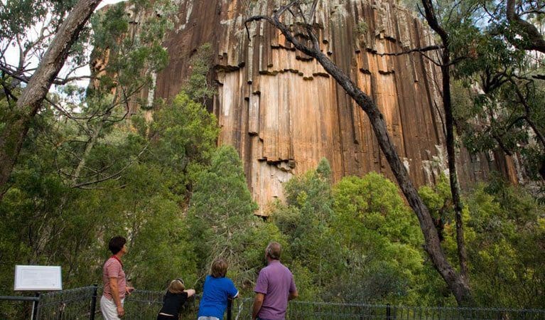
Starting at the Old Woolshed picnic area, the trail crosses Wambelong Creek and leads through a grassy valley. The track gradually climbs through eucalypt forest, bringing you to the distinctive Pilliga sandstone slopes. As you continue along the path, you'll arrive at Tara Cave, a significant site where evidence of Aboriginal occupation can be found. The cave was once used for shelter and for manufacturing stone tools. At the entrance, you’ll find a stone slab featuring grinding grooves, a reminder of the area’s ancient use by the local people. Along the way, interpretive displays provide insight into the deep connection the Aboriginal people have with this land, enriching the walk with historical context.
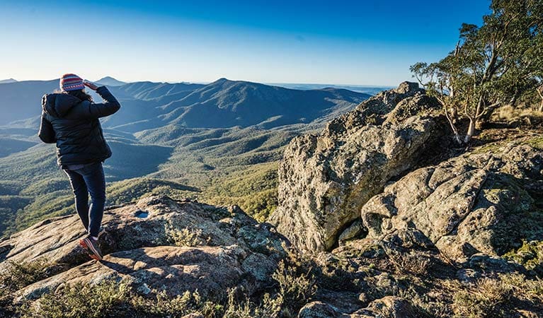
The top of the trail offers stunning views of Warrumbungle National Park’s iconic skyline, making it a perfect spot for reflection. After your hike, take the chance to relax with a picnic at the Old Woolshed area or enjoy a barbecue at the nearby Canyon picnic area. If you’re keen to explore further, you can combine the Tara Cave track with a short walk to the Whitegum lookout, which is accessible for those with mobility needs.
Visiting in spring brings extra rewards, as the area blooms with wildflowers, including vibrant yellow everlasting daisies and billy buttons. The cooler temperatures make for a pleasant walk, and it’s a fantastic time for birdwatching. Keep an eye out for turquoise parrots and spotted pardalotes, adding a colourful touch to the already stunning surroundings. Whether you're keen to learn about the area's cultural history or simply enjoy the natural beauty, the Tara Cave walking track offers a fulfilling and enriching experience.
Tips
- This walk includes a creek crossing. Please check water level height at Warrumbungle National Park Visitor Centre before starting this walk. Take special care after heavy rain.
- Visit Warrumbungle National Park Visitor Centre before you set out to pick up a free trail map and get detailed route information and advice.
Gallery
Got some great shots from this hike? Upload your photos here to inspire others and show off the beauty of the trail!
Uploading your photos doesn’t mean you lose ownership. You can be credited for your contributions, and you can request removal at any time.
Walk map and GPX file
Max elevation: 501 m
Min elevation: 416 m
Total climbing: 99 m
Total descent: -99 m
Content use
Every trail on this site has been personally mapped and refined to support Australia’s hiking community. While some info comes from land managers, each listing reflects significant personal work. Please don’t upload GPX files or content from this site to AllTrails or any other platform. This is a free community initiative—your respect helps keep it that way.
Getting there
Closest towns to this walk: Baradine, Binnaway, Coolah, Coonabarabran, Dunedoo, Gilgandra, Gulargambone, Mendooran
Getting to the trailhead in Warrumbungle National Park.Nestled within Warrumbungle National Park, the Tara Cave Walking Track is easily accessible by car year-round. Whether you’re coming from Coonabarabran or Gilgandra, well-maintained sealed roads pave the way for a smooth journey.
From Coonabarabran: Follow Newell Highway west onto Dalgarno Street for about 450 meters. Make a right turn onto Namoi Street, then continue onto Eden Street and eventually Timor Road after 400 meters. Keep an eye out for signs guiding you towards Warrumbungle National Park along Timor Road for roughly 23 kilometers. Upon entering the park, the road transforms into John Renshaw Parkway. Stay on this parkway for 14 kilometers, and you’ll find the Old Woolshed picnic area conveniently located on your right.
From Gilgandra: Take Newell Highway north towards Coonabarabran. After traveling for about 40 kilometers, look out for the brown Tourist Drive 1 sign. Use this as your cue to turn left onto the road leading into Tooraweenah village. Traverse through Tooraweenah, following Tourist Drive 1 north for another 28 kilometers until you reach the old Gummin Gummin homestead. Make a right turn here and follow John Renshaw Parkway for 10 kilometers. Your destination, the Old Woolshed picnic area, awaits you at the end of this journey.
Parking and Facilities: Ample parking is available at the Old Woolshed picnic area, providing a convenient starting point for your exploration of the Tara Cave Walking Track.
About the region
Millions of years ago, a mighty shield volcano sculpted the jagged peaks of Warrumbungle National Park. Today, these ancient formations rise majestically from eucalyptus-dotted plains, creating a landscape unlike any other in New South Wales.
As Australia's first Dark Sky Park, Warrumbungle boasts pristine skies untouched by light pollution. Here, the Milky Way stretches across the heavens, revealing a dazzling display of stars, planets, and distant galaxies. Whether you're a seasoned astronomer or a curious beginner, Warrumbungle offers unforgettable stargazing experiences.
Lace up your boots and explore a network of walking tracks. Hike the iconic Breadknife and Grand High Tops Walk for breathtaking close-up views of the park's most recognizable rock formations. The park is a haven for outdoor enthusiasts, with opportunities for camping, birdwatching, and capturing stunning photographs of the dramatic scenery.
While wildfires impacted the park in 2013, the National Parks and Wildlife Service (NPWS) has meticulously restored walking tracks, campgrounds, and visitor facilities. Start your adventure at the Warrumbungle Visitor Centre, where you can gather park information or purchase a star chart to navigate the night sky.
Similar trails nearby
Looking for hikes and trails in Warrumbungle National Park or nearby? Try these walks with a similar grade.
Track grade
Grade 2 (Easy) - A Gentle Introduction to Inclines: Grade 2 on the AWTGS represents easy walking tracks that offer a slightly more challenging experience compared to Grade 1. Similar to Grade 1, no prior bushwalking experience is required. The track surface is typically hardened or compacted and may have gentle hill sections or occasional steps. The total distance of a Grade 2 walk is typically no greater than 10 kilometers. These walks are still suitable for families with a bit more experience or those seeking a gentle introduction to some inclines.
Explore safe
Plan ahead and hike safely! Carry enough water, pack layers for changing conditions, and bring safety gear like a torch, PLB, and reliable communication device. Check official sources for trail updates, closures, and access requirements, and review local weather and bushfire advice. Most importantly, share your plans with someone before you go. Being prepared makes for a safer and more enjoyable hike! Stay Safe, Explore More, and Always #ExploreSafe.
Packing checklists
What you carry in your pack depends on factors like weather, terrain, and your adventure type. Not sure what to bring? My free planning, food, and packing checklists are a great starting point, covering day hikes, overnight trips, and multi-day adventures. Use them to customise your kit and always prioritise safety.
Let someone know
Before heading out, take a moment to fill out your trip intentions form. It’s a quick way to share your hike details with family or friends. If something goes wrong, they can notify emergency services, ensuring a faster response and peace of mind. Stay safe and enjoy your adventure
Suggest an edit
Spotted a change on this trail? Maybe there are new features, the route has shifted, or the trail is permanently closed. Whatever the update, I’d love your input. Your feedback helps fellow hikers stay informed and ensures that our trail info stays fresh and reliable.
Acknowledgement of Country
Trail Hiking Australia acknowledges the Traditional Owners of the lands on which we hike and pay respects to their Elders, past and present, and we acknowledge the First Nations people of other communities who may be here today.


