Trail Fast Facts
The Stapylton Ampitheatre traverse is a 6.5km, grade 4 hike in Grampians National Park, Victoria. This hike typically takes 4 hours to complete.
Warning
This is a demanding hike that is not for the faint-hearted or ill-prepared. It includes exposed ledges, serious rock scrambling and challenging route finding.
Hike Overview
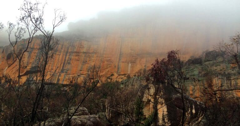
Regarded as one of Victoria's most challenging day walks, Stapylton Amphitheatre follows an unmarked ridge route between Hollow Mountain and Mt Stapylton in Grampians National Park. Featuring exposed scrambling, cave climbing, and precarious drops, this rugged trek is best for experienced hikers only.
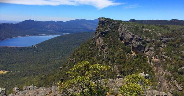
Prepare for water crossings, slippery tracks, rock hopping, and unassisted climbing through wind-scoured caverns. You'll be rewarded with splendid vistas of iron-stained cliffs, rocky outcrops, densely vegetated gullies, and woodlands teeming with banksias, grass trees, native pines, and eucalypts. The Stapylton Amphitheatre itself is a sight to behold.
This demanding hike is not for the faint-hearted. A substantial part involves exposed scrambling and tricky route-finding, requiring good navigation skills and a head for heights. If you're an experienced hiker seeking an unforgettable adventure, Stapylton Amphitheatre awaits.
Track Grade
Grade 4 (Hard) - Challenging Walks for Experienced Walkers: Grade 4 on the AWTGS signifies challenging walking tracks. Bushwalking experience is recommended for these tracks, which may be long, rough, and very steep. Directional signage may be limited, requiring a good sense of navigation. These walks are suited for experienced walkers who are comfortable with steeper inclines, rougher terrain, and potentially longer distances.
Tips
- The GPX file has strategic waypoints that may assist with navigation between Hollow Mountain and Stapylton.
- This is the most challenging section of the walk where a wrong turn could see you stranded on the edge of a ravine.
Map and GPX file
Max elevation: 489 m
Min elevation: 229 m
Total climbing: 401 m
Total descent: -401 m
Trailhead
Sorry, no records were found. Please adjust your search criteria and try again.
Sorry, unable to load the Maps API.
Getting there
From Melbourne, follow the Western Highway through Stawell (235km) to Dadswells Bridge (and the big Koala). Continue on for 10.8km to turn left along Dadswell Bridge Road (signposted for Mount Zero). Follow the sealed road for 3km to turn left on unsealed Flat Rock Road. Drive for 3km to a t-intersection. Turn right on the Mount Zero-Halls Gap Road and follow it or 1.4km to turn left into Hollow Mountain Carpark.
About the region
Grampians National Park is part of the Gariwerd Aboriginal cultural landscape. Parks Victoria respects the deep and continuing connection that Traditional Owners have to these lands and waters, and we recognise their ongoing role in caring for Country.
Explore the natural beauty of the Grampians from its world-famous hiking trails. Discover majestic waterfalls, dazzling spring wildflower displays and awe-inspiring mountain panoramas. Cross paths with kangaroos, wallabies, emus and native birds. Heritage-listed for its Aboriginal heritage, animal and plant life, and stunning natural beauty, the Grampians National Park is one of Australia's most recognisable places. The best way to appreciate it is on one of its many world-class walks or hikes or by taking a scenic drive.
Traditionally known as Gariwerd, this region is home to the largest number of significant and ancient Aboriginal rock art paintings and shelters in southern Australia. A visit to Brambuk – The National Park & Cultural Centre will help you get the most of your trip to these rock shelters.
The Grampians draws walkers from around the world. Hike to the highest peak within the Grampians, Mount William, or explore the plethora of walks around Halls Gap and the Wonderland Range. Views from the Pinnacle are famous, but the steep walk should only be attempted by the fit. If you’re an experienced walker you’ll enjoy the unique challenge of the park’s overnight hikes. Choose from the iconic Grampians Peaks Trail, Major Mitchell Plateau or The Fortress and Mt Thackeray Overnight Hike.
There are more relaxing pursuits to enjoy in the Grampians, too. Go fishing, canoeing or kayaking at Lake Wartook, Lake Bellfield and Moora Moora Reservoir or one of the park’s many other streams and creeks.
Similar trails nearby
Looking for things to do in Grampians National Park? Try these hikes or bushwalks.
Explore Safe
While planning your hike, it’s important to check official government sources for updated information, temporary closures and trail access requirements. Before hitting the trail, check local weather and bushfire advice for planned burns and bushfire warnings and let someone know before you go. Plan ahead and hike safely.
Let someone know
Adventure with peace of mind: Fill out your trip intentions form. Before you hit the trail, fill out an online form to privately send important details about your hike to your family or friends. If you don’t return on time, they can easily alert emergency services, preventing worry and ensuring a swift response. Hike with peace of mind and enjoy your outdoor adventure to the fullest. Be smart, be safe: Register your plans here.
Gear to consider
What you carry in your pack will depend on the weather, terrain, time of year, type of adventure, and personal preferences. Having trouble deciding what gear’s right for you? My free planning, food and packing checklists provide an introduction to things your could consider (as well as the Ten Essentials) on your day, overnight and multi-day adventures. Customise your kit according to your personal needs, always considering safety first.
Suggest an edit
Trail changed? New features discovered? Has the route changed? Trail permanently closed? Help fellow hikers by suggesting edits! Click above to update route descriptions, GPX file, trail features (like boardwalks), or access conditions (like parking availability). Help me keep the trails info fresh!
Weather
Acknowledgement of Country
Trail Hiking Australia acknowledges the Traditional Owners of the lands on which we hike and pay respects to their Elders, past and present, and we acknowledge the First Nations people of other communities who may be here today.


3 Reviews on “Stapylton Ampitheatre Hike (6.7km)”
Which direction is easier? Mt Stapylton to Hollow Mt or the other way?
One of my favourites in the Grampians. Highly recommend avoiding this one in the wet as the rocks get very slippery 🙂