Hike at a Glance
Max elevation: 39m
Min elevation: 1m
Total Ascent: 504m
Hike overview
Solitary Islands coastal walk traverses 60km of beaches and rainforest on the Coffs Coast. Enjoy whale watching, birdwatching and swimming on your journey from Red Rock to the coastal village of Sawtell.
You'll be hard pressed to find a more beautiful walk on the east coast of NSW. The Solitary Islands coastal walk links a string of idyllic golden beaches, rocky headlands and lush rainforest along the Coffs Coast.
Make your way through Coffs Coast Regional Park, Moonee Beach Nature Reserve and Muttonbird Island Nature Reserve before winding up at Sawtell, near Bongil Bongil National Park.
Solitary Islands and Muttonbird Island are picturesque and make for perfect birdwatching, so bring your binoculars; little terns and white bellied eagles are often seen along the shores. Dolphins surf the waves of these beaches all year round and the headlands are ideal for whale watching.
There are plenty of options for picnicking, swimming and water sports. And with loads of nearby cafes and accommodation to suit any budget, you'll want to keep coming back to discover all the charms of this beautiful walking track.
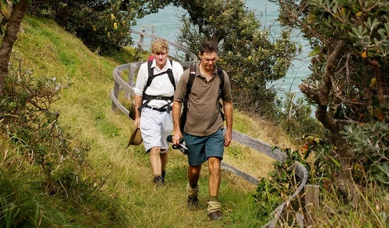
If you're feeling energetic, pack your backpack and do the whole walk and camp over four days. Or why not stroll along the coastal walk in shorter sections, accessed from Arrawarra Headland, Woolgoolga Beach and Headland, Emerald Beach, Diggers Beach, and nearby Muttonbird Island Nature Reserve.
Tips
Check the tides - walking along the beach is easiest at low tide. Areas that are best walked at low tide include creek crossings at Arrawarra and Moonee Creek and around rocks on Campbells Beach.
Gallery
Got some great shots from this hike? Upload your photos here to inspire others and show off the beauty of the trail!
Click to view form >>
Submitting your photos doesn’t mean you lose ownership. You can be credited for your contributions, and you can request removal at any time.
Content use
Please don’t copy GPX files or content from this site to AllTrails or other platforms. Each trail has been personally mapped, documented, and refined to support Australia’s bushwalking and hiking community. While some details come from land managers, every listing reflects significant personal effort. This is a free, community-driven initiative—your respect helps keep it that way.
Walk map and GPX file
Max elevation: 39 m
Min elevation: 1 m
Total climbing: 504 m
Total descent: -503 m
Getting there
Getting to the trailhead: Coffs Coast Regional Park.
Solitary Islands coastal walk is in Coffs Coast Regional Park, Moonee Beach and Muttonbird Island nature reserves. To access the northern end of the walk at Red Rock (55km from Grafton and 41km from Coffs Harbour): Turn off Pacific Highway at Corindi Beach (48km south of Grafton and 34km north of Coffs Harbour). Turn left onto Red Rock Road and continue 6km to Red Rock. Explore the creek-side boardwalk before heading south along the beach toward Arrawarra Headland.
To access the southern end of the walk at Sawtell Headland (5km south of Coffs Harbour): Follow the signs to Sawtell Headland from Lyons Road/First Avenue. Explore the tidal pool and head north along the beach toward Boambee Headland Parking Parking is available at Red Rock and Sawtell Headland.
Closest towns to this walk: Coffs Harbour, Korora, Moonee Beach, Sapphire Beach, Toormina
About the region
Coffs Coast Regional Park, near Coffs Harbour, is a top spot for fishing, surfing and birdwatching. You'll find great picnic areas, plus beaches with off-leash dog zones.
It's easy to experience an endless summer at Coffs Coast Regional Park. Lose yourself in its string of pristine beaches which together offer everything from unbeatable surf and safe swimming to picnic areas and children's playgrounds.
Explore undulating dunes, rainforest pockets, tranquil lakes, inviting parklands and charming coastal towns along the coastal walk and discover majestic headlands ideal for whale watching and taking in sweeping views of Solitary Islands Marine Park.
Similar walks nearby
Looking for more walks in or near Coffs Coast Regional Park? Try these trails with a similar difficulty grade.
Track grade
Grade 4 (Hard) - Challenging Walks for Experienced Walkers: Grade 4 on the AWTGS signifies challenging walking tracks. Bushwalking experience is recommended for these tracks, which may be long, rough, and very steep. Directional signage may be limited, requiring a good sense of navigation. These walks are suited for experienced walkers who are comfortable with steeper inclines, rougher terrain, and potentially longer distances.
Explore safe
Plan ahead and hike safely! Carry enough water, pack layers for changing conditions, and bring safety gear like a torch, PLB, and reliable communication device. Check official sources for trail updates, closures, and access requirements, and review local weather and bushfire advice. Most importantly, share your plans with someone before you go. Being prepared makes for a safer and more enjoyable hike! Stay Safe, Explore More, and Always #ExploreSafe.
Packing checklists
What you carry in your pack depends on factors like weather, terrain, and your adventure type. Not sure what to bring? My free planning, food, and packing checklists are a great starting point, covering day hikes, overnight trips, and multi-day adventures. Use them to customise your kit and always prioritise safety.
Let someone know
Before heading out, take a moment to fill out your trip intentions form. It’s a quick way to share your hike details with family or friends. If something goes wrong, they can notify emergency services, ensuring a faster response and peace of mind. Stay safe and enjoy your adventure
Suggest an edit
Spotted a change on this trail? Maybe there are new features, the route has shifted, or the trail is permanently closed. Whatever the update, I’d love your input. Your feedback helps fellow hikers stay informed and ensures that our trail info stays fresh and reliable.
Acknowledgement of Country
Trail Hiking Australia acknowledges the Traditional Owners of the lands on which we hike and pay respects to their Elders, past and present, and we acknowledge the First Nations people of other communities who may be here today.


