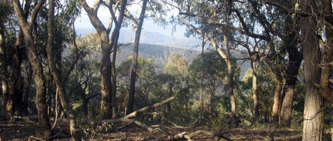
This Silver Creek Circuit Kinglake circuit is a combination of outer routes of the suggested loops for Silver Creek. It is quite a scenic walk with a few steep hills to get the lungs going. The tracks follow vehicle management tracks. The area is still regenerating from the tragic fires. There are the cascades roughly halfway along that are worth a look as well. Upon arrival there is an information board with a basic map and a series of suggested loops colour coded.
The route can be done either way (clockwise or anticlockwise), there is no distinct advantage to either. Plus if you are short of time you could choose one of the shorter loops. At the time of writing signage was very good along the route. But do take a copy of the map so you can know which junction to take.
Please don’t copy GPX files or content from this site to AllTrails or other platforms. Each trail has been personally mapped, documented, and refined to support Australia’s bushwalking and hiking community. While some details come from land managers, every listing reflects significant personal effort. This is a free, community-driven initiative—your respect helps keep it that way.
Total distance: 13546 m
Max elevation: 511 m
Min elevation: 330 m
Total climbing: 744 m
Total descent: -745 m
Getting there
Getting to the trailhead: Kinglake National Park.
Kinglake National Park is 65km north-east of Melbourne. Access from Melbourne is by three main routes: the Melba Highway from Yarra Glen or Glenburn, the Heidelberg-Kinglake Road from St Andrews and the Whittlesea-Yea Road from Whittlesea. Follow the Whittlesea-Yea Road north towards Flowerdale. Approximately 13.5km from the junction of Whittlesea-Kinglake road you will locate Silver Creek Road on your left. Follow this for approximately 1.5km to the park entrance and car park. Park your car here.
Closest towns to this walk: Flowerdale, Glenburn, Hurstbridge, Kinglake, St Andrews, Whittlesea, Yarra Glen, Yea
About the region
Kinglake National Park includes the traditional Country of the Taungurung and Wurundjeri Peoples. Parks Victoria respects the deep and continuing connection that Traditional Owners have to these lands and waters, and we recognise their ongoing role in caring for Country. We're proud to be joint management partners with Taungurung Land and Waters Council Aboriginal Corporation for part of this Aboriginal cultural landscape.
Similar walks nearby
Looking for more walks in or near Kinglake National Park? Try these trails with a similar difficulty grade.
Favourite

Favourite

Favourite

Favourite

Track grade
Grade 3 (Moderate) - Walks for Most Fitness Levels: Grade 3 on the
AWTGS represents moderate walking tracks. These are ideal for walkers with some fitness who are comfortable with some hills and uneven terrain. While suitable for most ages, some bushwalking experience is recommended to ensure a safe and enjoyable experience. Tracks may have short, steep hill sections, a rough surface, and many steps. The total distance of a Grade 3 walk can be up to 20 kilometers.
Explore safe
Plan ahead and hike safely! Carry enough water, pack layers for changing conditions, and bring safety gear like a torch, PLB, and reliable communication device. Check official sources for trail updates, closures, and access requirements, and review local weather and bushfire advice. Most importantly, share your plans with someone before you go. Being prepared makes for a safer and more enjoyable hike! Stay Safe, Explore More, and Always #ExploreSafe.
Packing checklists
What you carry in your pack depends on factors like weather, terrain, and your adventure type. Not sure what to bring? My free planning, food, and packing checklists are a great starting point, covering day hikes, overnight trips, and multi-day adventures. Use them to customise your kit and always prioritise safety.
Let someone know
Before heading out, take a moment to fill out your trip intentions form. It’s a quick way to share your hike details with family or friends. If something goes wrong, they can notify emergency services, ensuring a faster response and peace of mind. Stay safe and enjoy your adventure
Suggest an edit
Spotted a change on this trail? Maybe there are new features, the route has shifted, or the trail is permanently closed. Whatever the update, I’d love your input. Your feedback helps fellow hikers stay informed and ensures that our trail info stays fresh and reliable.
/Silver-Creek-Circuit-Kinglake-Hike_5.jpg)
/Silver-Creek-Circuit-Kinglake-Hike_8.jpg)
/Silver-Creek-Circuit-Kinglake-Hike_3.jpg)
/Silver-Creek-Circuit-Kinglake-Hike_11.jpg)
/Silver-Creek-Circuit-Kinglake-Hike_14.jpg)
/Silver-Creek-Circuit-Kinglake-Hike_9.jpg)
/Silver-Creek-Circuit-Kinglake-Hike_13.jpg)
/Silver-Creek-Circuit-Kinglake-Hike_1.jpg)
/Silver-Creek-Circuit-Kinglake-Hike_7.jpg)
/Silver-Creek-Circuit-Kinglake-Hike_10.jpg)
/Silver-Creek-Circuit-Kinglake-Hike_4.jpg)
/Silver-Creek-Circuit-Kinglake-Hike_12.jpg)
/Silver-Creek-Circuit-Kinglake-Hike_2.jpg)


8 Reviews on “Silver Creek Circuit Kinglake Hike (13.5km)”
A large portion of the South-West side is now prohibited entry – I think it’s the yellow track. You can still make your way back without having to repeat any extra of the route but it does lose roughly. 2KM.
As Philip said, a lot of trees have fallen over past the Cascades section. They’re okay to walk through but I’d recommend long-sleeve shirt and pants for all the bushes, expect to be doing some duck walking under fallen branches.
Walked this today. Map at entry was easy to understand and coloured pointers on trail posts were good. Range of flora was interesting. Some clearing of fallen trees from winter storms was evident with a little more needed. We enjoyed it,. We walked the red, yellow and orange trails combined which took about 4 hours.
I walked this in the last year. It was worthwhile but the steep fire trail sections were a little tiresome _ could see the potential for pleasant graded walking track.
I walked this last weekend. The Cascades section has a number of fallen trees across the trail – is almost impassable. The other loops are clear.