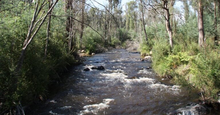
This Wirrawill, Myrtle Gully, Tanglefoot Tracks hike is a very beautiful hike that takes the Western side of Mount Tanglefoot, and is a shorter version of the Tanglefoot Track plus includes the Wirrawilla Rainforest Walk. This walk is well worth taking your time to admire the scenery on.
Once leaving the carpark take the left track down, soon you will see a left off to Wirrawilla Rainforest Walk. It is certainly worth the diversion to take. Follow the circuit and soon you will return onto the Myrtle Gully Track. This section follows through a long section of beautiful ferns lining the track.
After a bit more than 4km since the start you will come to the junction with the Tanglefoot Track. Take the right and follow that for roughly 3km. Keep an eye out for the track to your right following the track down to join the Quarry Track. Take the right to follow back down to the Wirrawilla Carpark.
- You can take this circuit either way, neither direction offers much in the way of advantage over the other.
- Be prepared for leeches as they can be numerous here. But it does vary.
Please don’t copy GPX files or content from this site to AllTrails or other platforms. Each trail has been personally mapped, documented, and refined to support Australia’s bushwalking and hiking community. While some details come from land managers, every listing reflects significant personal effort. This is a free, community-driven initiative—your respect helps keep it that way.
Total distance: 8443 m
Max elevation: 884 m
Min elevation: 649 m
Total climbing: 482 m
Total descent: -483 m
Getting there
Getting to the trailhead: Toolangi State Forest.
One option is to head to Healesville, then take Myers Creek Road for nearly 13km. Take the right for Sylvia Creek Road. Follow this for roughly 4km until you see the sign for Wirrawilla Carpark on your right. But ensure you watch out for the signs.
Closest towns to this walk: Chum Creek, Dixons Creek, Healesville, Kinglake, Marysville, Narbethong, Toolangi, Yarra Glen, Yea
Access conditions
- 2WD Access
- Gravel Road
- Winding Road
- Small Car Park
- Public Toilets
- Picnic Table
About the region
Toolangi State Forest just north of Healesville, offers an immersive environment in Victoria's tall forest region. The name Toolangi is an Aboriginal word meaning tall trees. The forest is mainly Eucalypt forest that has regrown from the 1939 Victoria Bushfires. Large sections of the forest were also burnt in the 2009 Victorian Bushfires, although there are some pockets of old-growth forest that have not yet been logged or seriously burnt.
Similar walks nearby
Looking for more walks in or near Toolangi State Forest? Try these trails with a similar difficulty grade.
Favourite

Favourite

Murrindindi Scenic Reserve
Favourite

Yarra Ranges National Park
Favourite

Yarra Ranges National Park
Track grade
Grade 3 (Moderate) - Walks for Most Fitness Levels: Grade 3 on the
AWTGS represents moderate walking tracks. These are ideal for walkers with some fitness who are comfortable with some hills and uneven terrain. While suitable for most ages, some bushwalking experience is recommended to ensure a safe and enjoyable experience. Tracks may have short, steep hill sections, a rough surface, and many steps. The total distance of a Grade 3 walk can be up to 20 kilometers.
Explore safe
Plan ahead and hike safely! Carry enough water, pack layers for changing conditions, and bring safety gear like a torch, PLB, and reliable communication device. Check official sources for trail updates, closures, and access requirements, and review local weather and bushfire advice. Most importantly, share your plans with someone before you go. Being prepared makes for a safer and more enjoyable hike! Stay Safe, Explore More, and Always #ExploreSafe.
Packing checklists
What you carry in your pack depends on factors like weather, terrain, and your adventure type. Not sure what to bring? My free planning, food, and packing checklists are a great starting point, covering day hikes, overnight trips, and multi-day adventures. Use them to customise your kit and always prioritise safety.
Let someone know
Before heading out, take a moment to fill out your trip intentions form. It’s a quick way to share your hike details with family or friends. If something goes wrong, they can notify emergency services, ensuring a faster response and peace of mind. Stay safe and enjoy your adventure
Suggest an edit
Spotted a change on this trail? Maybe there are new features, the route has shifted, or the trail is permanently closed. Whatever the update, I’d love your input. Your feedback helps fellow hikers stay informed and ensures that our trail info stays fresh and reliable.
/Wirrawill,-Myrtle-Gully,-Tanglefoot-Tracks-Hike_9.jpg)
/Wirrawill,-Myrtle-Gully,-Tanglefoot-Tracks-Hike_11.jpg)
/Wirrawill,-Myrtle-Gully,-Tanglefoot-Tracks-Hike_7.jpg)
/Wirrawill,-Myrtle-Gully,-Tanglefoot-Tracks-Hike_5.jpg)
/Wirrawill,-Myrtle-Gully,-Tanglefoot-Tracks-Hike_6.jpg)
/Wirrawill,-Myrtle-Gully,-Tanglefoot-Tracks-Hike_1.jpg)
/Wirrawill,-Myrtle-Gully,-Tanglefoot-Tracks-Hike_2.jpg)
/Wirrawill,-Myrtle-Gully,-Tanglefoot-Tracks-Hike_3.jpg)
/Wirrawill,-Myrtle-Gully,-Tanglefoot-Tracks-Hike_8.jpg)
/Wirrawill,-Myrtle-Gully,-Tanglefoot-Tracks-Hike_4.jpg)
/Wirrawill,-Myrtle-Gully,-Tanglefoot-Tracks-Hike_13.jpg)
/Wirrawill,-Myrtle-Gully,-Tanglefoot-Tracks-Hike_10.jpg)
/Wirrawill,-Myrtle-Gully,-Tanglefoot-Tracks-Hike_12.jpg)


