Trail Fast Facts
Shoal Bay to Fingal Bay Walk is a 5km, grade 3 hike in Tomaree National Park, New South Wales. This hike typically takes 2 hours to complete.
Hike Overview
This 5 km one-way walk from Shoal Bay to Fingal Bay in Tomaree National Park is ideal if you're after an easy walk near beaches and cafes.
This short day walk from Shoal Bay to Fingal Bay is part of the longer Tomaree Coastal Walk experience, however this section is suitable for inexperienced walkers and families with kids.
You can start the 5 km walk from either Shoal Bay or Fingal Bay, then catch a bus or a taxi back to your starting point. If travelling in a group with 2 cars, you could arrange a car shuffle.
From Shoal Bay, park at Zenith Beach car park and follow the Tomaree Coastal Walk signage featuring the iconic totem of a white-bellied sea eagle. Begin your journey trekking south across the sandy shores of Zenith Beach while enjoying views of Tomaree Head Summit. Part of largest marine park in New South Wales, Zenith Beach is a great place to see birdlife and dolphins.
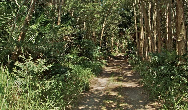
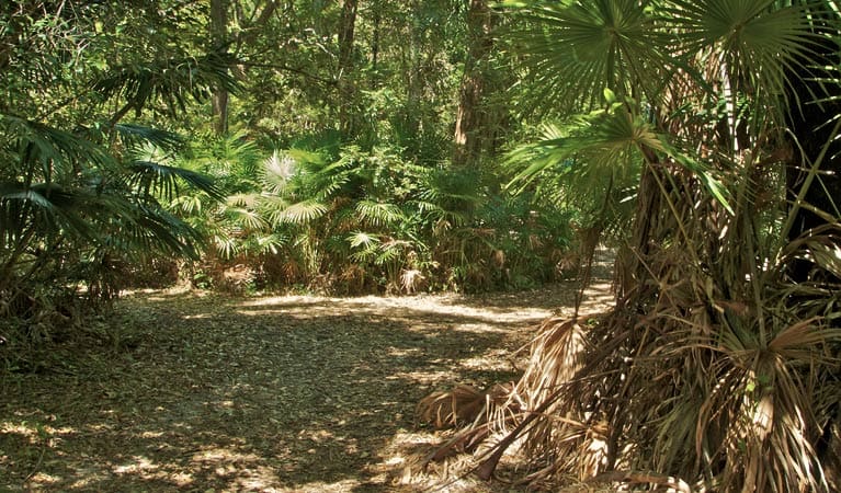
As you traverse around the back of Quarry Hill you might spot the resident echidnas on the hunt for ants. Listen out for wattlebirds and rare black glossy cockatoos in the bushland and forests here. Although it's an open coastal walk you'll also enjoy the cool shade of smooth barked apple or angophora trees along the way.
If you happen to be walking in the cooler months, keep an eye out for migrating humpback whales between May and November.
As you approach Fingal Bay surf life saving club you'll spot a café options for breakfast and lunch. Fingal Bay Beach is patrolled by lifeguards for most of the year a swim or a snorkel is the perfect way to end your hike.
Track Grade
Grade 3 (Moderate) - Walks for Most Fitness Levels: Grade 3 on the AWTGS represents moderate walking tracks. These are ideal for walkers with some fitness who are comfortable with some hills and uneven terrain. While suitable for most ages, some bushwalking experience is recommended to ensure a safe and enjoyable experience. Tracks may have short, steep hill sections, a rough surface, and many steps. The total distance of a Grade 3 walk can be up to 20 kilometers.
Tips
- The best spot to stop for a swim or snorkel is Fingal Bay Beach as it has lifeguards on patrol.
- Many sections of the track are natural surface like rock platforms.
- Follow the wayfinding totems picturing the sea eagle to navigate your along the walk.
- Public toilets are available along this walk at: Shoal Bay Road, or behind Fingal Bay surf life saving club.
- Picnic tables are located at Fingal Bay.
- Barbecue facilities are located at Fingal Bay.
- Cafés are located at Fingal Bay surf life saving club.
Map and GPX file
Max elevation: 81 m
Min elevation: 0 m
Total climbing: 138 m
Total descent: -143 m
Trail Location (trailhead)
Sorry, no records were found. Please adjust your search criteria and try again.
Sorry, unable to load the Maps API.
Getting there
Shoal Bay to Fingal Bay walking track is in Tomaree National Park.
To get to the Shoal Bay start point, take the Pacific Highway from Newcastle or Buladelah, turn east into Richardson Road and continue along Nelson Bay Road. From Nelson Bay, follow Shoal Bay Road to the lower Zenith Beach carpark. Free all-day parking is available at the base of the track, and along Shoal Bay Road. Arrive early because this area is busy on weekends and in summer.
To get to the Fingal Bay start point, take the Pacific Highway from Newcastle or Buladelah, turn east into Richardson Road and continue along Nelson Bay Road. Fom Nelson Bay, follow Shoal Bay Road, turn right on Government Road which turns left slightly and becomes Sylvia Road, continue on Marine Drive until you reach the car park at the back of Fingal Beach surf life saving club.
At Shoal Bay, free all-day parking is available along Shoal Bay Road and at the lower Zenith Beach carpark or upper Zenith beach carpark. Arrive early because this area is busy on weekends and in summer. Parking is available at Fingal Bay along Marine Drive or at the back of Fingal Beach surf life saving club. Arrive early because this area is busy on weekends and in summer.
Photo gallery
If you have any photos from this hike and are happy to share them, please upload your .jpg files here.
Please note: Uploading photos does not transfer ownership of copyright away from you. If requested, you will be credited for any photos you provide and can ask they be deleted at any time.
About the region
Tomaree National Park near Port Stephens is on Worimi Country. It's a great place for a weekend getaway. With so many coastal lookouts it's easy to go whale watching, hike the tracks, or explore the historical significance of Fort Tomaree.
Tomaree National Park provides a magnificent backdrop to the coastal villages of Nelson Bay, Shoal Bay, Fingal Bay, One Mile, Boat Harbour and Anna Bay. With 27km of connected hiking Tomaree Coastal Walk offers you a taste of everything in this surprisingly diverse park.
It's the only place in NSW where you can see outcrops of the acid volcanic rock rhyodacite. The national park also borders the largest marine park in the state as well as the largest moving coastal sand dune in the southern hemisphere at nearby Worimi Conservation Lands. The Worimi connection to Country is strong and you can learn more about this at Birubi Point Aboriginal Place.
It's an excellent spot for whale watching and offers a range of scenic walks, including the short Wreck Beach walk through coastal angophora forest and the longer Morna Point walk that comes alive with spring wildflowers. As you walk, look for sea eagles in the sky, koalas dozing high in the trees, and echidnas on the ground.
The park's beaches are pretty places for a family barbecue and there are picnic facilities around Anna Bay, Fingal Bay, and Fishermans Bay. Enjoy a swim or snorkel at the beaches patrolled by lifeguards including One Mile Beach, Fingal Bay Beach, or Birubi Beach. Although there are some good places for fishing you'll need to check the marine park zoning before setting out.
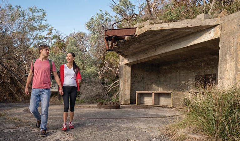
However you choose to spend your time in Tomaree National Park, make sure you hike Tomaree Head Summit. It's steep but short and you'll be rewarded with panoramic ocean views over Port Stephens, and Broughton, Cabbage Tree and Boondelbah Islands nature reserves. While you're there, check out the historic gun emplacements, part of Fort Tomaree and built in 1941 as part of Australia's World War II east coast defence system.
Similar trails nearby
Explore Safe
While planning your hike, it’s important to check official government sources for updated information, temporary closures and trail access requirements. Before hitting the trail, check local weather and bushfire advice for planned burns and bushfire warnings and let someone know before you go. Plan ahead and hike safely.
Let someone know
Adventure with peace of mind: Fill out your trip intentions form. Before you hit the trail, fill out an online form to privately send important details about your hike to your family or friends. If you don’t return on time, they can easily alert emergency services, preventing worry and ensuring a swift response. Hike with peace of mind and enjoy your outdoor adventure to the fullest. Be smart, be safe: Register your plans here.
Gear to consider
What you carry in your pack will depend on the weather, terrain, time of year, type of adventure, and personal preferences. Having trouble deciding what gear’s right for you? My free planning, food and packing checklists provide an introduction to things your could consider (as well as the Ten Essentials) on your day, overnight and multi-day adventures. Customise your kit according to your personal needs, always considering safety first.
Suggest an edit
Trail changed? New features discovered? Has the route changed? Trail permanently closed? Help fellow hikers by suggesting edits! Click above to update route descriptions, GPX file, trail features (like boardwalks), or access conditions (like parking availability). Help me keep the trails info fresh!
Weather
Acknowledgement of Country
Trail Hiking Australia acknowledges the Traditional Owners of the lands on which we hike and pay respects to their Elders, past and present, and we acknowledge the First Nations people of other communities who may be here today.


