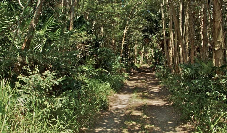
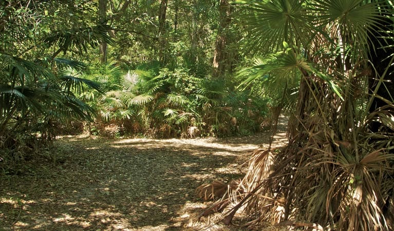
Fort Tomaree walk is an easy walk that runs just below Tomaree Head Summit walk and takes you to the World War II gun emplacements, used in the defence of east coast Australia during World War II.
This easy walk on a paved track around the lower slopes of Tomaree Head brings you face-to-face with local military heritage - World War II gun emplacements, built in 1941 to defend the east coast of Australia. Learn about Fort Tomaree from interpretive signs, or take a guided discovery tour for even more detail.
A further track takes you up elevated walkways on Tomaree Head Summit walk, which offers breathtaking lookout views over Port Stephens and nature reserves like Cabbage Tree Island. Humpbacks migrate past here in winter and spring, so you'll want to bring your camera for whale watching.
Finish your visit by relaxing on the lovely sands of beautiful Zenith Beach, near where the walk begins. Or make your way to the nearby picnic area; an idyllic spot to unwind underneath the shade of angophora trees.
There are some steep sections and the pavement can become slippery when wet, so use caution when walking.
Remember to take your binoculars if you want to birdwatch or whalewatch
Zenith Beach is a sanctuary zone, meaning no collecting or fishing is permitted.
Visit NSW National Parks and Wildlife Service for more information on this trail.
Got some great shots from this hike? Upload your photos here to inspire others and show off the beauty of the trail!
Submitting your photos doesn’t mean you lose ownership. You can be credited for your contributions, and you can request removal at any time.
Please don’t copy GPX files or content from this site to AllTrails or other platforms. Each trail has been personally mapped, documented, and refined to support Australia’s bushwalking and hiking community. While some details come from land managers, every listing reflects significant personal effort. This is a free, community-driven initiative—your respect helps keep it that way.
Total distance: 2093 m
Max elevation: 87 m
Min elevation: 12 m
Total climbing: 135 m
Total descent: -135 m
Getting there
Getting to the trailhead: Tomaree National Park.
Fort Tomaree walk is at Tomaree Head within Tomaree National Park. To get there from Nelson Bay, follow Shoal Bay Road to the lower Zenith Beach carpark Park entry points Tomaree Head carpark. Parking is available at lower Zenith Beach carpark or upper Zenith beach carpark. On busy days you may need to find a parking spot on Shoal Bay Road.
Closest towns to this walk: Anna Bay, Corlette, Fingal Bay, Medowie, Nelson Bay, Port Stephens, Salamander Bay, Shoal Bay
About the region
Tomaree National Park, jointly managed with Hunter Water Corporation, provides a magnificent backdrop to the coastal towns and villages of Nelson Bay, Shoal Bay, Boat Harbour and Anna Bay. It's the only place in NSW where you can see outcrops of the acid volcanic rock rhyodacite.
It's an excellent spot for whale watching and offers a range of scenic walks, including the short Wreck Beach walk through coastal angophora forest and the longer Morna Point walk that comes alive with spring wildflowers. Keep your eyes out for koalas dozing high in the trees.
The park's beaches are pretty places for a family barbecue and there are picnic facilities around Anna Bay and Fishermans Bay - enjoy a swim or snorkel or head to One Mile Beach for some surfing. There are some good places for fishing, though you'll need to check the marine park zoning before setting out.
Similar walks nearby
Looking for more walks in or near Tomaree National Park? Try these trails with a similar difficulty grade.
Favourite

Favourite

Favourite

Myall Lakes National Park
Favourite

Myall Lakes National Park
Track grade
Grade 3 (Moderate) - Walks for Most Fitness Levels: Grade 3 on the
AWTGS represents moderate walking tracks. These are ideal for walkers with some fitness who are comfortable with some hills and uneven terrain. While suitable for most ages, some bushwalking experience is recommended to ensure a safe and enjoyable experience. Tracks may have short, steep hill sections, a rough surface, and many steps. The total distance of a Grade 3 walk can be up to 20 kilometers.
Explore safe
Plan ahead and hike safely! Carry enough water, pack layers for changing conditions, and bring safety gear like a torch, PLB, and reliable communication device. Check official sources for trail updates, closures, and access requirements, and review local weather and bushfire advice. Most importantly, share your plans with someone before you go. Being prepared makes for a safer and more enjoyable hike! Stay Safe, Explore More, and Always #ExploreSafe.
Packing checklists
What you carry in your pack depends on factors like weather, terrain, and your adventure type. Not sure what to bring? My free planning, food, and packing checklists are a great starting point, covering day hikes, overnight trips, and multi-day adventures. Use them to customise your kit and always prioritise safety.
Let someone know
Before heading out, take a moment to fill out your trip intentions form. It’s a quick way to share your hike details with family or friends. If something goes wrong, they can notify emergency services, ensuring a faster response and peace of mind. Stay safe and enjoy your adventure
Suggest an edit
Spotted a change on this trail? Maybe there are new features, the route has shifted, or the trail is permanently closed. Whatever the update, I’d love your input. Your feedback helps fellow hikers stay informed and ensures that our trail info stays fresh and reliable.


