Hike at a Glance
Max elevation: 1022m
Min elevation: 801m
Total Ascent: 580m
Hike overview
The Rhyloite Peak trail will test your fitness, but reward your efforts with some stunning views (on the right day¦) over the extensive wilderness area of the Misty Mountains. This walk is rarely used, so its an excellent chance that you'll not have another person on the trail as you gaze out over miles of intact rainforest.
The trail is part of the larger Misty Mountains trail network, and is one short section of the extensive system stretching from Ravenshoe to Tully. Its not an overly long walk, but the climb up the hill for the last 1.5km of the walk is very steep and unrelenting. The trail is not well marked and you will need some bushwalking skills to ensure you do not lose the trail getting lost in this part of the world is not a good idea!
From the Walter's Waterhole trailhead off Tully Falls Road, approx 15km from the Kennedy Highway, and 16.3km from Ravenshoe. This is the start of the trail, and you will retrun back here on this in-and-back hike.
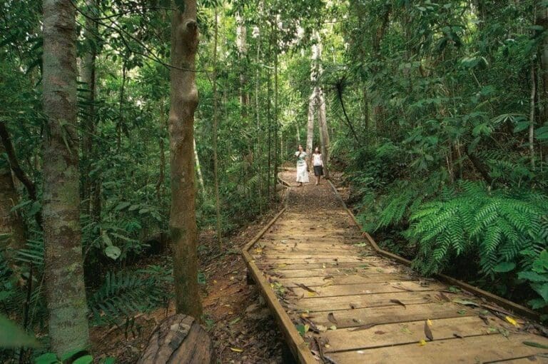
Follow the trail into the rainforest. In 500m you will come to the crossing of Koolmoon Creek, and another creek crossing at 3.0km. At 3.5km you will come to a junction (signed) turn left and begin the climb towards the Rhyolite Peak.
The trail is 1.4km up the hill, winding back and forth, gaining about 200m in elevation. The trail is often overgrown and you may need to go around fallen timber. When passing fallen trees, make sure you keep someone on the trail until you find it again on the other side to ensure you do no lose the trail.
Towards the summit of the trail (but not at the highest point) you need to keep you eyes out for a side trail off on the left. There is an old and faded sign attached to the rock face Rhyolite Peak but this is often overgrown with epiphytes. Take this short trail (~100m) up and onto the exposed rock surface for great views over the Cardwell Range, Tully Falls National Park and the coast beyond.
Return the way you came.
Tips
This trail is best done in the Dry Season (May-Oct) as during the Wet, the creek crossing can be deep, the trail muddy and slippery and the leeches altogether too friendly! The first ~3.7km of the trail is easier, but the next 1.4km are a steep climb through rainforest to the Rhyolite Peak lookout. The trail can be overgrown and you will need some bushwalking experience.
The trail passes through stunning intact rainforest where you will have a chance to see some of the amazing fauna endemic to North Queensland, including Southern Cassowary, Musky Rat Kangaroo and plenty of birds. The lookout and/or the creek crossing make a great place for a break on the trail. This trail is seldom used, and provides access to and views over some great wilderness areas seemingly untouched good for the soul and the heart.
Gallery
Got some great shots from this hike? Upload your photos here to inspire others and show off the beauty of the trail!
Click to view form >>
Submitting your photos doesn’t mean you lose ownership. You can be credited for your contributions, and you can request removal at any time.
Content use
Please don’t copy GPX files or content from this site to AllTrails or other platforms. Each trail has been personally mapped, documented, and refined to support Australia’s bushwalking and hiking community. While some details come from land managers, every listing reflects significant personal effort. This is a free, community-driven initiative—your respect helps keep it that way.
Walk map and GPX file
Max elevation: 1022 m
Min elevation: 801 m
Total climbing: 580 m
Total descent: -660 m
Getting there
Getting to the trailhead: Atherton Tablelands.
From Ravenshoe, drive south 1.2km to the Kennedy Highway and start of Tully Falls Road. Once on Tully falls Road, drive 15.2km until you see the Walters Waterhole Trailhead sign, part of the Misty Mountains trail network. Park at the sign, with the trail heading off into the rainforest immediately behind the sign. The first section of the trail (~3.7km) is generally maintained and easy to follow but includes a couple of creek crossings where you will get your feet wet.
Closest towns to this walk: Atherton, Malanda, Mareeba, Tolga, Yungaburra
About the region
Misty Mountains Wilderness Tracks
The Misty Mountains wilderness tracks are in an area bounded by Tully, Innisfail, Mena Creek, Millaa Millaa and Ravenshoe traversing Tully Falls, Tully Gorge and Wooroonooran national parks. A 130 km network of short and long wilderness tracks takes visitors through pristine, high-altitude rainforest with crystal clear creeks, waterfalls and panoramic views. Some tracks are suitable only for bushwalkers, while others are shared tracks with mountain biking permitted.
Delve deeply into the Wet Tropics World Heritage Area along the 130 kilometre network of the Misty Mountains wilderness tracks. The world heritage area is famed for its exceptional natural beauty, outstanding examples of the record of life, evolutionary history and remarkable diversity. Discover lush, high altitude rainforest dotted with crystal clear creeks, stunning waterfalls and panoramic views.
Walk, drive and camp throughout the area along four long tracksKoolmoon Creek, Cannabullen Creek, Cardwell Range and Gorrell tracksor explore smaller fragments of the tracks. You can even mountain bike along some sections!
Similar walks nearby
Looking for more walks in or near Atherton Tablelands? Try these trails with a similar difficulty grade.
Track grade
Grade 3 (Moderate) - Walks for Most Fitness Levels: Grade 3 on the AWTGS represents moderate walking tracks. These are ideal for walkers with some fitness who are comfortable with some hills and uneven terrain. While suitable for most ages, some bushwalking experience is recommended to ensure a safe and enjoyable experience. Tracks may have short, steep hill sections, a rough surface, and many steps. The total distance of a Grade 3 walk can be up to 20 kilometers.
Explore safe
Plan ahead and hike safely! Carry enough water, pack layers for changing conditions, and bring safety gear like a torch, PLB, and reliable communication device. Check official sources for trail updates, closures, and access requirements, and review local weather and bushfire advice. Most importantly, share your plans with someone before you go. Being prepared makes for a safer and more enjoyable hike! Stay Safe, Explore More, and Always #ExploreSafe.
Packing checklists
What you carry in your pack depends on factors like weather, terrain, and your adventure type. Not sure what to bring? My free planning, food, and packing checklists are a great starting point, covering day hikes, overnight trips, and multi-day adventures. Use them to customise your kit and always prioritise safety.
Let someone know
Before heading out, take a moment to fill out your trip intentions form. It’s a quick way to share your hike details with family or friends. If something goes wrong, they can notify emergency services, ensuring a faster response and peace of mind. Stay safe and enjoy your adventure
Suggest an edit
Spotted a change on this trail? Maybe there are new features, the route has shifted, or the trail is permanently closed. Whatever the update, I’d love your input. Your feedback helps fellow hikers stay informed and ensures that our trail info stays fresh and reliable.
Acknowledgement of Country
Trail Hiking Australia acknowledges the Traditional Owners of the lands on which we hike and pay respects to their Elders, past and present, and we acknowledge the First Nations people of other communities who may be here today.


