Hike at a Glance
Max elevation: 454m
Min elevation: 391m
Total Ascent: 121m
Hike overview
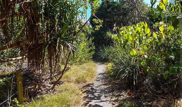
Rayners walking track offers a wonderful opportunity to explore the beauty of Mount Jerusalem National Park, nestled near Mullumbimby in the North Coast of New South Wales. This easy 4-kilometre walk is perfect for families, particularly those introducing children to the wonders of the Koonyum Range. The track begins on Koonyum Range Road, where you’ll soon find yourself walking through an enchanting forest of scribbly gums and hairpin banksias, their distinctive shapes casting interesting shadows on the ground. The walk is mostly shaded, with dappled sunlight filtering through the canopy, creating a peaceful atmosphere as you make your way along.
After about 1.6 kilometres, you’ll reach the tranquil waters of Rayners Dam. The dam’s surface, stained by tea tree, reflects the surrounding landscape in stunning detail, offering a beautiful spot to pause and take in the scene. Along the way, you'll pass through three gentle stream crossings, where wildlife sightings are common. The area is home to yellow-tailed black cockatoos, satin bowerbirds, and koalas, making it an exciting destination for birdwatchers and nature lovers alike. If you're lucky, you might even catch a glimpse of a wedge-tailed eagle soaring above.
The best times to visit are in spring and autumn when the forest is awash with vibrant wildflowers, adding splashes of colour to the surroundings. As dusk falls, the track takes on a magical quality, with nocturnal creatures like long-nosed bandicoots, sugar gliders, and southern boobook owls becoming more active. For those keen to explore more of the Byron Bay hinterland, consider extending your adventure with the child-friendly Boggy Creek walk in Whian Whian State Conservation Area, or the longer Minyon Falls walking track in Nightcap National Park.
Tips
- What to bring: Drinking water, sturdy shoes, hat, raincoat, suitable clothing for all weather, first aid kit, sunscreen, snacks.
- Please note: There is no drinking water available in the park. The park may close temporarily due to poor weather or fire danger.
Gallery
Got some great shots from this hike? Upload your photos here to inspire others and show off the beauty of the trail!
Uploading your photos doesn’t mean you lose ownership. You can be credited for your contributions, and you can request removal at any time.
Content use
Please don’t copy GPX files or content from this site to AllTrails or other platforms. Each trail has been personally mapped, documented, and refined to support Australia’s bushwalking and hiking community. While some details come from land managers, every listing reflects significant personal effort. This is a free, community-driven initiative—your respect helps keep it that way.
Walk map and GPX file
Max elevation: 454 m
Min elevation: 391 m
Total climbing: 121 m
Total descent: -121 m
Getting there
Getting to the trailhead: Mount Jerusalem National Park.
Rayners walking track is located in the Koonyum Range area of Mount Jerusalem National Park, accessible from Mullumbimby. To reach the trailhead, start by driving south on Jubilee Avenue, then continue straight onto Coolamon Scenic Drive for about 1 kilometre. Turn right onto Wilsons Creek Road and drive for 5.1 kilometres before turning right again onto Koonyum Range Road. From here, travel for 2.6 kilometres until you enter the park, then continue for another 2.3 kilometres. The trailhead will be on your right. The road to the trailhead is a mix of sealed and unsealed sections, with Koonyum Range Road being a dry weather road, so it’s best to avoid this route after heavy rain. While most of the roads are suitable for 2WD vehicles, access can be tricky in wet conditions. Limited parking is available along the side of Koonyum Range Road, so it’s advisable to arrive early, especially on weekends when the area can get busier.
Closest towns to this walk: Byron Bay, Lismore, Mullumbimby, Murwillumbah, Nimbin, Uki
About the region
Mount Jerusalem National Park
Mount Jerusalem National Park is a hidden gem nestled in the Byron Bay hinterland, just a 50-minute drive from the coast. This tranquil park is the perfect escape for nature lovers, offering a serene introduction to the beauty of the Tweed Valley. Whether you’re keen to explore the park on foot, horseback, or simply enjoy its picturesque waterfalls, there’s something here for everyone.
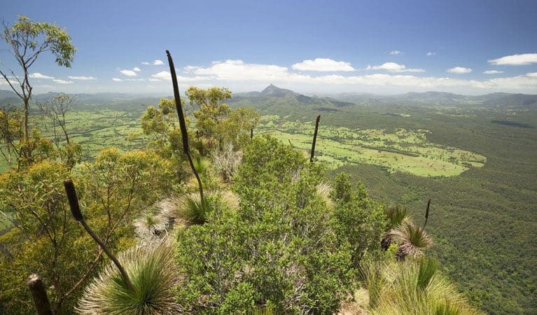
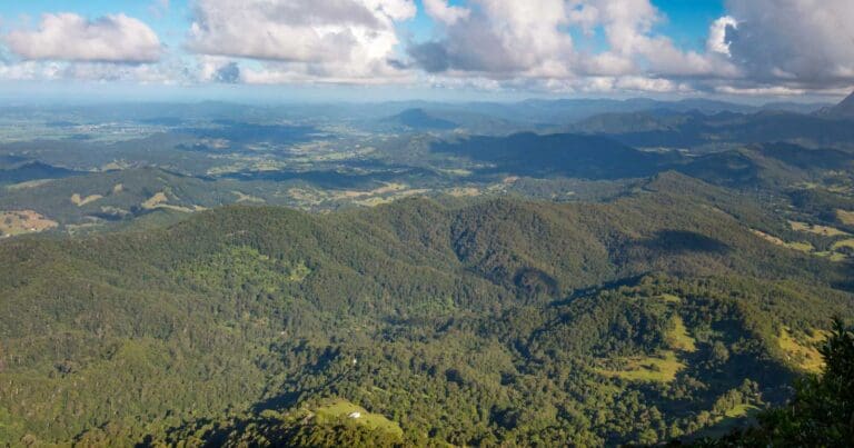
As you wander along the park’s walking tracks, you’ll encounter a stunning variety of landscapes. Towering eucalypt forests give way to subtropical and warm temperate rainforests that line the creek beds, creating a rich tapestry of green that feels both timeless and rejuvenating. These tracks provide the opportunity to immerse yourself in nature, with each bend in the trail revealing new sights and sounds.
The park is home to an array of wildlife, some of which are threatened and rare. Albert’s lyrebird and the red-legged pademelon are just two of the species that inhabit this lush environment. If you’re lucky, you may spot native birds flitting among the bright red berries of the bangalow palms when they bloom in winter. For those who enjoy the quiet solitude of the bush, the park offers plenty of opportunities to connect with nature, whether it’s taking a moment to relax by a creek or catching the peaceful sound of a distant waterfall.
Mount Jerusalem National Park’s easy access from Byron Bay, Mullumbimby, and Uki makes it an ideal destination for a day trip, while its diverse ecosystems are sure to captivate bushwalkers, birdwatchers, horse riders, and anyone with an appreciation for the natural world. Whether you’re looking to get your boots muddy on a trail or simply enjoy the scenery, the park offers an experience that’s both rejuvenating and awe-inspiring.
Similar walks nearby
Looking for more walks in or near Mount Jerusalem National Park? Try these trails with a similar difficulty grade.
Track grade
Grade 2 (Easy) - A Gentle Introduction to Inclines: Grade 2 on the AWTGS represents easy walking tracks that offer a slightly more challenging experience compared to Grade 1. Similar to Grade 1, no prior bushwalking experience is required. The track surface is typically hardened or compacted and may have gentle hill sections or occasional steps. The total distance of a Grade 2 walk is typically no greater than 10 kilometers. These walks are still suitable for families with a bit more experience or those seeking a gentle introduction to some inclines.
Explore safe
Plan ahead and hike safely! Carry enough water, pack layers for changing conditions, and bring safety gear like a torch, PLB, and reliable communication device. Check official sources for trail updates, closures, and access requirements, and review local weather and bushfire advice. Most importantly, share your plans with someone before you go. Being prepared makes for a safer and more enjoyable hike! Stay Safe, Explore More, and Always #ExploreSafe.
Packing checklists
What you carry in your pack depends on factors like weather, terrain, and your adventure type. Not sure what to bring? My free planning, food, and packing checklists are a great starting point, covering day hikes, overnight trips, and multi-day adventures. Use them to customise your kit and always prioritise safety.
Let someone know
Before heading out, take a moment to fill out your trip intentions form. It’s a quick way to share your hike details with family or friends. If something goes wrong, they can notify emergency services, ensuring a faster response and peace of mind. Stay safe and enjoy your adventure
Suggest an edit
Spotted a change on this trail? Maybe there are new features, the route has shifted, or the trail is permanently closed. Whatever the update, I’d love your input. Your feedback helps fellow hikers stay informed and ensures that our trail info stays fresh and reliable.
Acknowledgement of Country
Trail Hiking Australia acknowledges the Traditional Owners of the lands on which we hike and pay respects to their Elders, past and present, and we acknowledge the First Nations people of other communities who may be here today.


