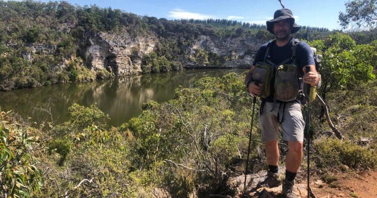
This hike is classified as Grade 4 (Hard) primarily due to its distance exceeding 20km. The terrain itself is relatively easy and suitable for most abilities. However, the long distance requires a good level of fitness and preparation. Feel free to turn back at any point for a shorter adventure.
Horses are permitted beside the trail only between Commercial Road (or Penshurst/WarrnamboolRd), Koroit and Illowa, then down Illowa Rd to Millers Lane and on to Levys Point track. This means horses are not permitted between Port Fairy and Koroit, or along the Merri Creek to Warrnambool.
The trail starts at Regent St in Port Fairy and ends at the Warrnambool foreshore promenade.
After leaving Port Fairy it skirts the northern side of a 25,000 year old extinct volcano, now the Tower Hill State Game Reserve. The crater is home to native animals and has many walking tracks.
From the Highway to Warrnambool the trail does not follow the original alignment.
The signage for the trail is deficient at the Warrnambool end.
Horses are permitted beside the trail only between Commercial Road (or Penshurst/WarrnamboolRd), Koroit and Illowa, then down Illowa Rd to Millers Lane and on to Levys Point track. This means horses are not permitted between Port Fairy and Koroit, or along the Merri Creek to Warrnambool.
Illowa - Underpass on the Princes Hwy. Park in Lanes Lane
Warrnambool - The trail starts at the Breakwater but is not well signposted. Alternately start where the Merri Creek intersects with Roxburgh Close
Port Fairy to Warrnambool in Western Victoria
260km south west of Melbourne
Compacted earth, Coarse gravel, Fine gravel, Sealed
Flat and undulating
Photo credit: Rail Trails Australia. For more information and a location map please visit RailTrails Australia.
Got some great shots from this hike? Upload your photos here to inspire others and show off the beauty of the trail!
Submitting your photos doesn’t mean you lose ownership. You can be credited for your contributions, and you can request removal at any time.
Please don’t copy GPX files or content from this site to AllTrails or other platforms. Each trail has been personally mapped, documented, and refined to support Australia’s bushwalking and hiking community. While some details come from land managers, every listing reflects significant personal effort. This is a free, community-driven initiative—your respect helps keep it that way.
It looks like I don’t have a GPX file for this trail yet. If you have one to share, please email it to me! I’ll verify it against official maps before adding it to help other hikers have a safer, easier experience. Thanks for contributing to a better hiking resource.
Getting there
Getting to the trailhead: Western Victoria.
Closest towns to this walk: Ararat, Ballarat, Hamilton, Horsham, Port Fairy, Stawell, Warrnambool
Similar walks nearby
Looking for more walks in or near Western Victoria? Try these trails with a similar difficulty grade.
Favourite

Discovery Bay Coastal Park
Favourite

Favourite

Favourite

Track grade
Grade 4 (Hard) -
Challenging Walks for Experienced Walkers: Grade 4 on the
AWTGS signifies challenging walking tracks. Bushwalking experience is recommended for these tracks, which may be long, rough, and very steep. Directional signage may be limited, requiring a good sense of navigation. These walks are suited for experienced walkers who are comfortable with steeper inclines, rougher terrain, and potentially longer distances.
Explore safe
Plan ahead and hike safely! Carry enough water, pack layers for changing conditions, and bring safety gear like a torch, PLB, and reliable communication device. Check official sources for trail updates, closures, and access requirements, and review local weather and bushfire advice. Most importantly, share your plans with someone before you go. Being prepared makes for a safer and more enjoyable hike! Stay Safe, Explore More, and Always #ExploreSafe.
Packing checklists
What you carry in your pack depends on factors like weather, terrain, and your adventure type. Not sure what to bring? My free planning, food, and packing checklists are a great starting point, covering day hikes, overnight trips, and multi-day adventures. Use them to customise your kit and always prioritise safety.
Let someone know
Before heading out, take a moment to fill out your trip intentions form. It’s a quick way to share your hike details with family or friends. If something goes wrong, they can notify emergency services, ensuring a faster response and peace of mind. Stay safe and enjoy your adventure
Suggest an edit
Spotted a change on this trail? Maybe there are new features, the route has shifted, or the trail is permanently closed. Whatever the update, I’d love your input. Your feedback helps fellow hikers stay informed and ensures that our trail info stays fresh and reliable.


