Hike at a Glance
Max elevation: 1050m
Min elevation: 1030m
Total Ascent: 33m
Hike overview
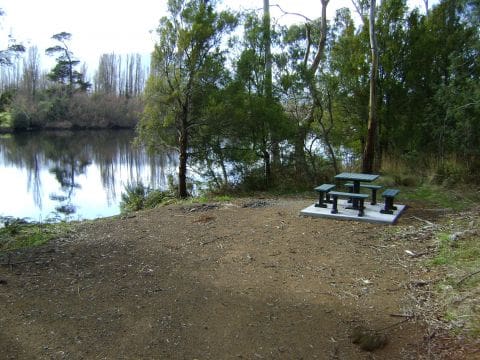
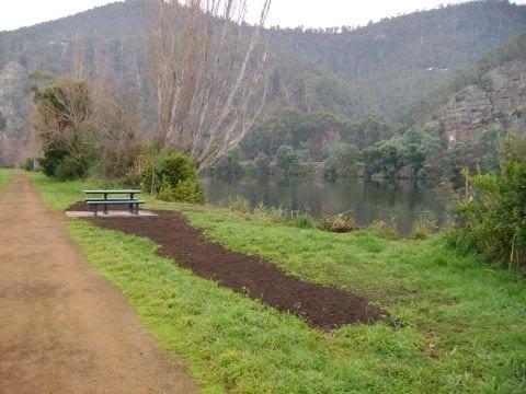
Named after the world’s tallest heath, the pandani, this walk circles Lake Dobson in Mount Field National Park. The Pandani Grove Nature Walk is a 1.5-kilometre, grade 2 trail that typically takes about 45 minutes to complete and is suitable for all the family in fine weather. The circuit provides a pleasant stroll through a verdant landscape beneath the ski slopes of Mount Field. As you walk, you will pass by pandani growing among alpine gums and soft tree ferns. These distinctive pandani, the tallest heath in the world, are adapted to the cold at this altitude (1000 metres) with their drooping foliage that helps shed snow and ice. Keep an eye out for platypuses in the lake, especially at dawn and dusk, as their ripples can occasionally be seen on the water’s surface.
The pandani is just one of many unique subalpine plants found in Tasmania and nowhere else on Earth. Throughout the walk, you will encounter a variety of alpine flora. Interestingly, Mount Field exhibits a greater diversity of plants in its upper reaches compared to the forests at its base. At the far end of the lake, the trail leads you into a striking patch of forest dominated by pandanis and pencil pines. Pencil pines, along with other ancient conifers, are endemic to Tasmania. The area offers a fascinating glimpse into the rich and varied plant life of this unique environment.
Tips
- The track is suitable for most ages, featuring a hardened or compacted surface with gentle inclines and occasional steps.
- Please supervise children at all times. Be aware that tracks can be affected by severe weather conditions, which may change rapidly. Snow and ice can make the tracks difficult to navigate and potentially impassable.
- A valid parks pass is required for entry into Tasmania's national parks.
- The walk begins at the Lake Dobson car park in Mount Field National Park. Once inside the park, drive 16 kilometres up Lake Dobson Road, which is unsealed and may be closed during snowy conditions.
Gallery
Got some great shots from this hike? Upload your photos here to inspire others and show off the beauty of the trail!
Click to view form >>
Submitting your photos doesn’t mean you lose ownership. You can be credited for your contributions, and you can request removal at any time.
Content use
Please don’t copy GPX files or content from this site to AllTrails or other platforms. Each trail has been personally mapped, documented, and refined to support Australia’s bushwalking and hiking community. While some details come from land managers, every listing reflects significant personal effort. This is a free, community-driven initiative—your respect helps keep it that way.
Walk map and GPX file
Max elevation: 1050 m
Min elevation: 1030 m
Total climbing: 33 m
Total descent: -33 m
Getting there
Getting to the trailhead: Mount Field National Park.
Mount Field National Park is located just over an hour’s drive from Hobart, accessible via the A10 or B62 through New Norfolk and Westerway. From Westerway, take a short, winding drive to the small township of National Park, where you will find the entrance to Mount Field National Park. To reach the trailhead for the Pandani Grove Nature Walk, follow Lake Dobson Road for 16 kilometres after entering the park. Please note that this section of road is unsealed and may be closed in snowy conditions. It is advisable to avoid driving in the reserves at night, as the roads are shared with native wildlife. Drive cautiously and be on the lookout for animals.
Closest towns to this walk: Bicheno, Bothwell, Brighton, Bushy Park, Ellendale, Fentonbury, Glenora, Granton, Hamilton, Maydena, Molesworth, Mount Field, New Norfolk, Ouse, Tyenna, Westerway
About the region
Mount Field National Park, often referred to as "the park for all seasons," showcases a remarkable array of natural landscapes. Located in southern Tasmania, approximately 64 kilometers northwest of Hobart, this park is a convenient day trip from the state capital, offering a diverse range of walks, bushwalks, and hikes suitable for all visitors.
The journey through Mount Field begins with a short, leisurely walk to Russell Falls, one of Tasmania's most iconic waterfalls. The path leads you through towering tree ferns and giant eucalypts, providing a tranquil introduction to the park's natural beauty. As you venture further into the park, the landscape changes dramatically. The road to Lake Dobson offers access to longer day walks and, during winter, the snow-dusted slopes of the Mount Mawson ski field. The Tarn Shelf, particularly stunning in autumn, comes alive with the vibrant colours of the deciduous beech, or fagus, which turns the hillsides gold, orange, and red.
Mount Field National Park covers nearly 163 square kilometers and is renowned for its ecological diversity. The park features towering eucalypt forests, some of the tallest in the world, which give way to unique alpine vegetation at higher altitudes. Glaciated landscapes and alpine tarns provide a dramatic backdrop for bushwalks, while the lower elevations offer easily accessible walking tracks past magnificent waterfalls, including Russell Falls, which is perhaps the most photographed waterfall in Tasmania.
For those interested in more challenging hikes, Lake Dobson serves as the starting point for several longer trails. The Pandani Grove walk, which skirts the edge of Lake Dobson, offers a closer look at the unique flora of the region. The park also provides well-equipped picnic spots, a playground for children, and a visitor centre with a café, making it an ideal destination for family trips.
Whether you're in the mood for a casual walk, an adventurous hike, or simply a day spent exploring Tasmania's diverse landscapes, Mount Field National Park has something to offer. The park’s changing altitudes and weather conditions provide a dynamic experience, showcasing the distinct ecological zones that make Tasmania so unique. During winter, the park even offers opportunities for cross-country skiing on Mount Mawson's slopes.
Want to find the best trails in Mount Field National Park for an adventurous hike, casual walk, or a family trip? Trail Hiking Australia has the best trails for walking, hiking, running, and more.
Similar walks nearby
Looking for more walks in or near Mount Field National Park? Try these trails with a similar difficulty grade.
Track grade
Grade 2 (Easy) - A Gentle Introduction to Inclines: Grade 2 on the AWTGS represents easy walking tracks that offer a slightly more challenging experience compared to Grade 1. Similar to Grade 1, no prior bushwalking experience is required. The track surface is typically hardened or compacted and may have gentle hill sections or occasional steps. The total distance of a Grade 2 walk is typically no greater than 10 kilometers. These walks are still suitable for families with a bit more experience or those seeking a gentle introduction to some inclines.
Explore safe
Plan ahead and hike safely! Carry enough water, pack layers for changing conditions, and bring safety gear like a torch, PLB, and reliable communication device. Check official sources for trail updates, closures, and access requirements, and review local weather and bushfire advice. Most importantly, share your plans with someone before you go. Being prepared makes for a safer and more enjoyable hike! Stay Safe, Explore More, and Always #ExploreSafe.
Packing checklists
What you carry in your pack depends on factors like weather, terrain, and your adventure type. Not sure what to bring? My free planning, food, and packing checklists are a great starting point, covering day hikes, overnight trips, and multi-day adventures. Use them to customise your kit and always prioritise safety.
Let someone know
Before heading out, take a moment to fill out your trip intentions form. It’s a quick way to share your hike details with family or friends. If something goes wrong, they can notify emergency services, ensuring a faster response and peace of mind. Stay safe and enjoy your adventure
Suggest an edit
Spotted a change on this trail? Maybe there are new features, the route has shifted, or the trail is permanently closed. Whatever the update, I’d love your input. Your feedback helps fellow hikers stay informed and ensures that our trail info stays fresh and reliable.
Acknowledgement of Country
Trail Hiking Australia acknowledges the Traditional Owners of the lands on which we hike and pay respects to their Elders, past and present, and we acknowledge the First Nations people of other communities who may be here today.


