Hike at a Glance
Max elevation: 544m
Min elevation: 435m
Total Ascent: 238m
Hike overview
The Mount Pleasant Summit Circuit offers a scenic exploration of Mount Crawford Forest Reserve, encompassing roughly 12 kilometres and classified as a moderate (grade 3) hike. This looped trail typically takes between 3 and 4 hours to complete.
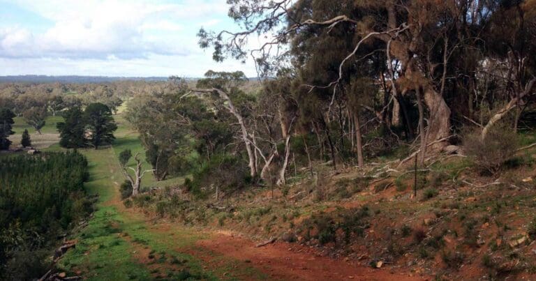
You can choose from three individual circuits or combine them into this longer hike. The starting point for all options is the Glen Devon Road Trailhead. The circuits weave through the diverse landscapes of Mount Crawford Forest, with a mix of pine plantations and pockets of native scrub. A particularly beautiful section of native vegetation lies between markers MP04 and MP05. The highlight of the first section is reaching the summit of Mount Pleasant, rewarding you with panoramic views across the forest towards Mount Crawford and Little Mount Crawford.
Gallery
Got some great shots from this hike? Upload your photos here to inspire others and show off the beauty of the trail!
Click to view form >>
Submitting your photos doesn’t mean you lose ownership. You can be credited for your contributions, and you can request removal at any time.
Content use
Please don’t copy GPX files or content from this site to AllTrails or other platforms. Each trail has been personally mapped, documented, and refined to support Australia’s bushwalking and hiking community. While some details come from land managers, every listing reflects significant personal effort. This is a free, community-driven initiative—your respect helps keep it that way.
Walk map and GPX file
Max elevation: 544 m
Min elevation: 435 m
Total climbing: 238 m
Total descent: -238 m
Getting there
Getting to the trailhead: Mount Crawford Forest Reserve.
For those planning a visit, Mount Crawford Forest Reserve is easily accessible by car. Situated in the northern Mount Lofty Ranges, it’s a comfortable one-hour drive from Adelaide and just seven kilometres from the town of Williamstown. Travellers from Adelaide can take the North East Road towards Gumeracha, followed by a turnoff to Williamstown which will lead you directly to the forest.
Closest towns to this walk: Birdwood, Gumeracha, Lobethal, Mount Pleasant, Williamstown, Woodside
About the region
Spanning 12,367 hectares across Kaurna and Peramangk Country, Mount Crawford Forest offers a unique blend of sustainable forestry, conservation areas, and recreational activities. Situated just an hour's drive from Adelaide, it's a popular destination for both locals and visitors.
Established in 1909, the forest has a rich history of sustainable wood production. Plantations were first established in 1914 and expanded until the 1960s, with some areas being selectively harvested and replanted to ensure the forest's longevity.
Beyond the planted areas, Mount Crawford Forest protects 4,440 hectares of native vegetation within eight gazetted Native Forest Reserves. These conservation zones boast a diverse range of trees, shrubs, and groundcover plants, providing vital habitat for native birds, reptiles, and mammals.
The forest caters to a range of recreational pursuits. Visitors can camp under the stars, enjoy the comfort of rustic cabins, explore the trails on foot or horseback, or participate in organised community events. Mountain bike enthusiasts can tackle the challenging tracks at Fox Creek Bike Park, South Australia's premier biking destination.
Similar walks nearby
Looking for more walks in or near Mount Crawford Forest Reserve? Try these trails with a similar difficulty grade.
Track grade
Grade 3 (Moderate) - Walks for Most Fitness Levels: Grade 3 on the AWTGS represents moderate walking tracks. These are ideal for walkers with some fitness who are comfortable with some hills and uneven terrain. While suitable for most ages, some bushwalking experience is recommended to ensure a safe and enjoyable experience. Tracks may have short, steep hill sections, a rough surface, and many steps. The total distance of a Grade 3 walk can be up to 20 kilometers.
Explore safe
Plan ahead and hike safely! Carry enough water, pack layers for changing conditions, and bring safety gear like a torch, PLB, and reliable communication device. Check official sources for trail updates, closures, and access requirements, and review local weather and bushfire advice. Most importantly, share your plans with someone before you go. Being prepared makes for a safer and more enjoyable hike! Stay Safe, Explore More, and Always #ExploreSafe.
Packing checklists
What you carry in your pack depends on factors like weather, terrain, and your adventure type. Not sure what to bring? My free planning, food, and packing checklists are a great starting point, covering day hikes, overnight trips, and multi-day adventures. Use them to customise your kit and always prioritise safety.
Let someone know
Before heading out, take a moment to fill out your trip intentions form. It’s a quick way to share your hike details with family or friends. If something goes wrong, they can notify emergency services, ensuring a faster response and peace of mind. Stay safe and enjoy your adventure
Suggest an edit
Spotted a change on this trail? Maybe there are new features, the route has shifted, or the trail is permanently closed. Whatever the update, I’d love your input. Your feedback helps fellow hikers stay informed and ensures that our trail info stays fresh and reliable.
Acknowledgement of Country
Trail Hiking Australia acknowledges the Traditional Owners of the lands on which we hike and pay respects to their Elders, past and present, and we acknowledge the First Nations people of other communities who may be here today.


